
Songkhla is one of the southern provinces (changwat) of Thailand. Neighbouring provinces are (from east clockwise) Satun, Phatthalung, Nakhon Si Thammarat, Pattani, and Yala. To the south it borders Kedah and Perlis of Malaysia. In contrast to most other provinces, the capital Songkhla is not the largest city in the province. The much newer city of Hat Yai is considerably larger with twice the population of Songkhla.
Geography: The province is on the Malay Peninsula, on the coast of the Gulf of Thailand. The highest elevation is Khao Mai Kaeo at 821 meters. In the north of the province is Songkhla Lake, the largest natural lake in Thailand. This shallow lake covers an area of 1,040 km², and has a south-north extent of 78 kilometers. At its mouth on the Gulf of Thailand, near the city of Songkhla, the water becomes brackish. A small population of Irrawaddy Dolphins live in the lake, but are in danger of extinction due to accidental capture by the nets of the local fishing industry. Songkhla Province hosts two national parks. San Kala Khiri covers 214 km² of mountain highlands on the Thai-Malay border. Khao Nam Khang, is also in the boundary mountains. Chinese Communist guerrillas inhabited this region until the 1980s.
History: Songkhla was the seat of an old Malay Kingdom with heavy Srivijayan influence. It formed the northern extremity of the Malay Kingdom of Langkasuka. Archaeological excavations on the isthmus between Lake Songkhla and the sea reveal that in the 10th through the 14th century this was a major urbanized area, and a center of international maritime trade, in particular with Quanzhou in China. Since the 18th century, Songkla has been firmly under Thai suzerainty. In 1909, Songkhla was formally annexed by Siam as part of Anglo-Siamese Treaty of 1909, negotiated with the British Empire, in which Siam gave up its claim to Kelantan in return for Britain recognizing Siam's right to the provinces north of that.
In the 18th century many Chinese immigrants, especially from Guangdong and Fujian, came to the province. Quickly rising to economic wealth, one of them won the bidding for the major tax farm of the province in 1769, establishing the Na Songkhla (from Songkhla) family as the most wealthy and influential. In 1777 the family also gained political power, when the old governor was dismissed and Luang Inthakhiri (Yiang, Chinese name Wu Rang) became the new governor. In 1786 the old governor started an uprising, which was put down after four months. The position was thereafter inherited in the family and was held by eight of his descendants until 1901, when Phraya Wichiankhiri (Chom) was honorably retired as part of the administrative reforms of Prince Damrong Rajanubhab. The family's former home was converted into the Songkhla National Museum in 1953.
Songkhla was the scene of heavy fighting when the Imperial Japanese Army invaded Thailand on 8 December 1941 and parts of the city were destroyed.
Transport: Phetkasem Road, running all the way from Bangkok, ends at the border crossing to Malaysia in Sadao. Asian highway 2 and 18 also run through the province. Of note is the Tinsulanond Bridge, which crosses Songkhla Lake to connect the narrow land east of the lake at the coast with the main southern part of the province. With a length of 2.6 km it is the longest concrete bridge in Thailand. Built in 1986, the bridge consists of two parts. The southern 1,140 m connects Mueang district with the island Ko Yo, and the northern part of 1,800 m to Ban Khao Khiao. Kanchanawanit Road, which runs from Songkhla town, though Hat Yai, and all the way to the Malaysian border at Sadao District, is considered the unofficial dividing line separating the Thai south from its deep south, Muslim-majority region.
The southern railway operated by the State Railway of Thailand runs through the province, and continues on into Malaysia, with Hat Yai Junction being the main railway station. It is a junction for the railway link to Malaysia through Padang Besar Town, where there are two stations: Padang Besar (Thai) on the Thai side and Padang Besar on the Malay side. Immigration is done on the Malay side. The other route from Hat Yai Junction goes further south to Pattani (Khok Pho), Yala, Tanyong Mat and Su-ngai Kolok. In the past, a railway line connected the town of Songkhla with Hat Yai, but it was closed in 1978 and is now partly dismantled and partly overgrown.
Songkhla is served by Hat Yai International Airport in Khlong Hoi Khong District.
Tourism: The modern city of Hat Yai is the major transport hub for road, rail and air in the south of the country and a jumping off point for the region and onward into Malaysia. The province as a whole is diverse with long sandy beaches, national parks and the iconic Songkhla Lake. Songkhla City is the place to discover the history of the province.
Provincial Government: Songkhla is divided into 16 districts (amphoe), which are further subdivided into 127 subdistricts (tambon) and 987 villages (muban).
Main source: https://en.wikipedia.org/wiki/Songkhla_Provinc10
Songkhla Province Map
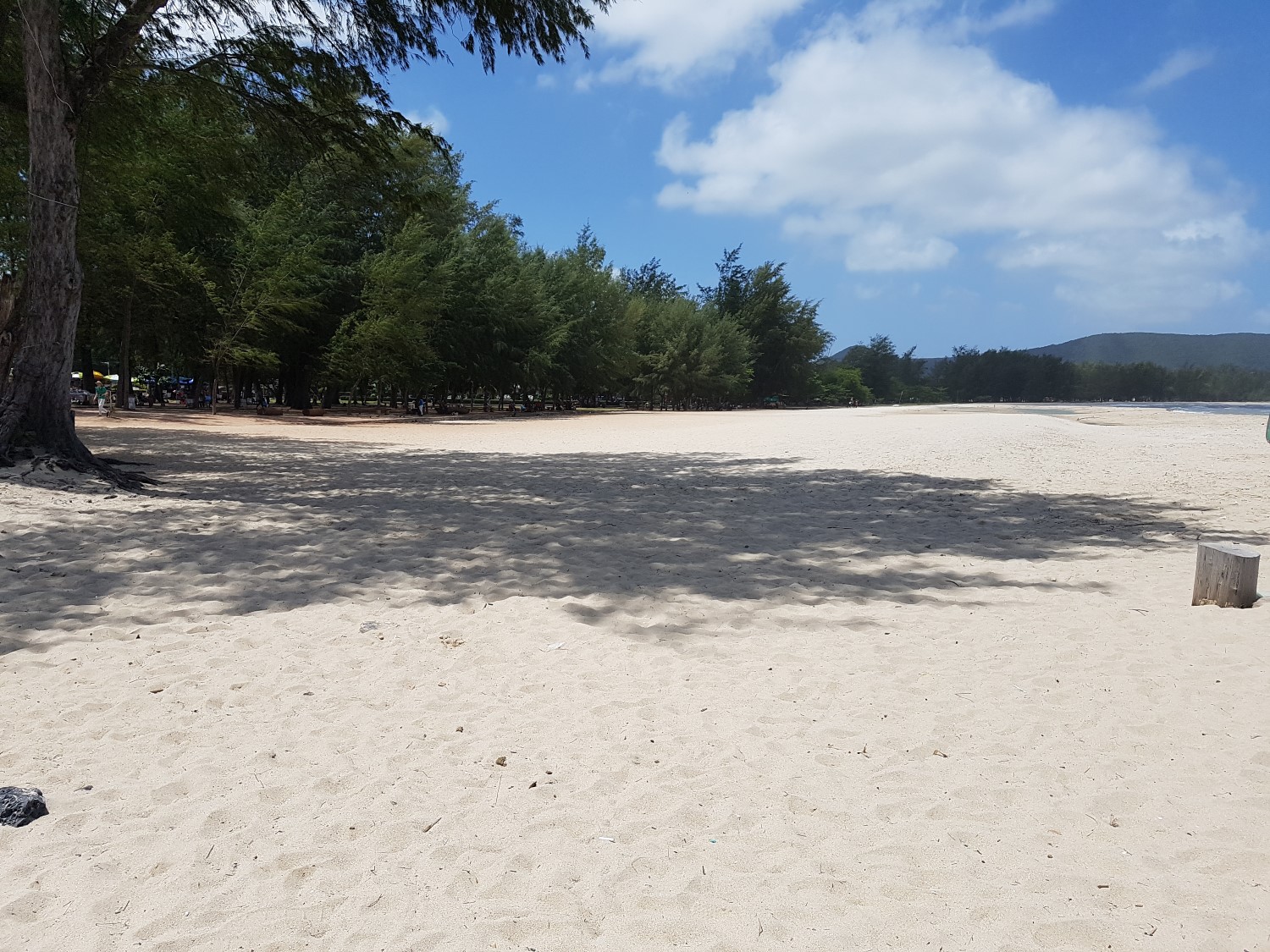
A deserted Simila Beach, Songkhla
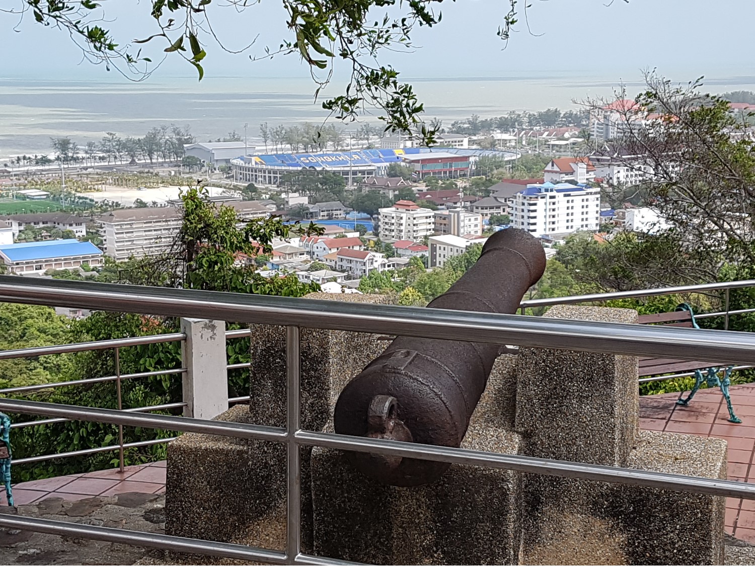
View from Tangkuan Hill, Songkhla
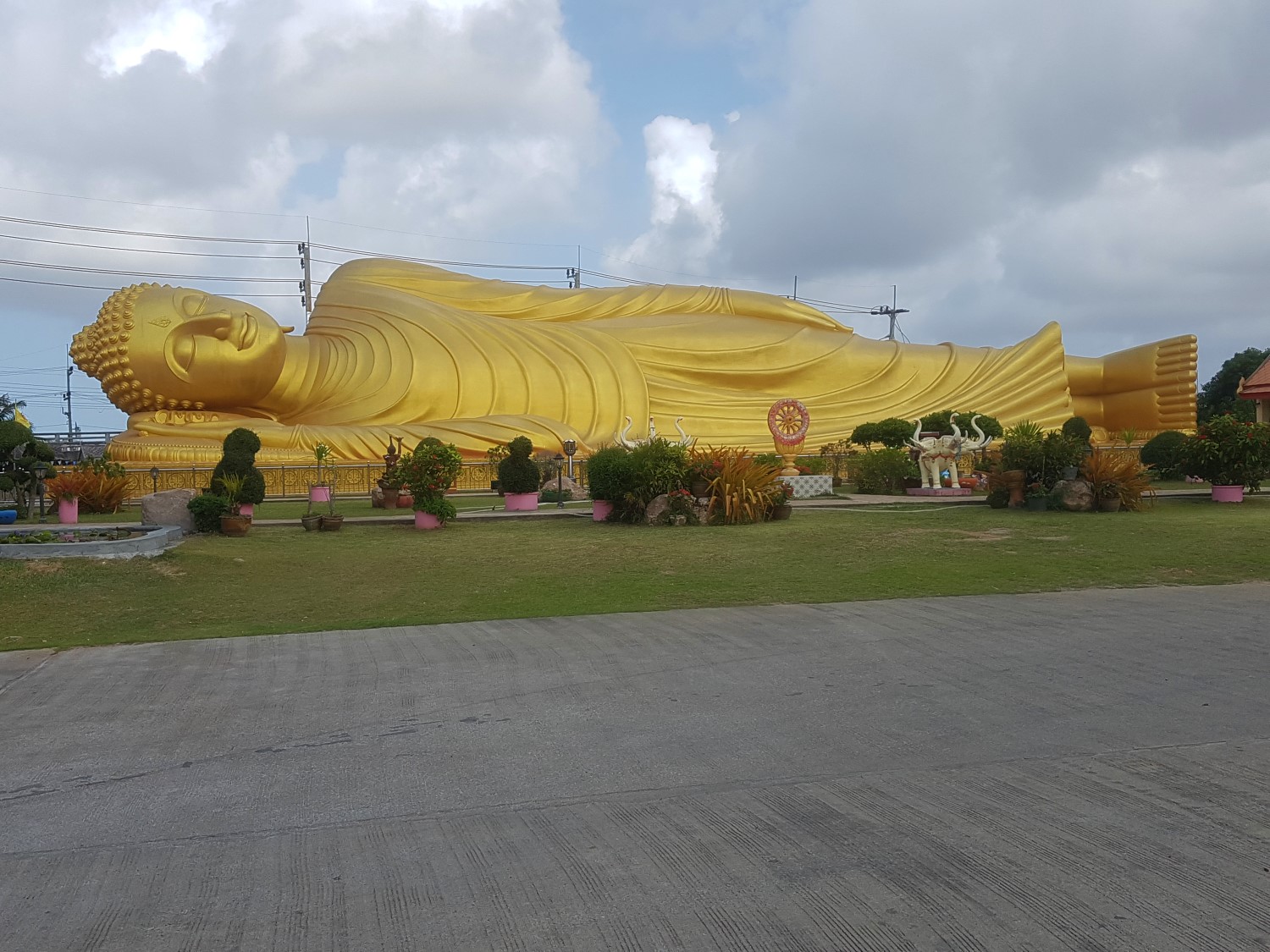
Reclining Buddha at Wat Laem Pho, Ko Yor, Mueang Songkhla District, Songkhla Province
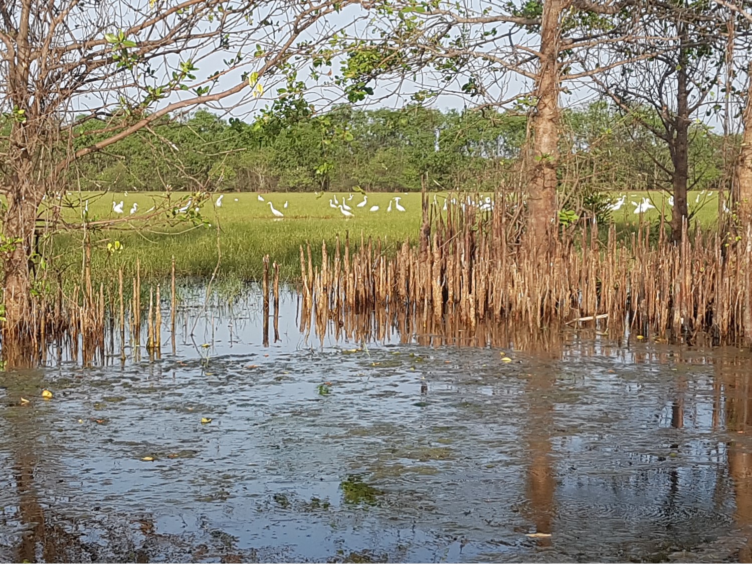
The magical Khu Khut Waterfowl Park, Cha Thing Phra, Sathing Phra District,
Songkhla Province
A deserted Simila Beach, Songkhla
View from Tangkuan Hill, Songkhla
Reclining Buddha at Wat Laem Pho, Ko Yor, Mueang Songkhla District, Songkhla Province
The magical Khu Khut Waterfowl Park, Cha Thing Phra, Sathing Phra District,
Songkhla Province