
Phuket (Malay: Talang or Tanjung Salang) is one of the southern provinces (changwat) of Thailand. It consists of the island of Phuket, the country's largest island, and another 32 smaller islands off its coast. It lies off the west coast of Thailand in the Andaman Sea. Phuket Island is connected by the Sarasin Bridge to Phang Nga Province to the north. The next nearest province is Krabi, to the east across Phang Nga Bay.
Phuket Province has an area of 576 square kilometres (222 sq mi), somewhat less than that of Singapore, and is the second-smallest province of Thailand. The island was on one of the major trading routes between India and China, and was frequently mentioned in foreign ships' logs of Portuguese, French, Dutch, and English traders, but was never colonised by a European power. It formerly derived its wealth from tin and rubber and now from tourism.
Geography: Phuket is the largest island in Thailand. It is in the Andaman Sea in southern Thailand. The island is mostly mountainous with a mountain range in the west of the island from the north to the south. The mountains of Phuket form the southern end of the Phuket mountain range, which ranges for 440 kilometres (270 mi) from the Kra Isthmus.
History:
16th-17th century: European contact - The Portuguese explorer Fernão Mendes Pinto arrived in Siam in 1545. His accounts of the country go beyond Ayutthaya and include a reasonably detailed account of ports in the south of the Kingdom as well. Pinto was one of the first European explorers to detail Phuket in his travel accounts. He referred to the island as "Junk Ceylon", a name the Portuguese used for Phuket Island in their maps, mentioning the name seven times in his accounts. Pinto said that Junk Ceylon was a destination port where trading vessels made regular stops for supplies and provisions. However, during the mid-16th century, the island was in decline due to pirates and often rough and unpredictable seas, which deterred merchant vessels from visiting the island. Pinto mentioned several other notable port cities in his accounts, including Pattani and Ligor, which is modern-day Nakhon Si Thammarat.
In the 17th century, the Dutch, English and, after the 1680s, the French, competed for the opportunity to trade with Junk Ceylon, which was a rich source of tin. In September 1680, a ship of the French East India Company visited the island and left with a full cargo of tin.
A year or two later, the Siamese King Narai, seeking to reduce Dutch and English influence, named as governor a French medical missionary, Brother René Charbonneau, a member of the Siam mission of the Société des Missions Étrangères. Charbonneau remained as governor until 1685.
1785: Burmese invasion
Before the Burmese attacked Thalang in 1785 during the "Nine Armies' Wars", Francis Light, a British East India Company captain (and later founder of Penang), who had been based on the island for some years, notified the local administration that he had observed Burmese forces preparing to attack. The island's military governor had just died, so the Burmese thought that it could be easily seized. Than Phu Ying Chan, the widow of the recently deceased governor, and her sister Mook ordered the women of the island to dress as soldiers and take positions on the Thalang city walls. The Burmese called off their attack due to the perceived strength of the defences. Short of food, they retreated. The two women became local heroines. They received the honorary titles, Thao Thep Kasatri and Thao Sri Sunthon, from King Rama I. After a month-long siege of the capital city, the Burmese were forced to retreat on 13 March 1785. The women became local heroines, receiving the royal titles Thao Thep Kasattri and Thao Si Sunthon from a grateful King Rama I.
19th–20th centuries
During the reign of King Chulalongkorn (Rama V) from 1 October 1868 to 23 October 1910, Phuket became the administrative centre of the tin-producing southern provinces. His reign was characterized by the modernization of Siam, governmental and social reforms, and territorial concessions to the British and French. As Siam was threatened by Western expansionism, Chulalongkorn managed to save Siam from colonization.
2004 tsunami
On 26 December 2004, Phuket and other nearby areas on Thailand's west coast suffered damage when they were struck by a tsunami caused by the Indian Ocean earthquake. The waves destroyed several highly populated areas in the region, killing up to 5,300 people in Thailand, and two hundred thousand more throughout the Asian region. Some 250 were reported dead in Phuket, including foreign tourists. Almost all of the major beaches on the west coast of Phuket, especially Kamala, Patong, Karon, and Kata sustained major damage, with some damage caused to resorts and villages on the island's southern beaches. Thailand's hardest-hit area was the Takua Pa District of Phang Nga Province north of Phuket, where a thousand or more Burmese workers building new beach resorts died.] In December 2006, Thailand launched the first of 22 tsunami-detection buoys to be positioned around the Indian Ocean as part of a regional warning system. The satellite-linked deep-sea buoys float 1,000 km (620 mi) offshore, roughly midway between Thailand and Sri Lanka.
Provincial government: Phuket is divided into three districts (amphoe), Mueang Phuket, Kathu and Thalang which are further divided into 17 subdistricts (tambon), and 103 villages (muban).
Phuket Province Map
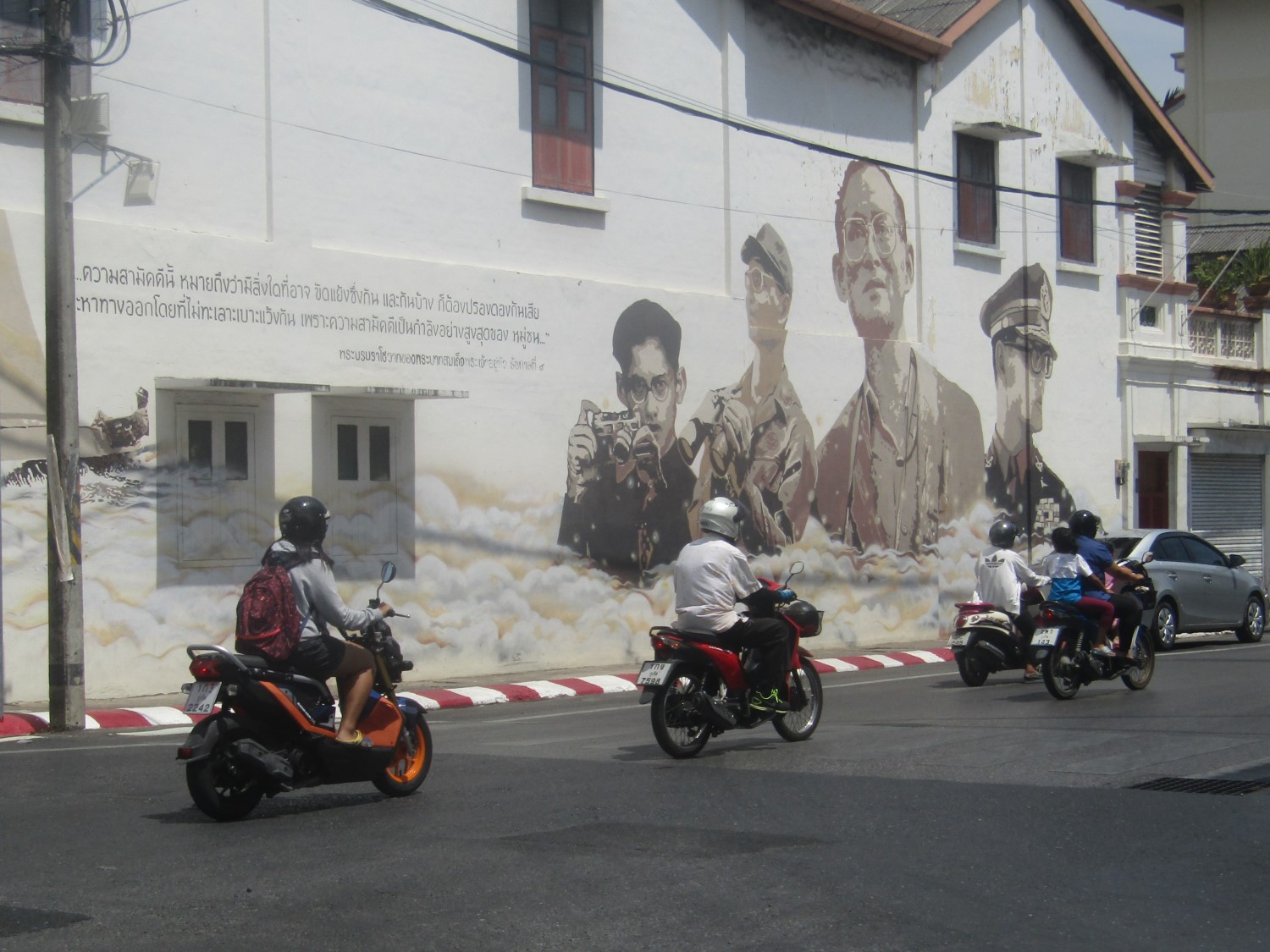
Street Art, Phuket Old Town
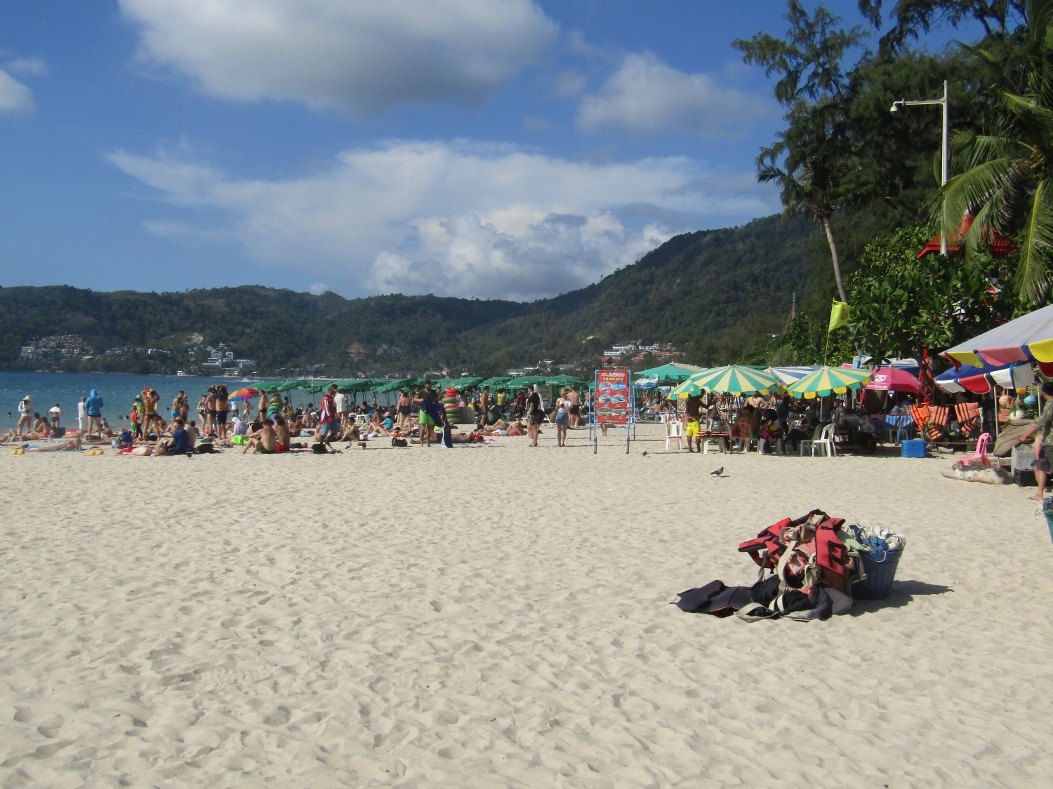
Patong Beach, Kathu District
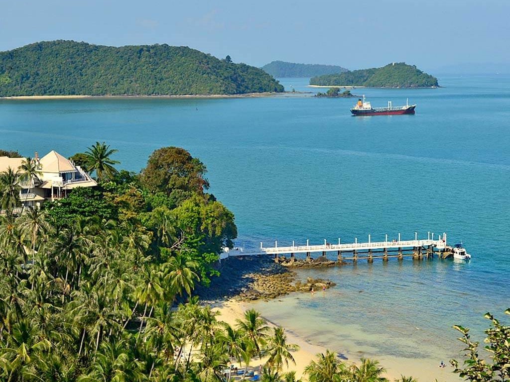
View from Khao Kad Tower,
Mueang Phuket District
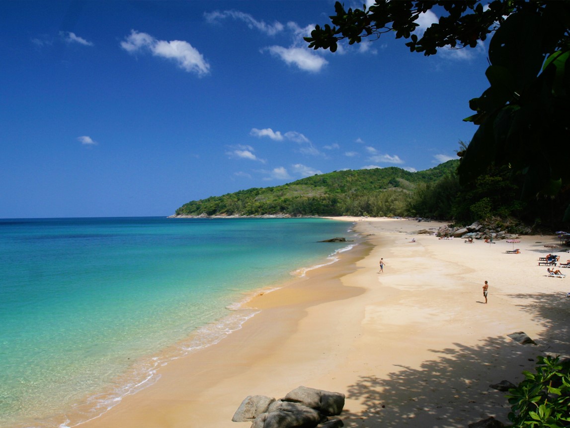
Nai Tron Beach, Thalang District
Street Art, Phuket Old Town
Patong Beach, Kathu District
View from Khao Kad Tower,
Mueang Phuket District
Nai Tron Beach, Thalang District