|
|

|
Wednesday 29 November 2017 Kingboon Resort........Google Map Located a few kilometres out of town on the left of highway 21, Kingpoon resort is not a resort as I know it. It’s a much larger establishment with a two story residential block and separate restaurant which we didn’t take advantage of. I would class it as a hotel more suitable for group tour bookings as it generally lacks the charm of the smaller resorts. At 600 baht the rooms are plain, the bathroom having more décor. As there is a coffee shop available at the rear of the lobby I presume there’s nothing complementary in the morning. I’m sure there is something better in the area but we just didn’t have the time to investigate yesterday. 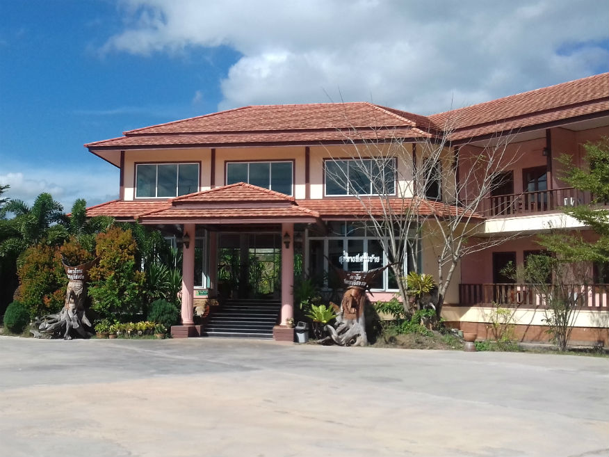
 Kingboon Resort, Dan Si, Loei Province
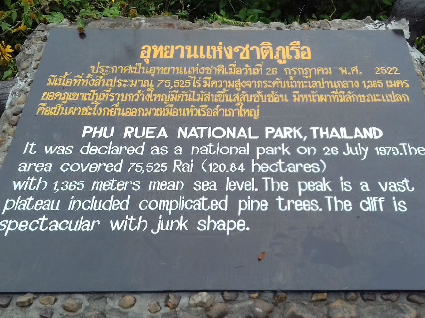
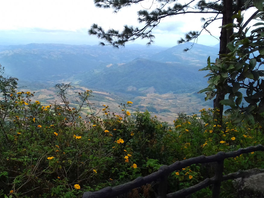
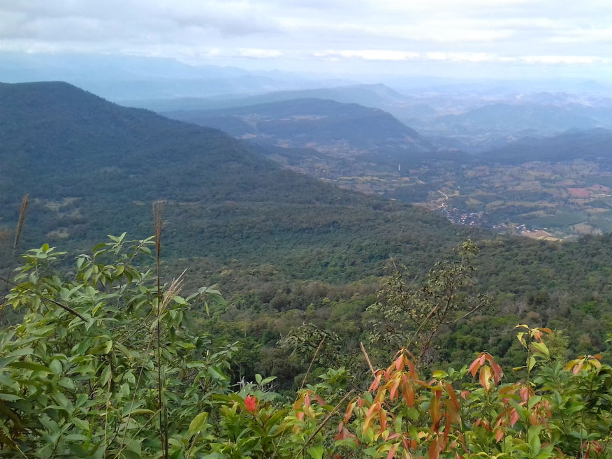
Dan Sai........Google Map Arriving at Dan Sai was purely a matter of convenience to solve the accommodation problem and we don’t need explore the area since it was well covered on a previous tour in November 2014. There are a number of temples here of historic significance and the Phi Tha Khon cultural centre unique to Dan Sai......more. Phu Ruea National Park........Google Map Phu Ruea National Park is 52 kilometres (32 mi) west of Loei town. The park's area is 121 square kilometres (47 sq mi). Phu Ruea mountain is 1,365 metres (4,478 ft) high and experiences some of Thailand's coldest temperatures. In December and January temperatures here can fall below freezing. Phu Ruea means "boat mountain", a name inspired by the shape of a cliff at the peak. 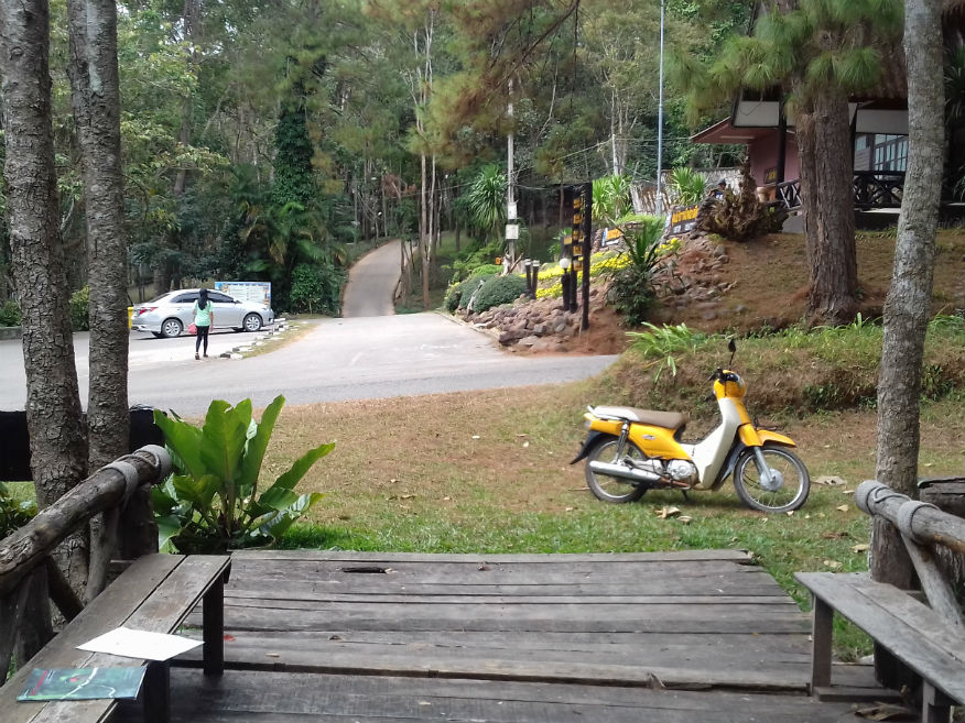
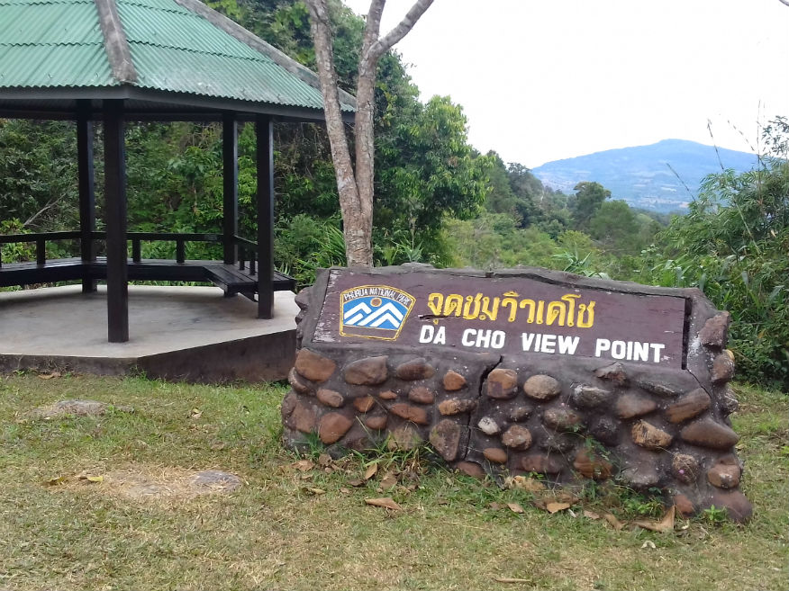
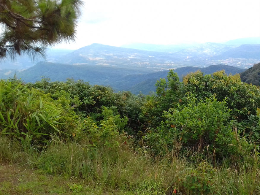 Phu Ruea National Park, Loei Province
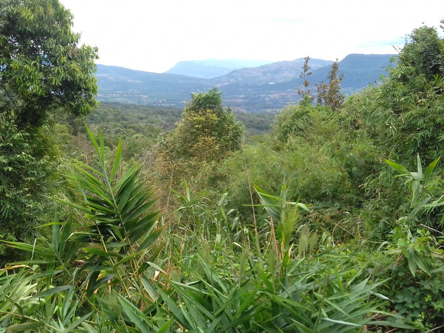
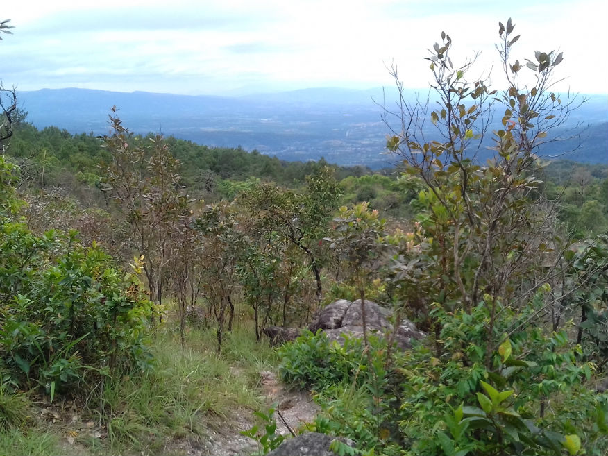
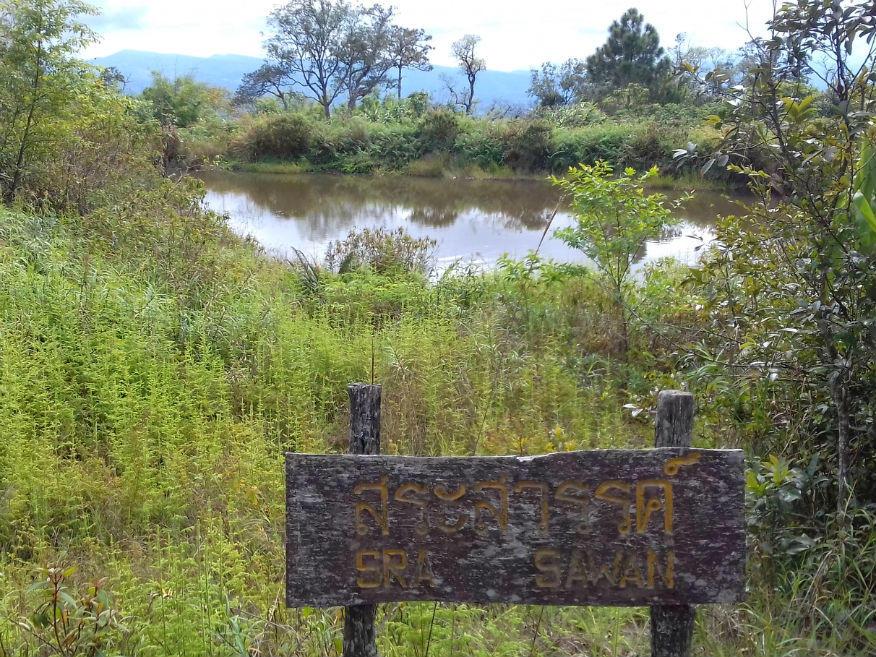
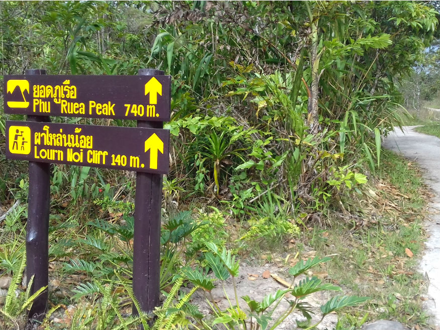
We arrive at the park well before lunch and for once I don’t complain about the foreigner tax. At 200 baht it’s still reasonable providing I spend some time in the park. Just past the check point is the visitor centre with staff always eager to please. It’s the first time I realise how high Phu Ruea mountain is, actually 20 metres higher than Ben Nevis but unlike the latter there is a generally good road to the summit: All credit to the works of the parks department. Obtaining a printed map I can see a number of viewpoints and other features on the way to the top. The visit is bound to absorb a couple hours at least but of course the main feature is the incredible views from the top as far as the Mekong and mountains of Laos. Typically there are a number of trails and I manage a couple of kilometres walking which proves somewhat demanding for me......more. 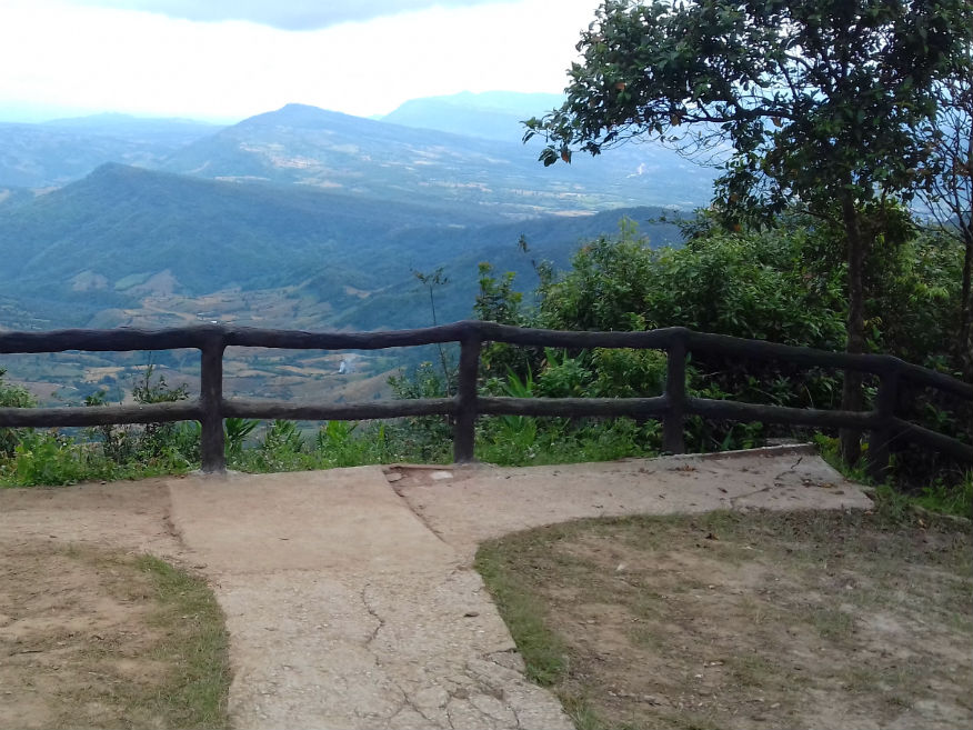
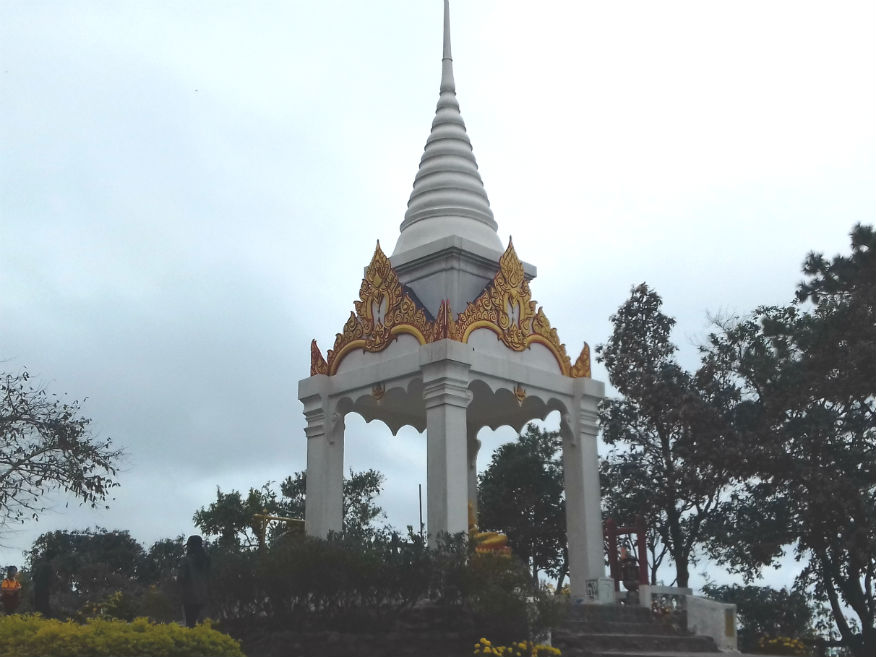
 Phu Ruea National Park, Loei Province
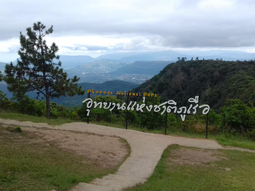
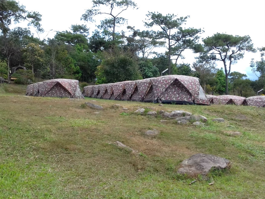
The table below lists the main attractions for visitors. A late lunch is taken at the campsite which is most reasonable and for the second time in as many days there is the opportunity to stay in the parks. Tents are available at 300 baht and the cabins look inviting but with so many resorts available nearby I pass yet again. At about 3.30pm we’re back down the mountain and into Phu Ruea set in a picturesque valley at the base of the park.
Rabiangphu Resort........Google Map Rabiangphu Resort is recommended by someone Katoon met in the park and with so much choice here, it’s a relief not to have to go searching around. The cabins easily meet with our approval and of course arriving mid afternoon is a massive contrast to last night and really welcome. I’m soon fast asleep. By 5.30pm we’ve wandered the few hundred kilometres into the town and find a steakhouse in a side street. Back at the resort there’s no too much writing to do but I do need to tether my PC again as the wifi signal isn’t strong enough. If I manage an early night for a change I’ll welcome that. Next Page
| |