|
|

|
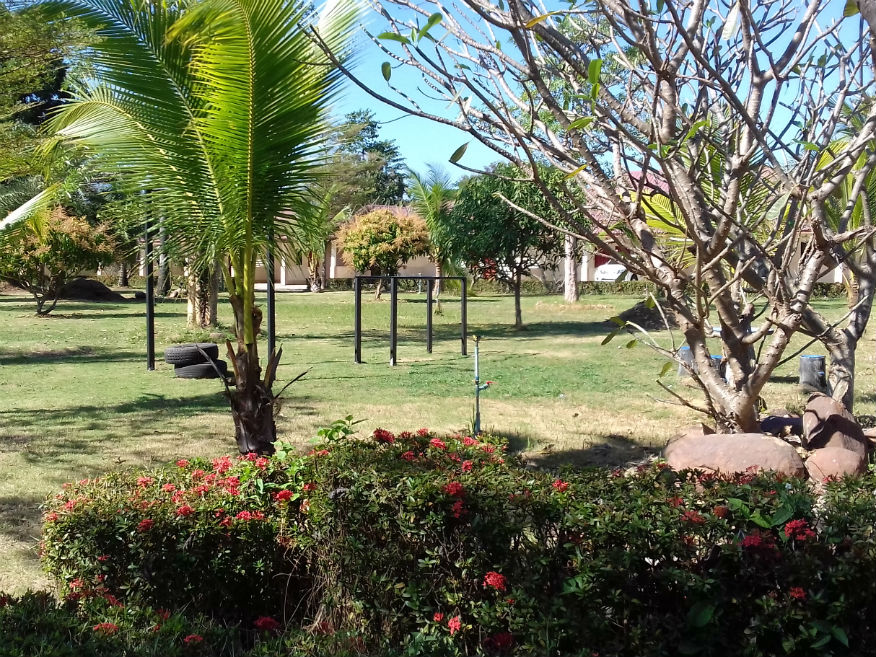
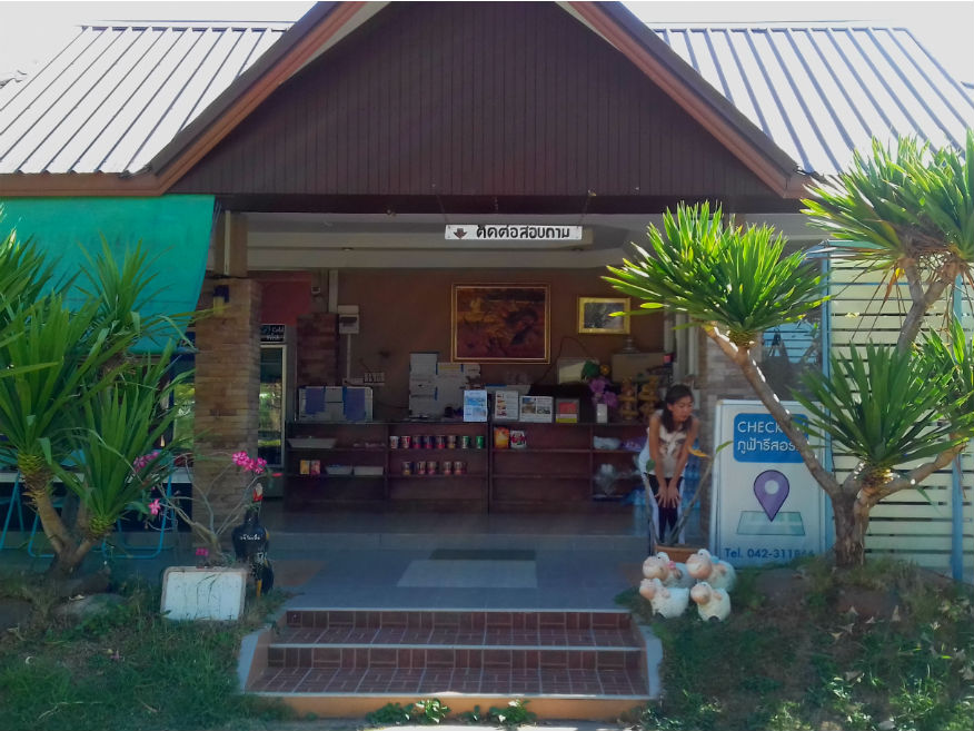
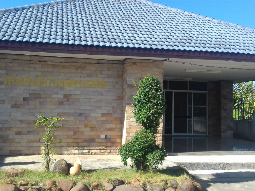
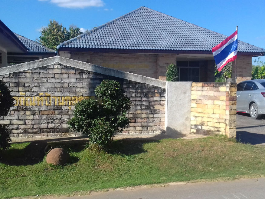
Monday 4 December 2017 Phufah Resort........Google Map With the distractions of previous nights out of the way I’ve managed to get some quality sleep greatly helped by easily the most comfortable bed so far on this tour. Phufah Resort consists of bungalows, two story accommodation and larger family bungalows sitting neatly around a rectangular field. At the front are the reception and a functions room. Further back is the kitchen that provides room service and buffets for conferences and parties or karaoke. On Google map it’s described as an apartment building so is easily missed off the accommodation list. 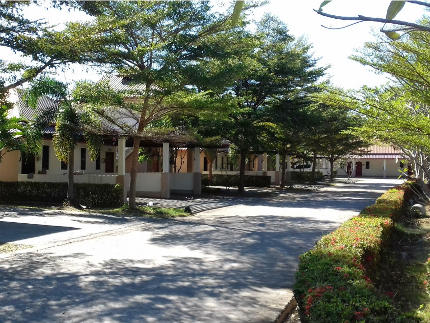
 Phufah Resort, Meuang Nong Bua Lamphu, Nong Bua Lamphu Province
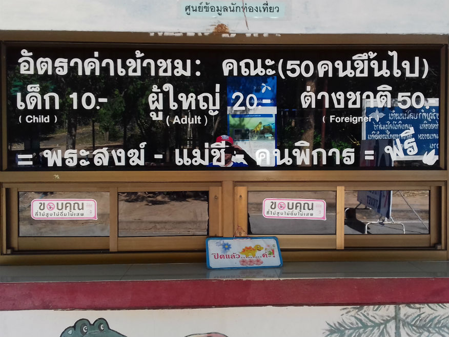
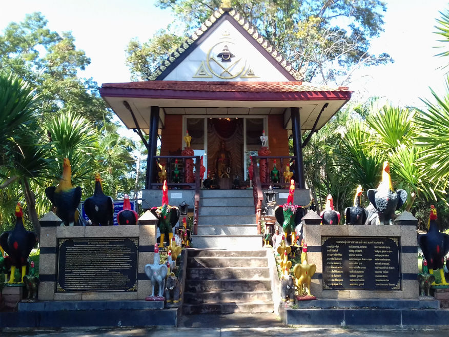
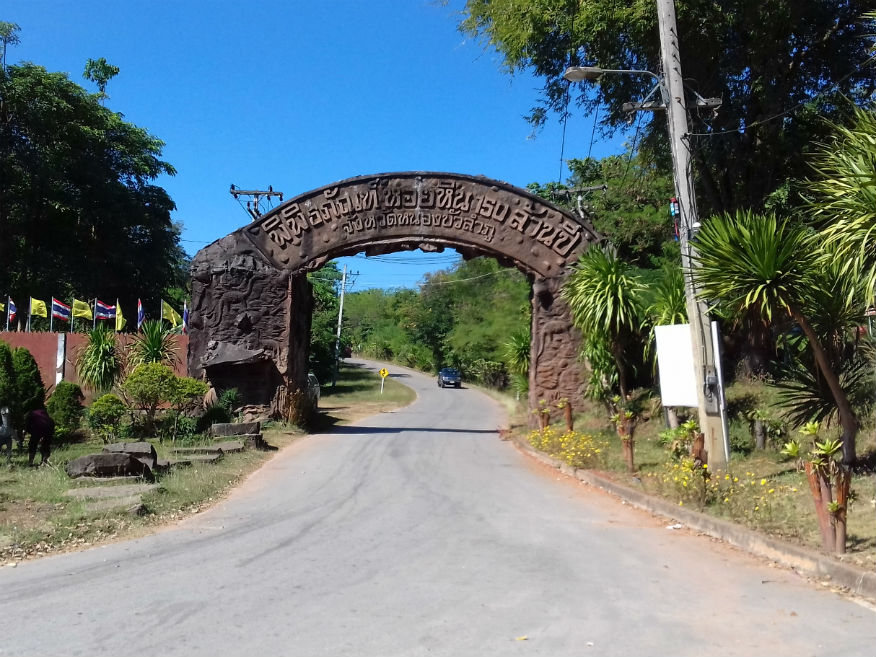
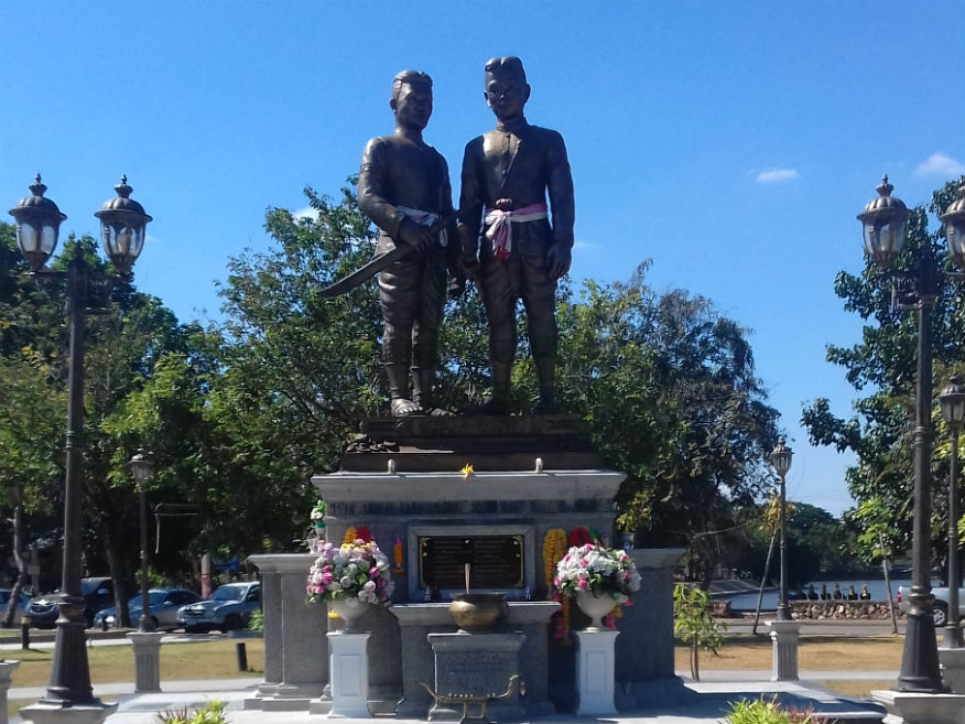
The rooms are smart and modern with the usual features including wifi but in room 066 it’s too weak to fire up my PC so not for the first time I tether it to my mobile, a service which I really appreciate. I will be relying on it more on more in future allowing me more flexibility with room selection. Trying to plan the day I suggest we stay around Nong Bua Lamphu until lunchtime as there are a few locations that look interesting not that far away. 150 Million Years Stone Shell Museum........Google Map The 150 Million Years Stone Shell Museum is located some 15 minutes drive from Nong Bua Lamphu heading along highway 210 towards Udon Thani. Locating the left turn to the Museum there’s a sign that needs no interpretation which throws my plans out of the window at the first hurdle: It’s closed. It’s not as if I shouldn’t know because Monday closure applies to museums all over Thailand. Disappointed I head for the car park anyway. It soon appears that the fossil museum isn’t the only attraction here as there is a building dedicated to discovery of dinosaur bones in the area. But it too is closed. However there is something I can review as a trail has been created in a secluded valley where the museum’s exhibits were found. Here they have kindly recreated full scale models of some of the dinosaurs we are familiar with but of course the rock layers in the cliff face where fossils were extracted are the primary attraction......more. With the trail absorbing at least half an hour it has gone some way to compensate for the museums’ closure. For those interested in Thailand’s history there is a shrine here to King Naresuan the Great (1555-1605) whose exploits have appeared before on this site. 
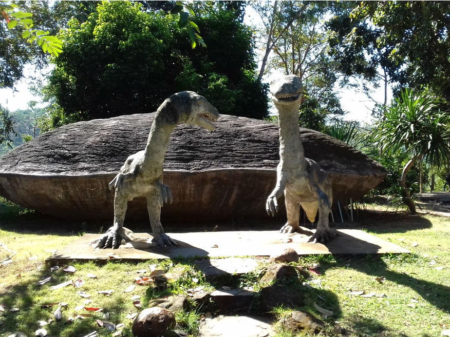 
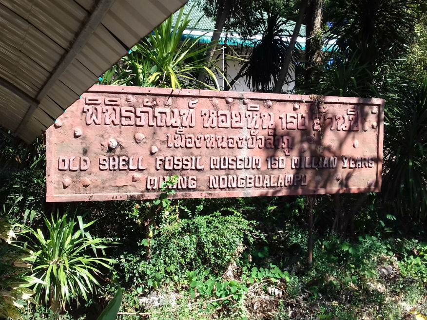
 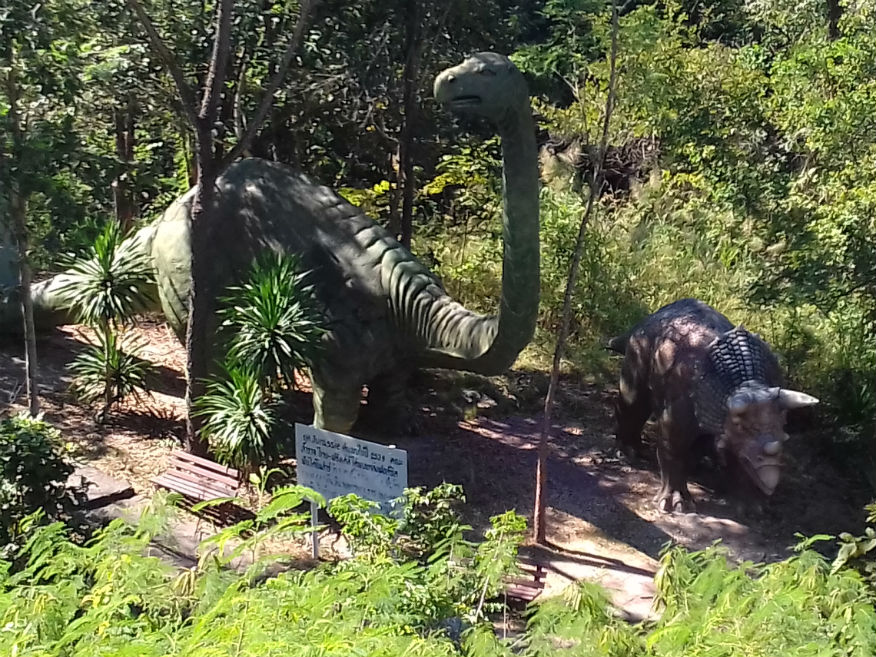
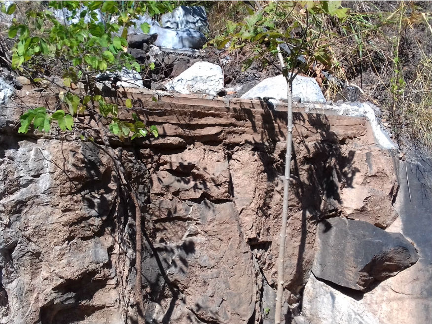
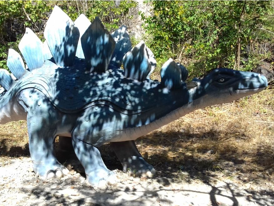 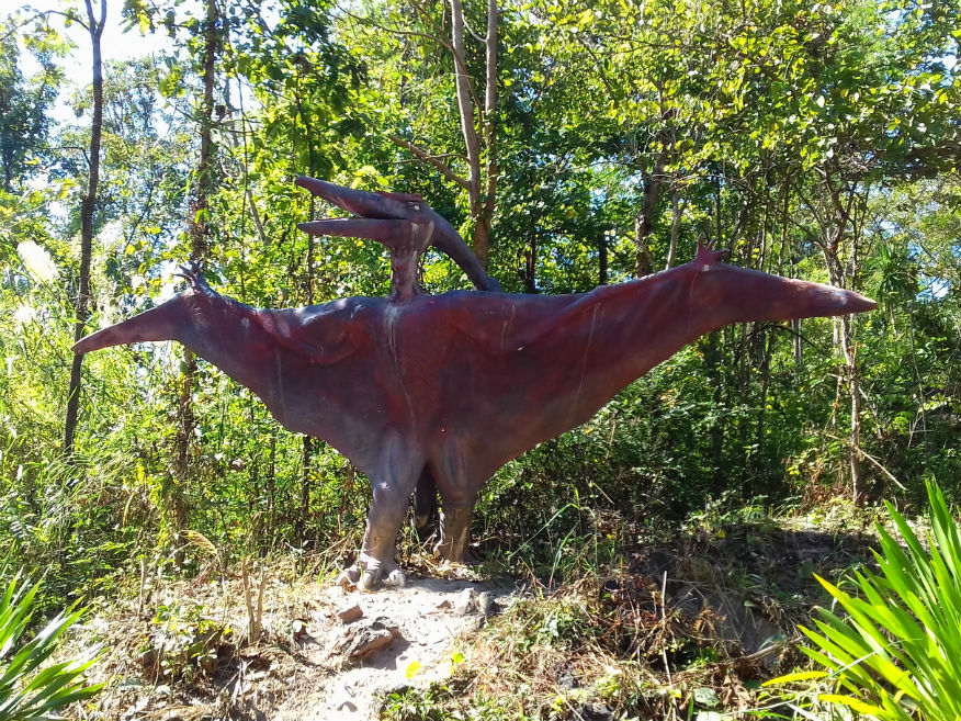
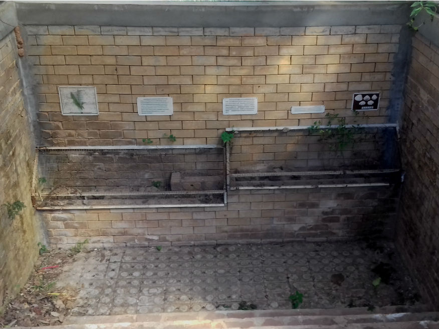
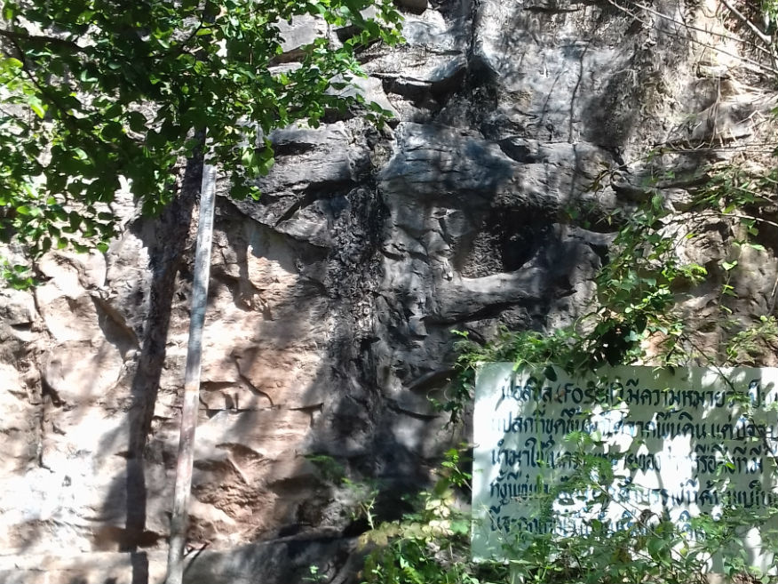 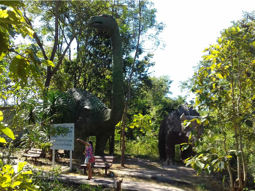
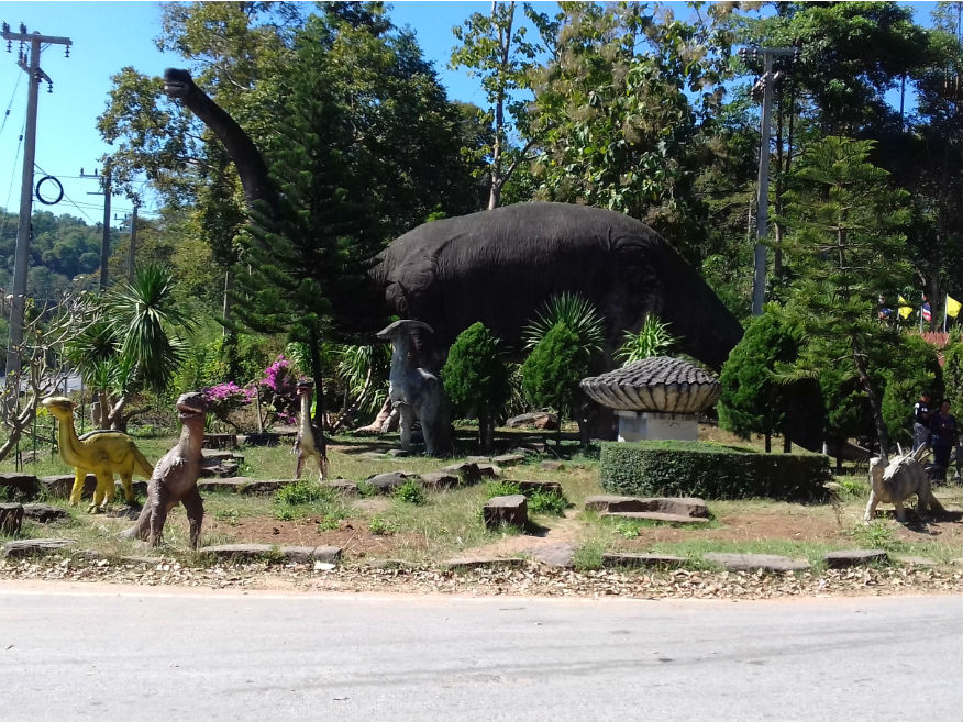 150 Million Years Stone Shell and Dinasaur Museum, Meuang Nong Bua Lamphu, Nong Bua Lamphu Province
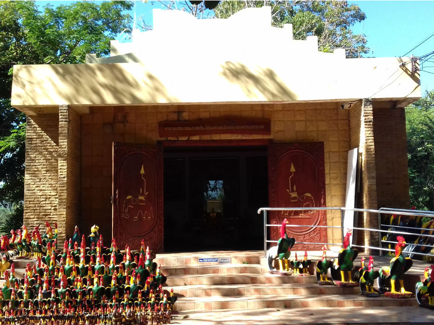
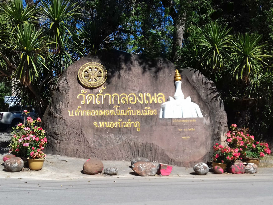
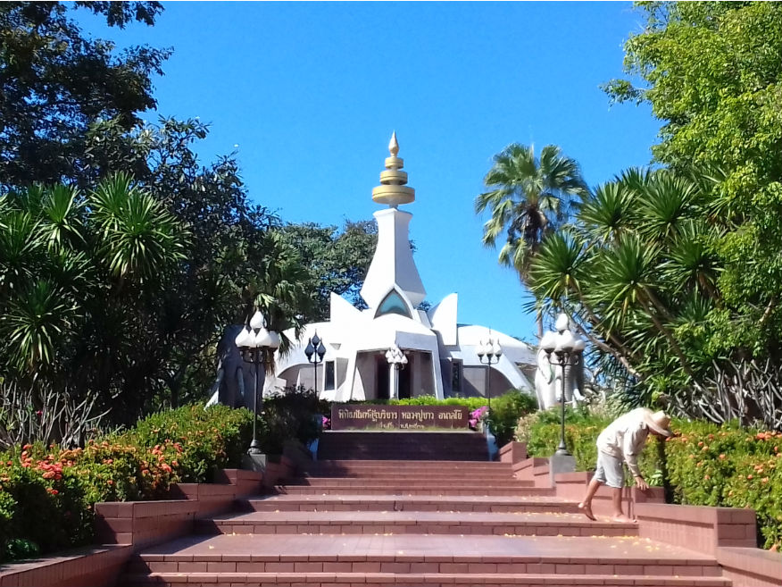
Wat Tham Klong Pen........Google Map Entrance to Wat Tham Klong Pen is a few kilometres further on the right of the 210. Located at the foot of Phu Phan mountain, Wat Tham Klong Phen is the province’s most famous forest temple. Though accurate historical accounts do not exist, it is likely that the temple was built during the Khmer period and was neglected or abandoned until 1958. Respected monk Luang Pu Khao Ananyo (1888-1983), who was a follower of Vipassana meditation, and who studied under Achan Man Phurithatta Thera, practiced meditation here. He built a cement roof over three or four huge rocks, creating a huge hall capable of accommodating hundreds of people......more. 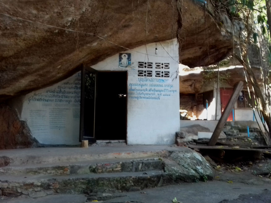
 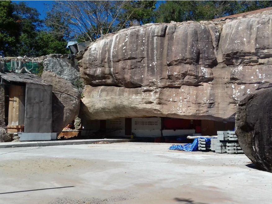
 Wat Tham Klong Pen, Meuang Nong Bua Lamphu, Nong Bua Lamphu Province
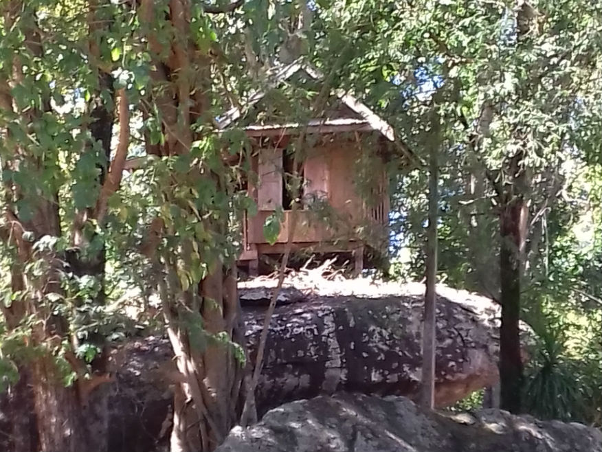
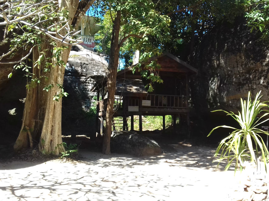
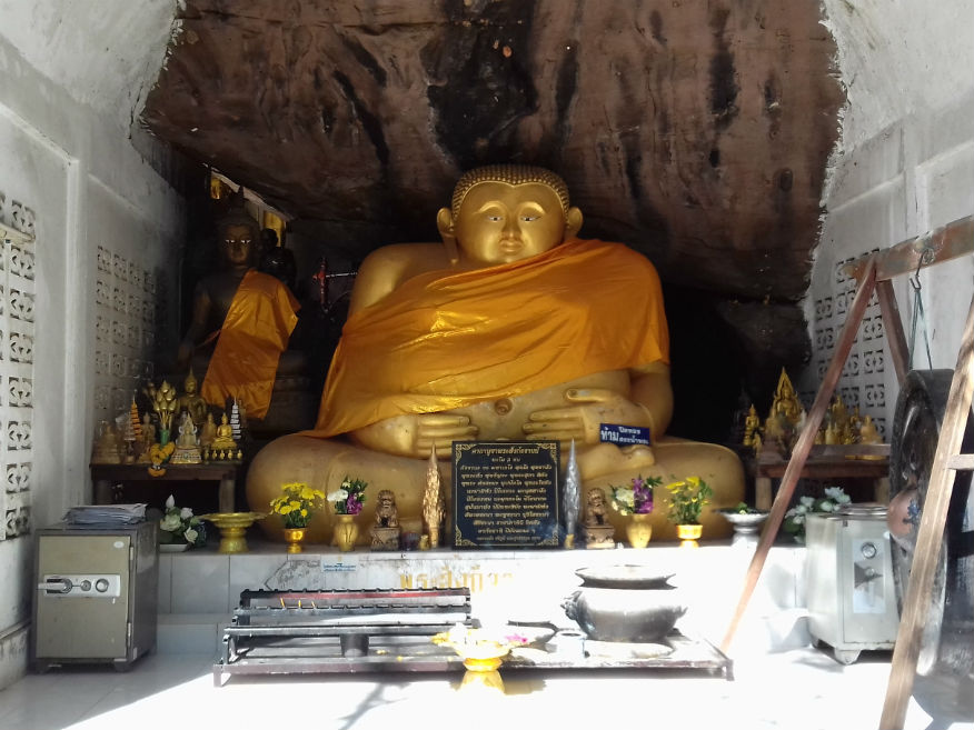
Blanketed with lush vegetable and decorated with a rock garden, the area around the temple is very shady and peaceful. The main hall or Ubosot houses the statue of Luang Phu Khao and a two-sided ancient drum or Klong Phen. A two-kilometre-long road running through a forest and strangely-shaped rocks leads to the monument of Luang Phu Khao, which has nearby museums, a pagoda and a pavilion dedicated to the monk as well as his old monastery. His original abode is a simple wooden structure and the pavilion is where he spent his final days, is left as it was after he died. 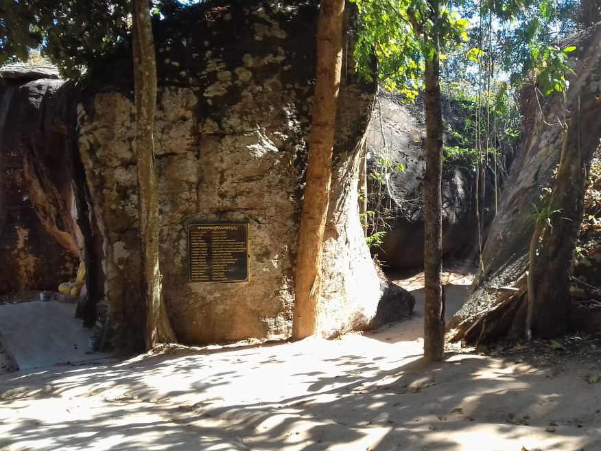
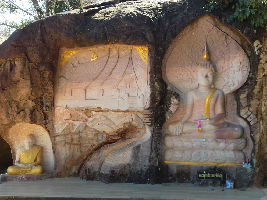
 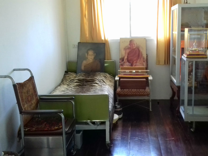
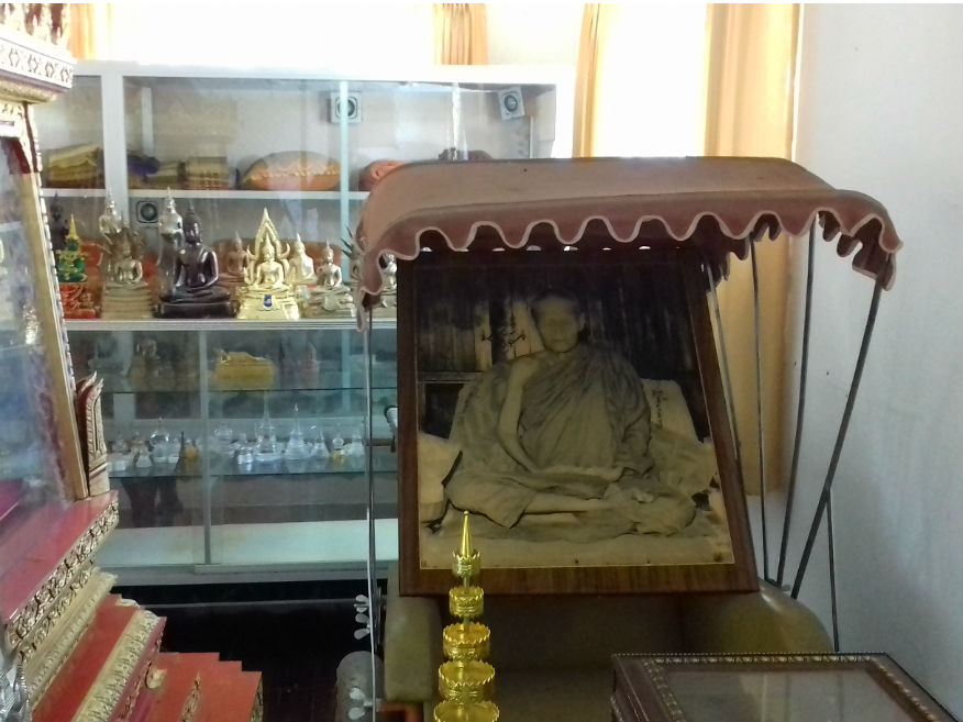
 Wat Tham Klong Pen and Luang Pu Khao Analayo Human Imagery Museum, Meuang Nong Bua Lamphu, Nong Bua Lamphu Province
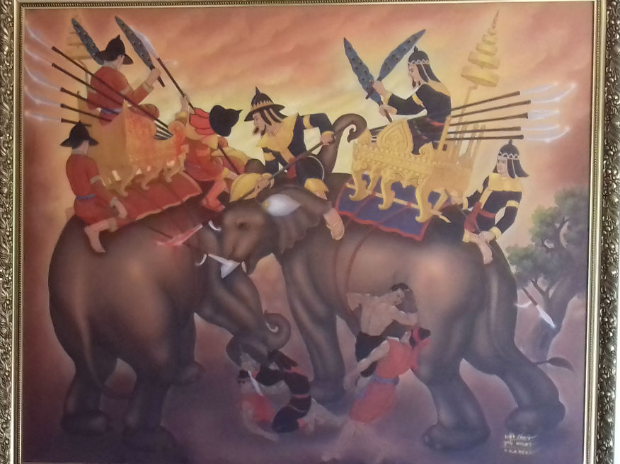
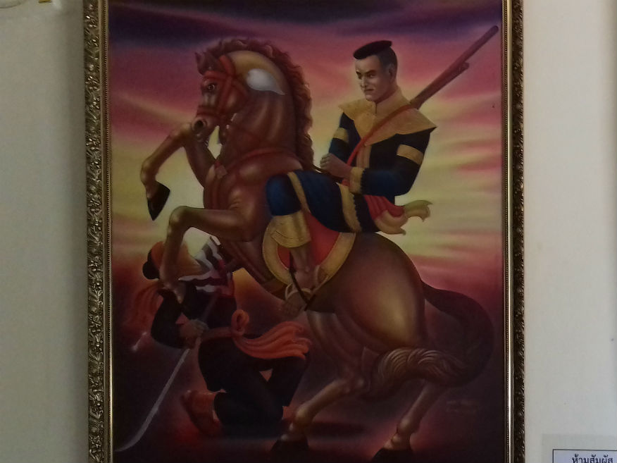
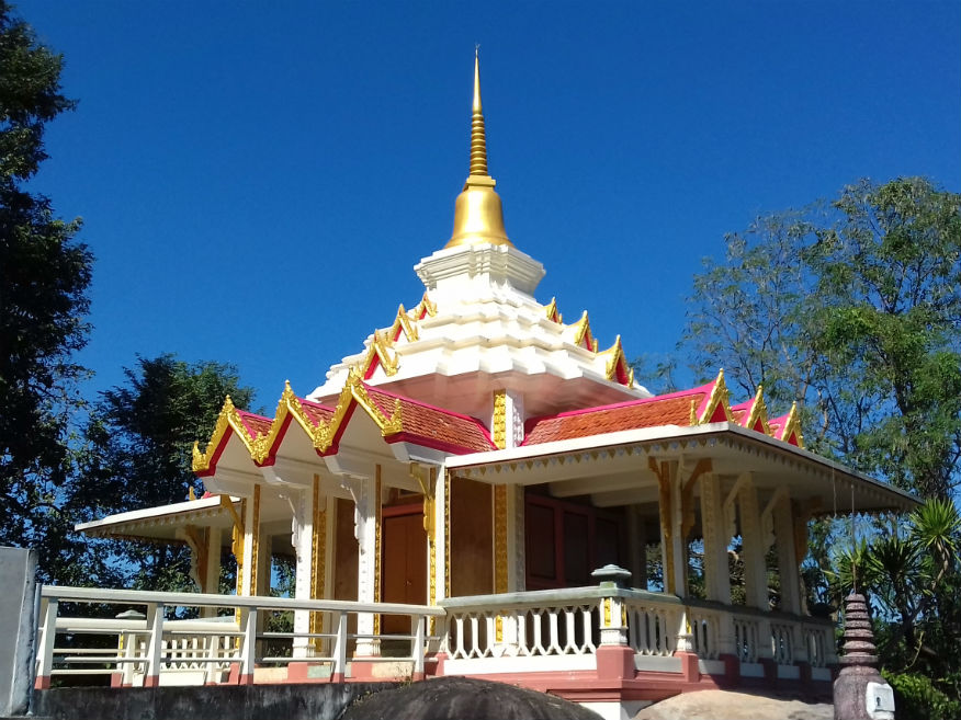
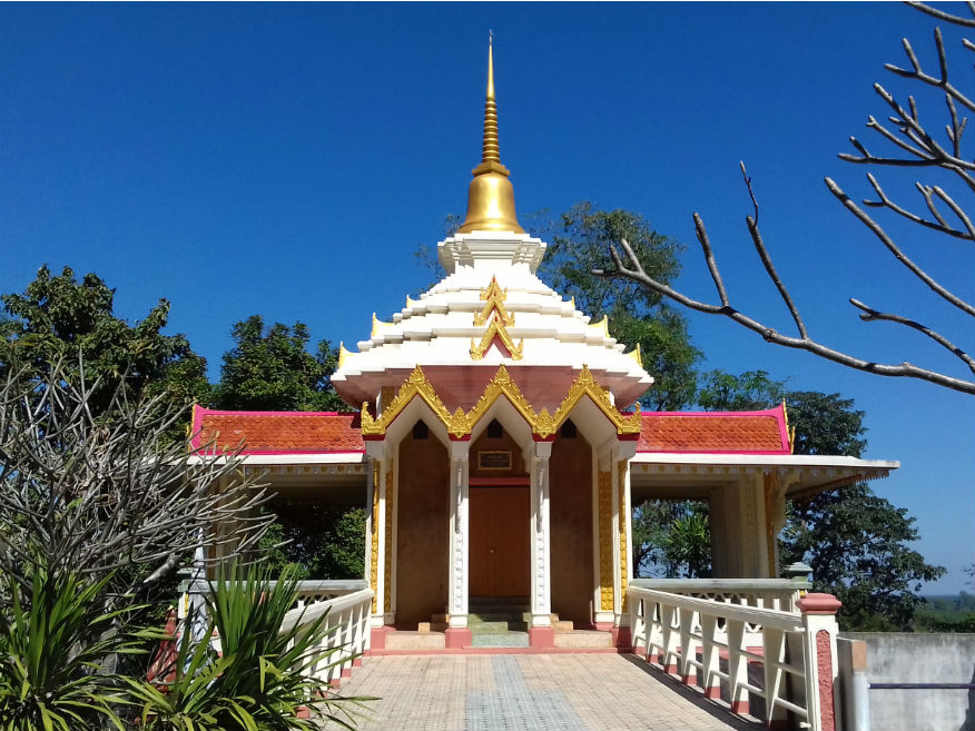
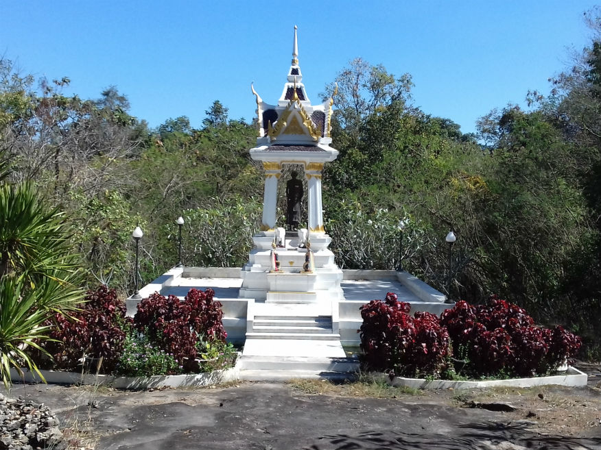
Such is the reverence afforded to Luang Phu Khao for his dedication, the national government and his followers have seen fit to extend the site building a museum even adding information in English for those interested in following his story. Somdej Phra Naresuan Maharat Shrine........Google Map At about midday it’s time to head back to Nong Bua Lamphu and start looking for somewhere to take lunch. As we turn onto highway 228 heading south, we past Nong Bua, a lake which must have given the town its name. Immediately in front of the lake is Somdej Phra Naresuan Maharat Shrine, a more substantial and elaborate tribute to King Naresuan. While his exploits still fascinate me especially his duel with the Burmese prince at the battle of Nong Serai (see my blog for Suphanburi) in 1592, I must focus on continuing this tour......more. 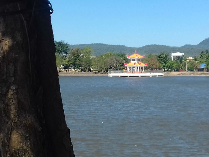
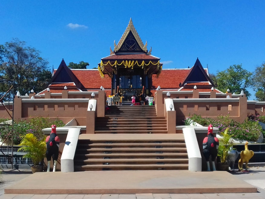
 Nong Bua Lake and Somdej Phra Naresuan Maharat Shrine, Nong Bua Lamphu
Decision........Over an enjoyable lunch near the lake I have a decision to make. Katoon has had a phone call from the lady we rented the car from. She asks if we need to extend the hire period and I immediately ask why that is necessary. Seems unusual to me but it has me thinking. One of the remaining sites for today, the most important, may also be closed. When I check the site map that’s confirmed. There will be no museum visits today. I consider the options and conclude that with much of the last week well under budget why shouldn’t I extend it? However that decision has a big impact on where we should head next. It gives me further options and I direct Katoon to continue south. I plot a course that will add sites to this tour while still maintaining options. I still have time to make my mind up. Ban Kut Kwang Soi Archaeological Site........Google Map We’re now heading southeast alone highway 2146. I’ve identified an archaeological site not far from the main road. Having already taken good advantage of my data package on my mobile I now set it up as a SatNav and it works perfectly taking us right outside the entrance. My concern was that it too might be closed but I’m in luck. While it’s unmanned the door has been left open. Ban Kut Kwang Soi Archaeological Site is small and not on the same scale as at Ban Chiang in Udon Thani that has achieved UNESCO accreditation but excavations in the 1990’s have revealed similar finds that link the two sites. The dig revealed evidence of occupation back to the Bronze Age. The discovery of burials with grave goods at lower levels proves that these predate the Buddhist era. Thereafter there are no human remains present but pottery and animal bones were still found. It is thought that settlement in the area was the result of suitability for domestication of hoofed animals. As mentioned, this is a small site. Many similar sites exist in Udon Thani province. From later finds links to the Lan Xang (Laotian) culture has been established. Pleased with this site, I confidently continue further along the 2146......more. 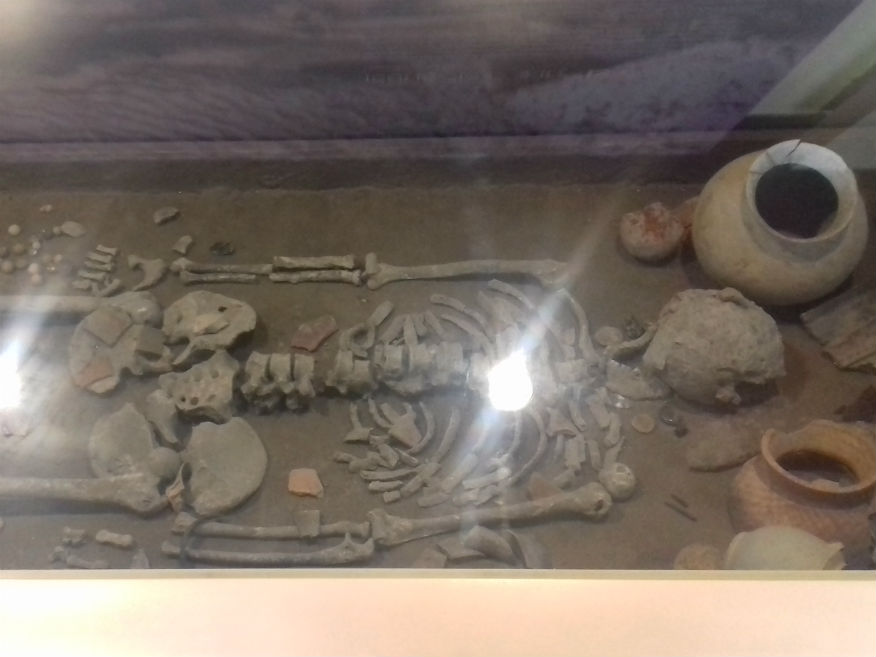
 Ban Kut Kwang Soi Archaeological Site, Non Sang District, Nong Bua Lamphu Province
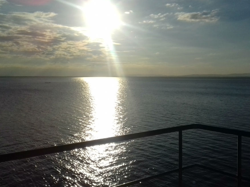
Ubolrattana Reservoir........Google Map My satnav soon shows we are approaching a scenic area. Dead ahead is the Phu Kao - Phu Phan Kham National Park which forms the border with Khon Kaen province while to the right, the massive Ubolratana Reservoir comes into view. It is this attraction that has caused the tour diversion as I’m confident of finding accommodation in the area. However before that is a viewpoint on the Nong Bua Lamphu/Khon Kaen border. The Khao Khat Valley Viewpoint offers excellent views of the reservoir to the west. 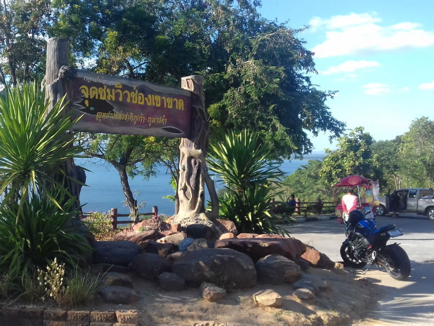
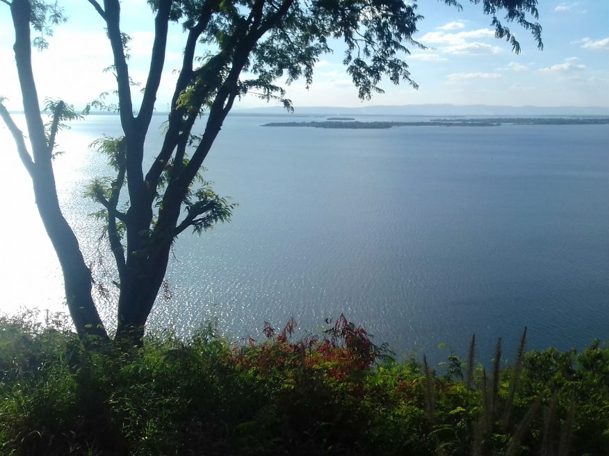
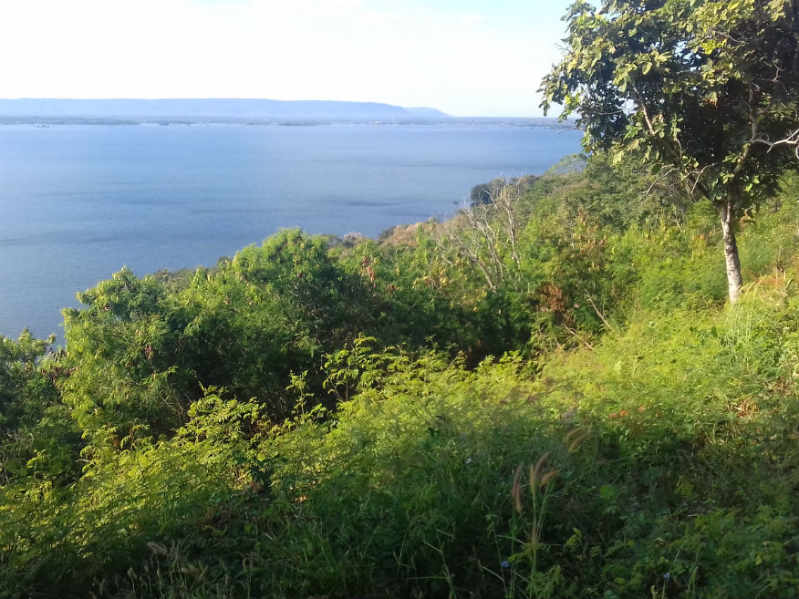 Ubolrattana Reservoir, Non Sang District, Nong Bua Lamphu Province
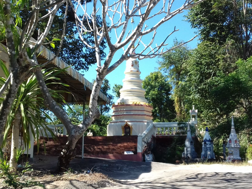
Wat Khuean Ubolratana........Google Map Ubonrat is the community adjacent to the dam. Initially I use the satnav to locate accommodation but on this occasion gigo (garbage in garbage out) kicks in. Who reviewed this site and gave it the thumbs up? Katoon thinks she can do a lot better in the more conventional way but as if sucked in by a powerful magnet she finds the temple Wat Khuean Ubolratana . This late in the day I’m not in the mood for another trek around temple grounds, however I do note the curious rock formations nearby, the result of erosion of sandstone causing a stone bridge under which the temple has installed a reclining Buddha image. While it’s still light, now about 5pm, I just know Katoon has not finished for the day. 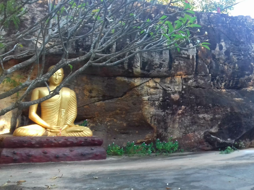
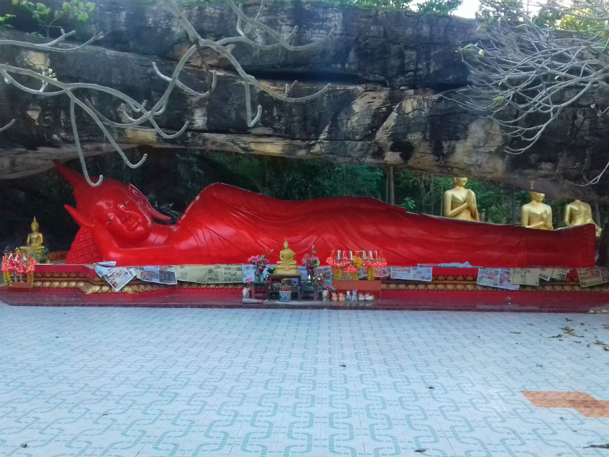
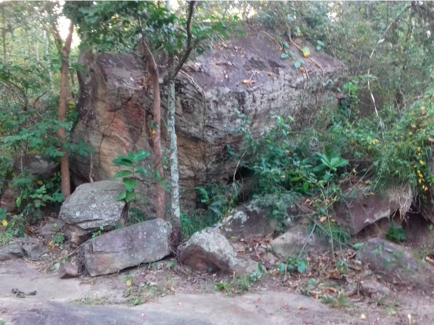 Wat Phra Bat Phu Phan Kham, Ubolratana District, Khon Kaen Province
Ubolratana Dam........Google Map The Ubolrattana Dam itself is a controlled area but includes accommodation, services and even a golf course. The dam is the focal point on the reservoir and you’re able to park up and walk across the embankment and sluice gates. 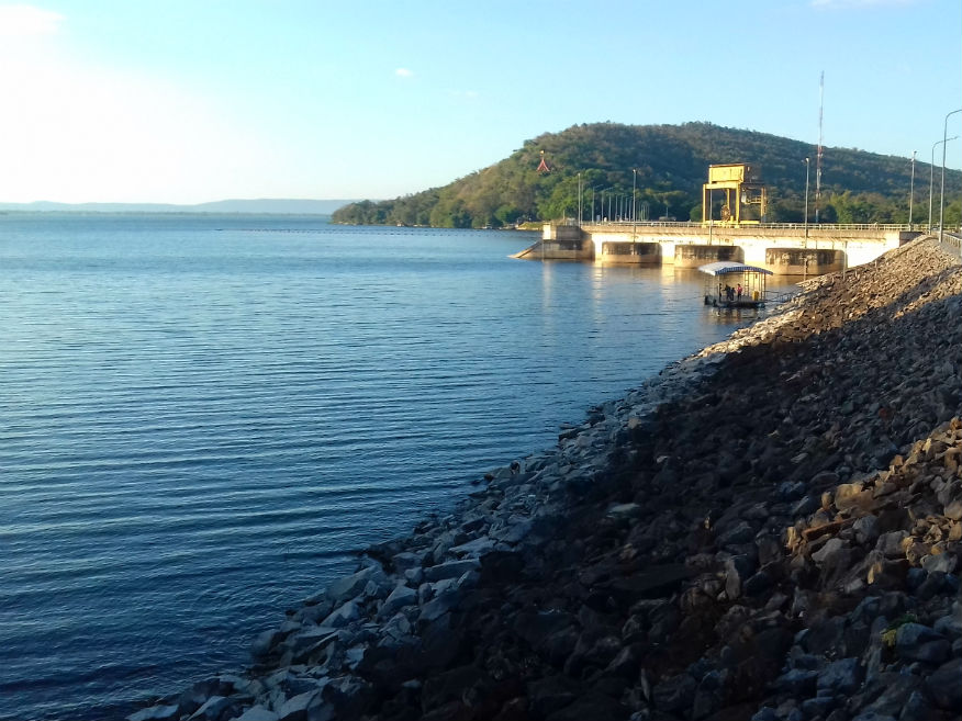
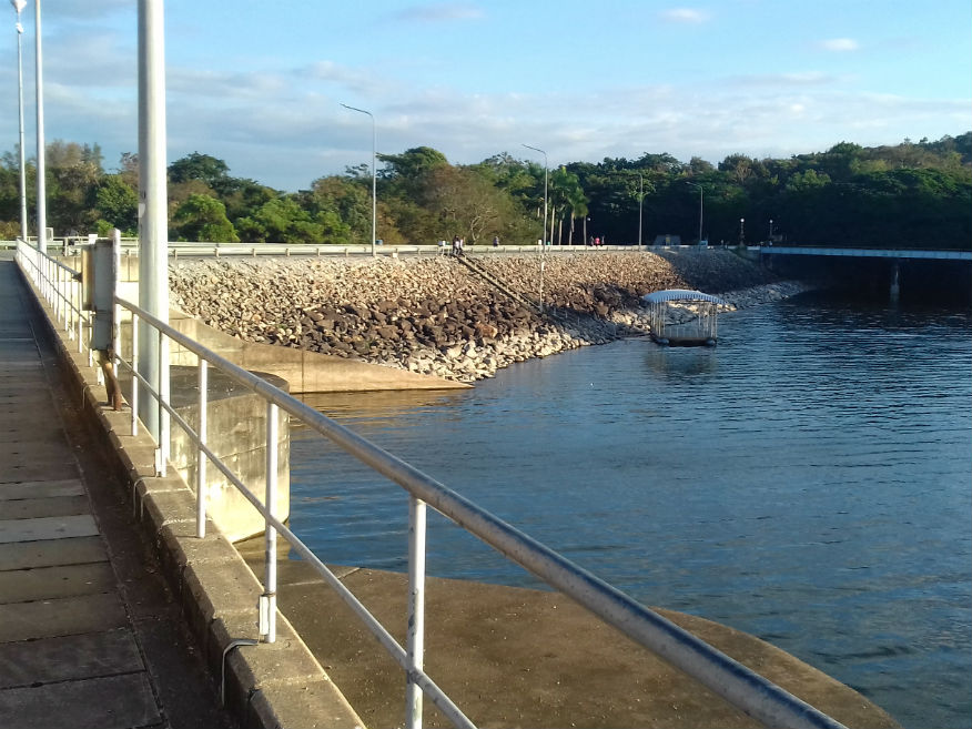 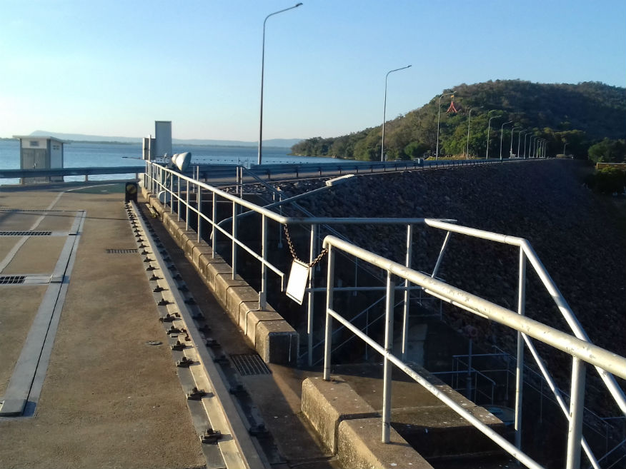
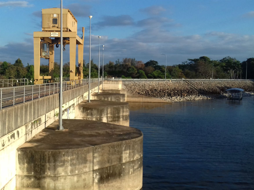
 Ubolratana Dam, Ubolratana District, Khon Kaen Province
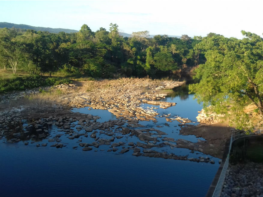
For the record, the Ubolrattana Dam is a Royal Dam named after Princess Ubol Rattana. It has an earth and rock core impounding the Phong River. It’s 32 metres high and 885 metres long. It was completed in 1966 for the Generating Authority of Thailand producing an annual generation of 57 GWh. Its cubic capacity of 2,263,000 cu metres......more. Arriving here in early December I note that the reservoir is quite full with some flooding in the catchment area. This wasn’t the case in April 2016 when it ran dry, the first Royal Dam to do so. The dam provides water for irrigation and for power generation and countless fish died during the drought. Koonta Resort........Google Map Now it really is time to find accommodation. Koonta Resort is located at the junction of the 2109 main road and the 4003. It’s not marked on any map I can see and we just stumble on it. It is a collection of Thai style wooden huts on posts. The only hut available is small and near the busy road but we just have to take it. Dinner is taken next door. The speciality here is fish from the lake. Tasting the local food is often a pleasantly surprising experience but OMG, it’s the most expensive meal we’ve yet had in Thailand which causes me to think the fish are just recovering after the drought. Back at the hut I’m struggling to complete my blog. Katoon seems to have dropped me in it again. However by this time I have made that important decision to add another day to the tour which will justify my decision to return to Bangkok via these eastern provinces but with a mere 67 kilometres covered today we need to make better progress tomorrow. Next Page
| |