|
|

|
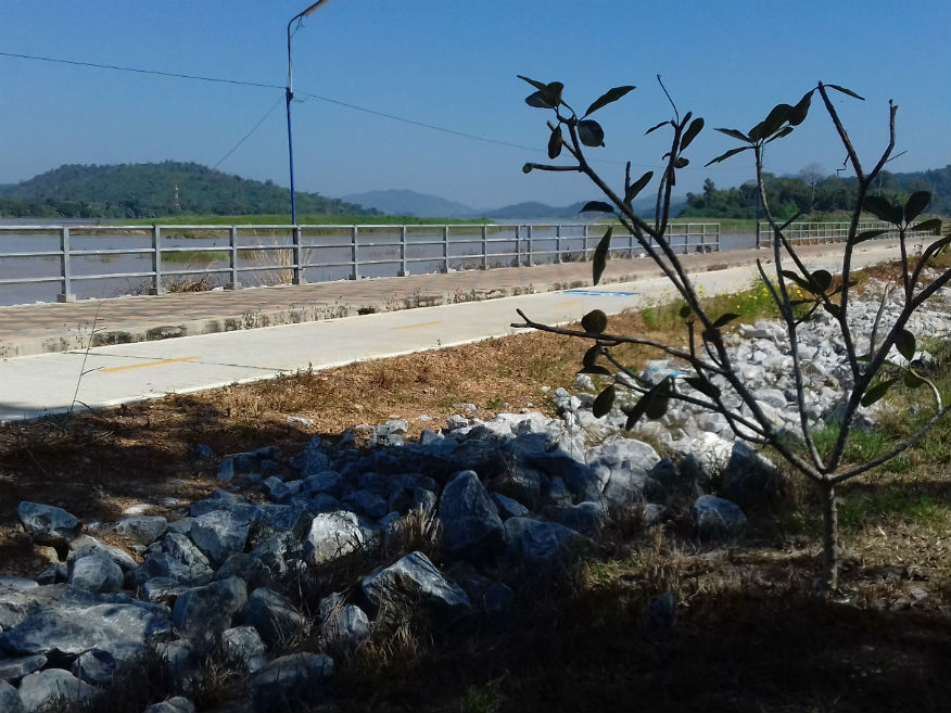
Sunday 3 December 2017 Farewell........After a late night I’m again having to write up my blog in the morning and obvious slow to start it. As I peer out of the window probably for the last time the Mekong River is shrouded in mist. Ideally I should be out there in the cool of the morning taking some exercise but I really need to continue writing and prepare for departure. It’s bound to be a late start and finally just after 11am I take one last look across to the mountains of Laos with some regret that I just didn’t find the time to just sit out by the river and just chill out. 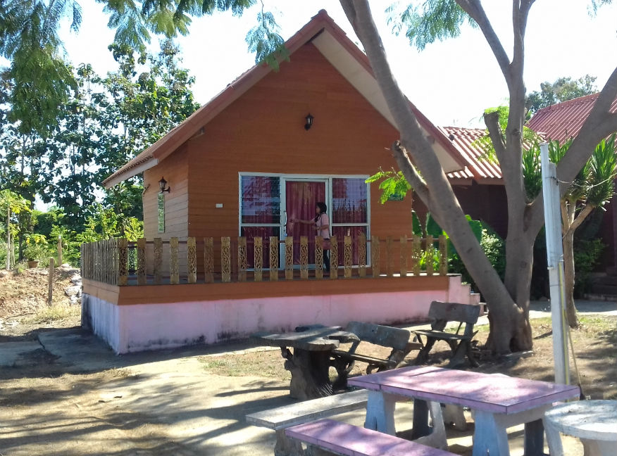
 Buluang Na Khra Resort, Pak Chom District, Loei Province
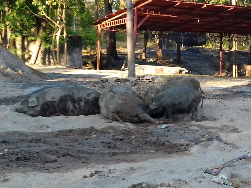
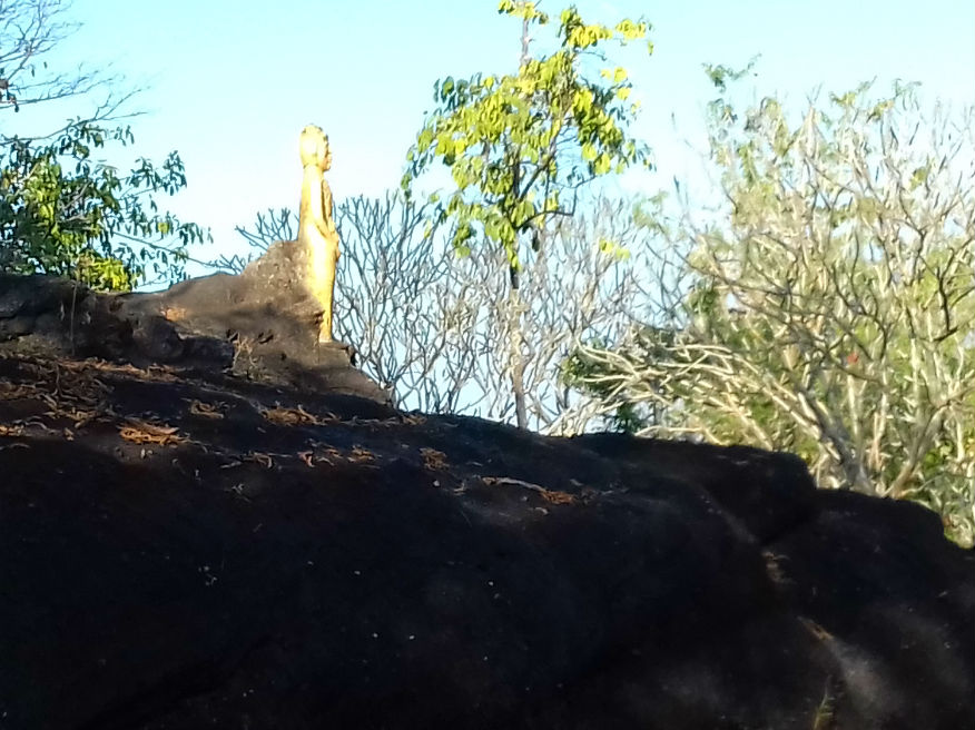
and right, Wild Boar at Wat Phra Phuttabatbuabok, Ban Phue District, Udon Thani Province
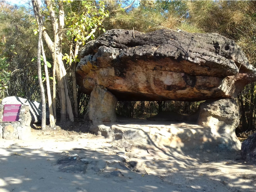
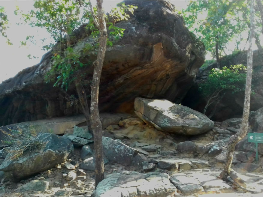
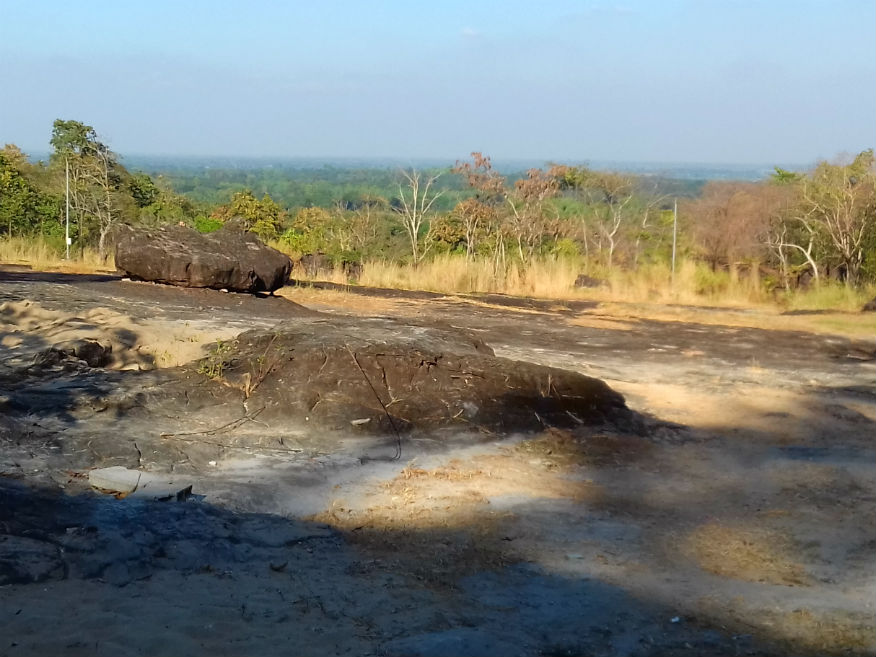
New target........Even as we depart there’s no clear plan for the day but I instinctively carry on eastwards along the river. In terms of touring, the two excursions the last two days were probably a waste of time. If we’re heading this way anyway we could have taken in the sites and saved those days but what we ended up with is a compromise to be with Katoon’s family. Reaching Sang Khom again, we stop for lunch then head south along the same road we returned along yesterday, heading for Udon Thani province. That trip yesterday helped set a target for today’s travels. Phu Phra Baht Historical Park........Google Map As with many of our site visits very little planning or research precedes them. It was only 24 hours ago that I noted a park for inclusion in this tour. Arriving at Phu Phra Bat Historical Park all I had was a picture in my head of unusual rack formations but then rock formations have hardly been missing from this tour so far. I did however question why it was referred to as an Historical Park rather than a National Park. Historical Parks are run by the Fine Arts Department and include such important sites as Ayutthaya and Sukothai and are therefore of archaeological rather than natural interest. I’m about to find out why......more. 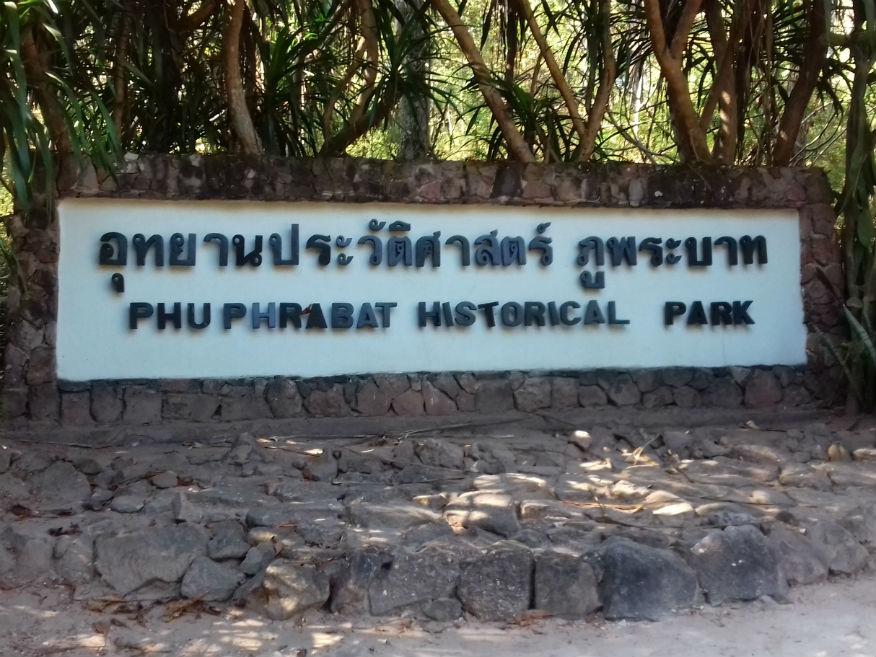
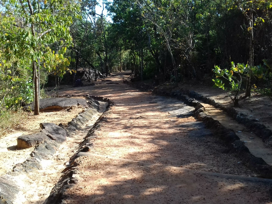
 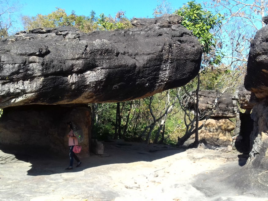
 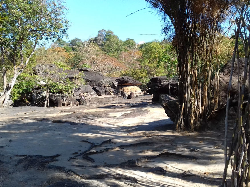
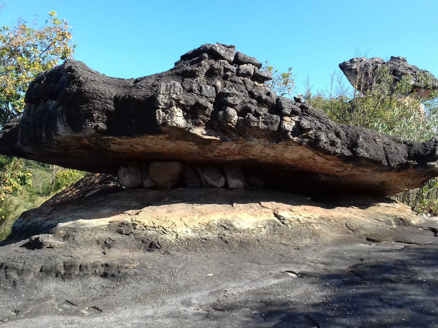
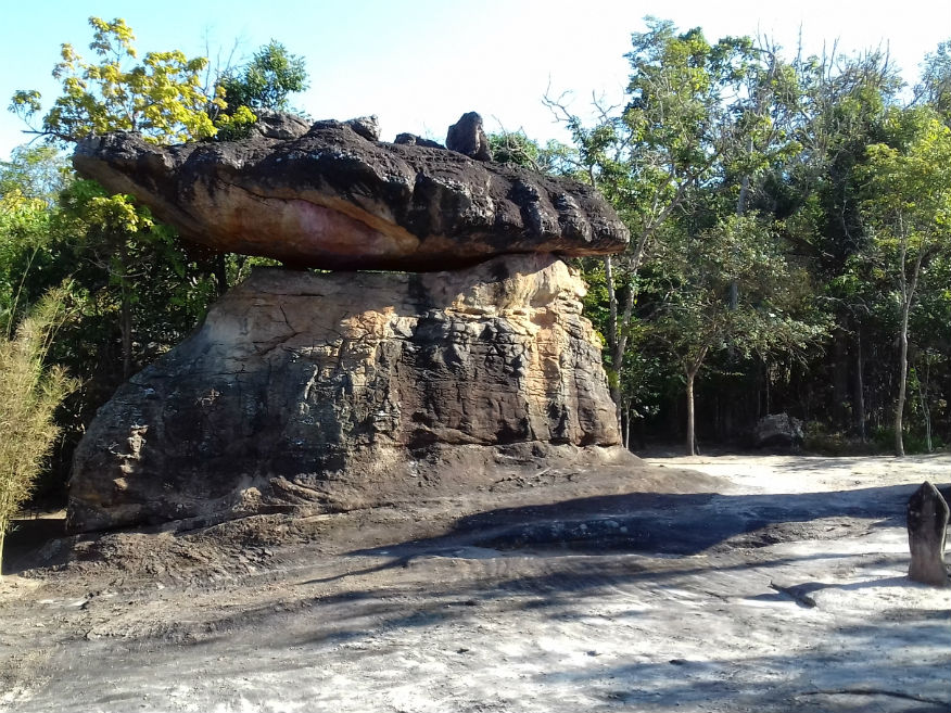
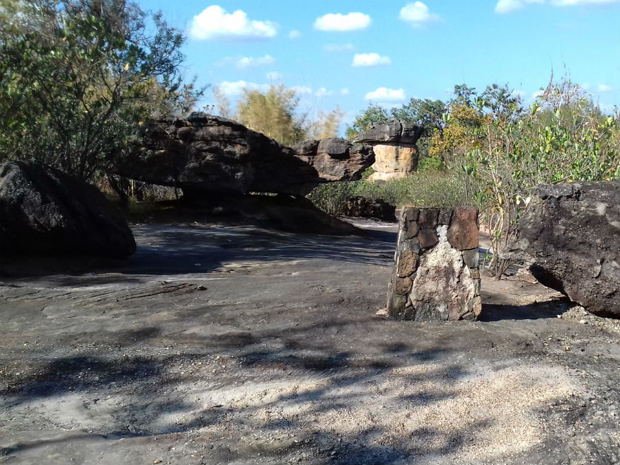 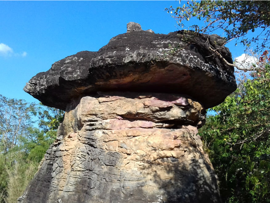
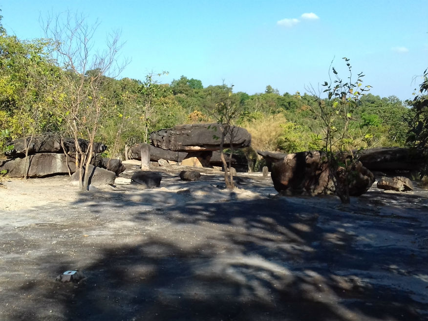 
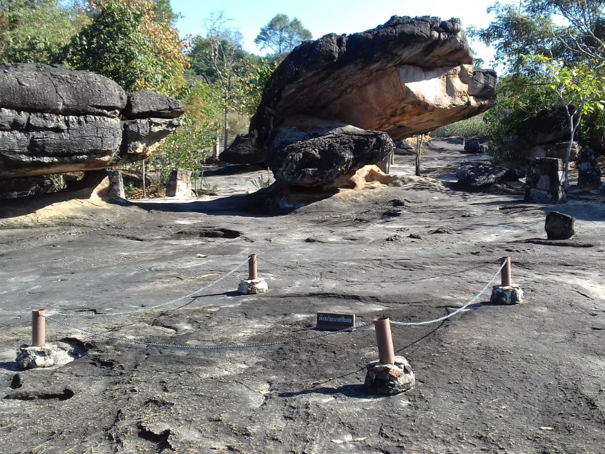
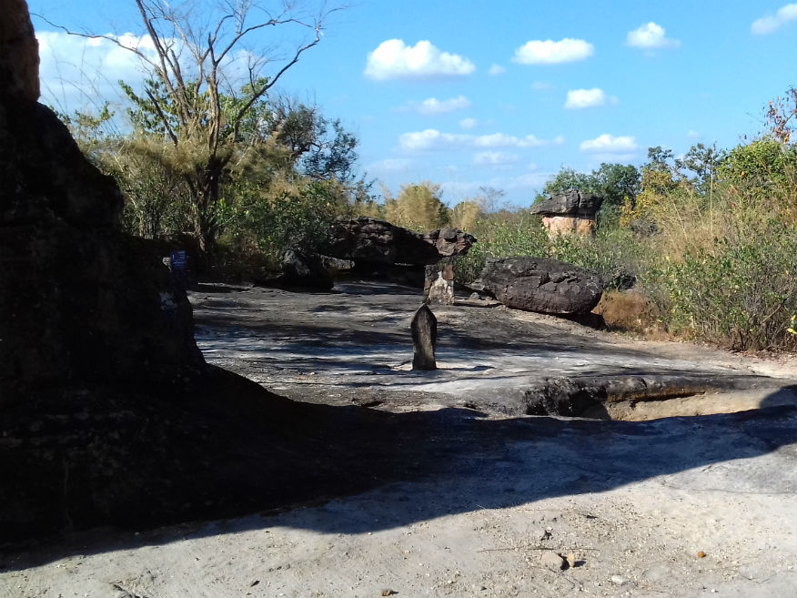
 The Rock Formations, Phu Phra Baht Historical Park, Ban Phue District, Udon Thani Province
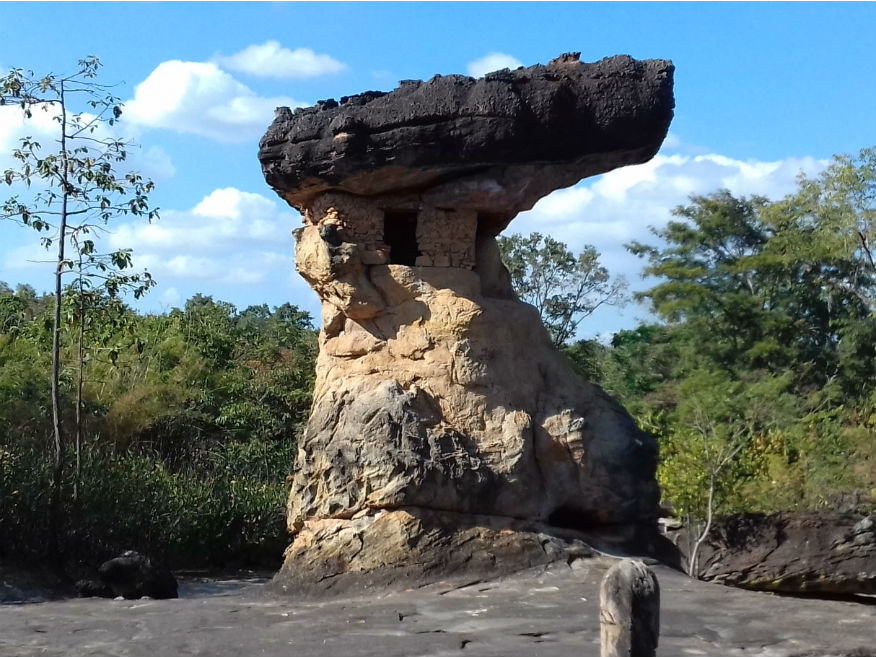
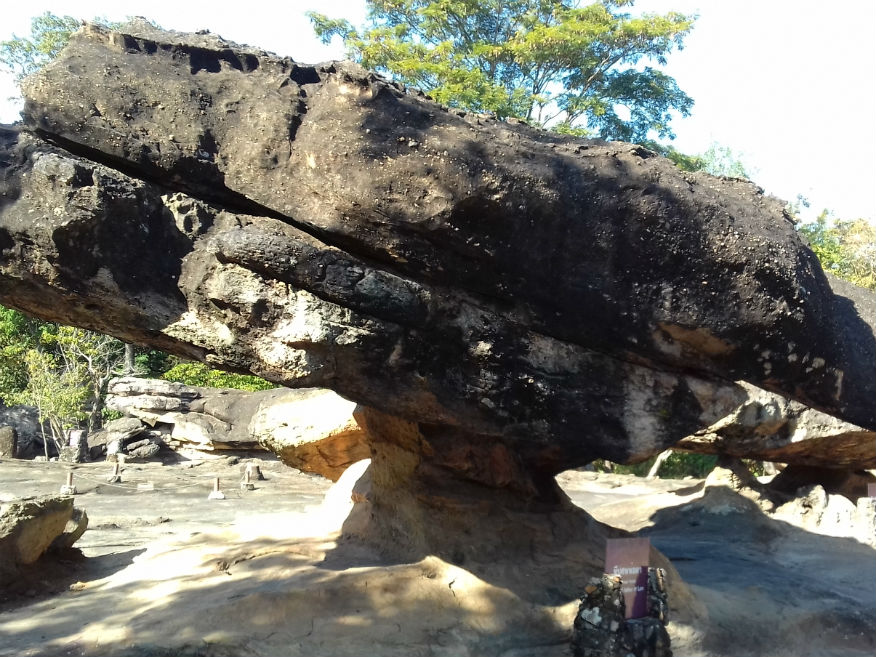
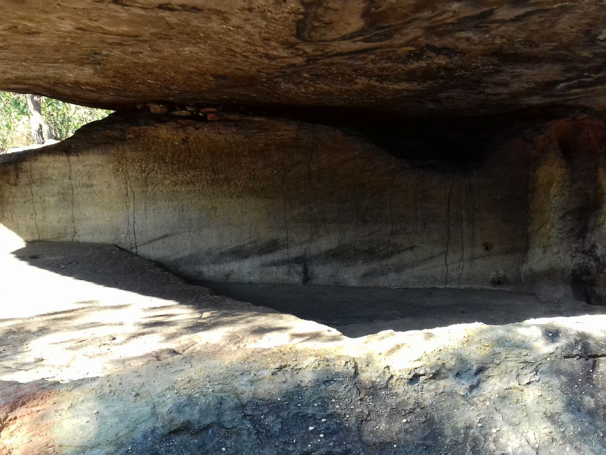
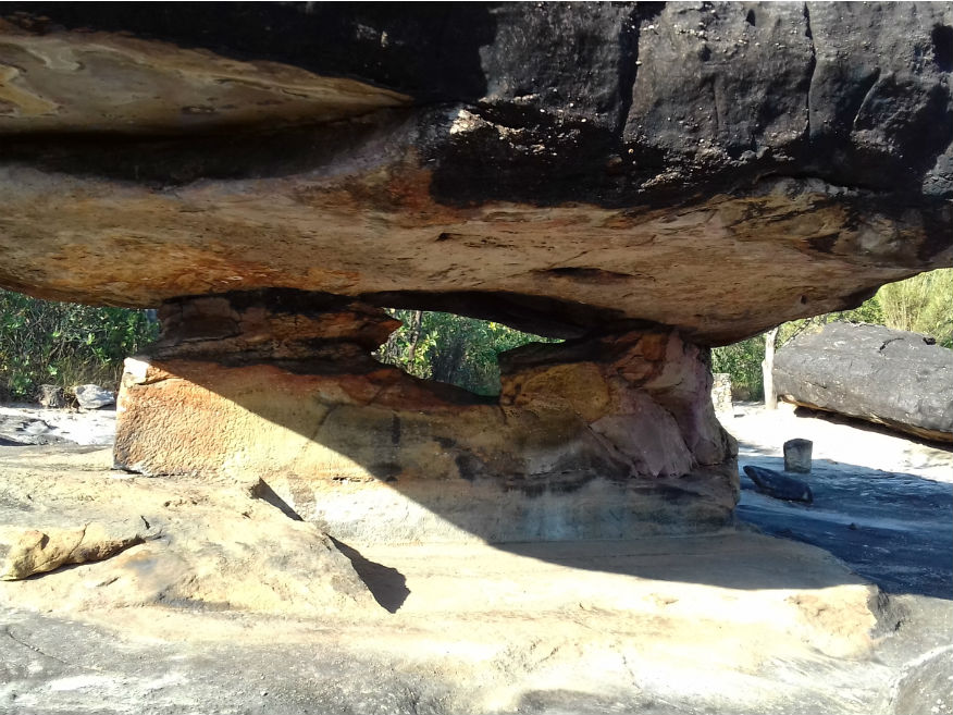
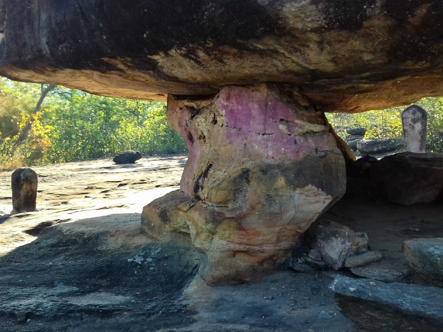
From a geological point of view the unusual rock formations are the result of sediments laid down 15 million years ago when this area was under water. But in more recent times the area was subject to human occupation over a long period of time. Research by the FAD has revealed evidence of occupation at least 3,000 years ago. A feature of the site is the way heavier rocks perch precariously on eroded sedimentary rock. They form natural enclosures and here there is examples of rock paintings indicating that domestication of cattle had already begun. 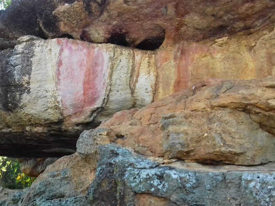
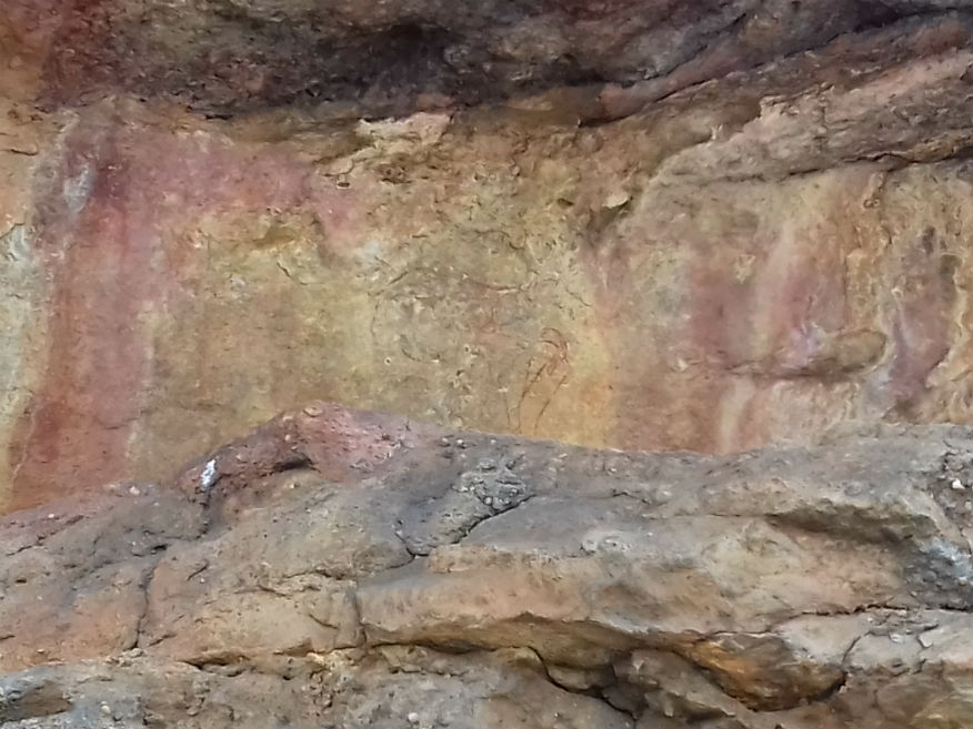
 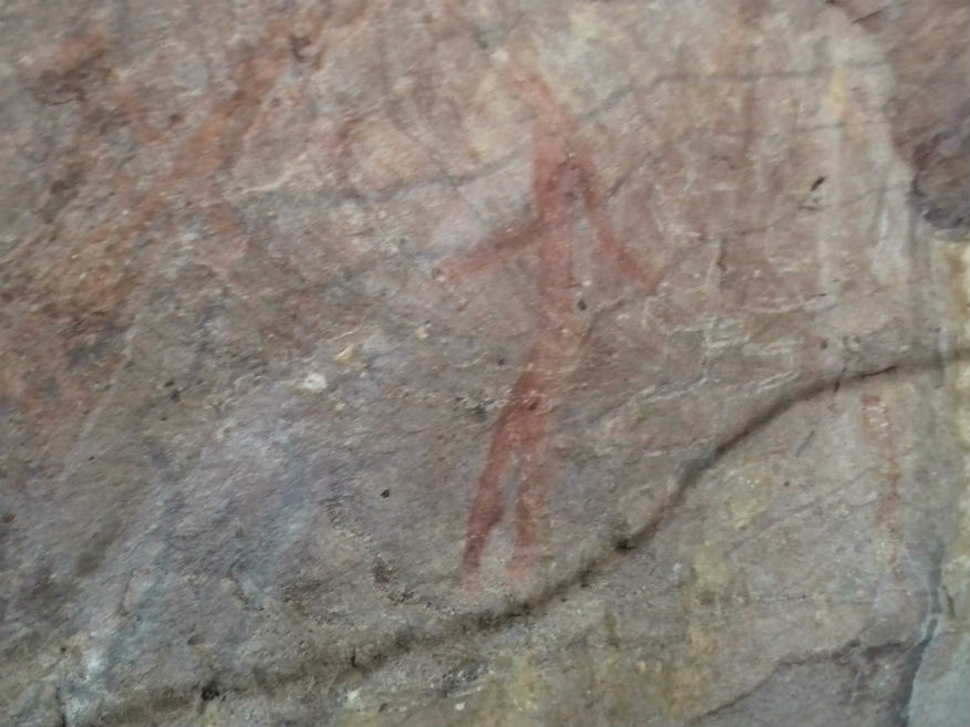
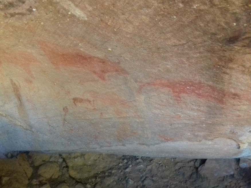 Ancient Rock Painting, Phu Phra Baht Historical Park, Ban Phue District, Udon Thani Province 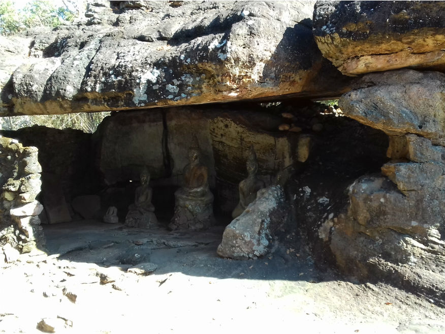
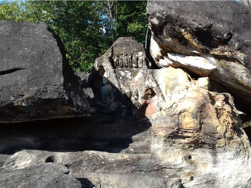
 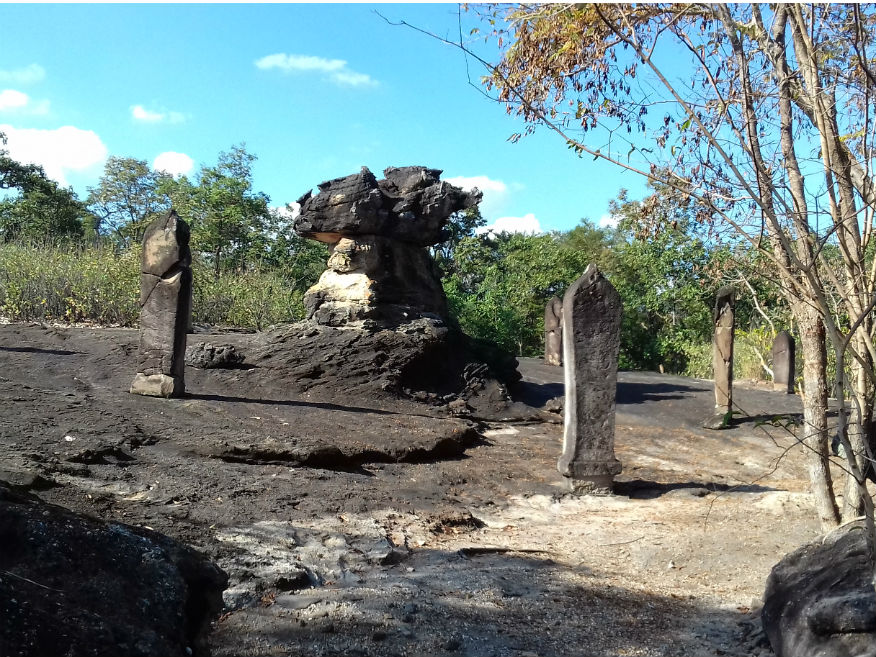
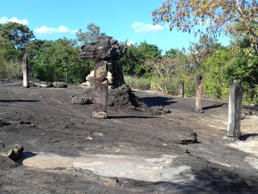
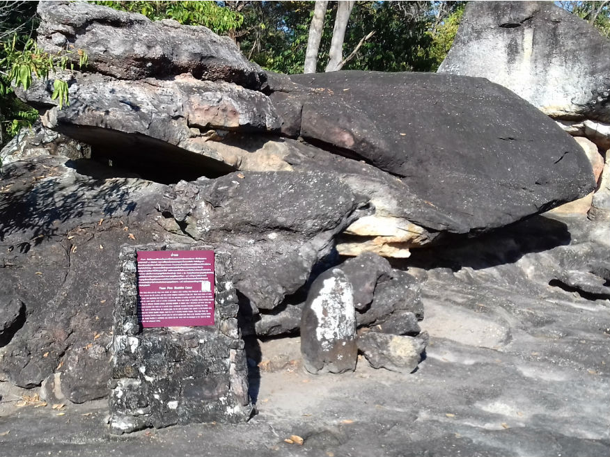
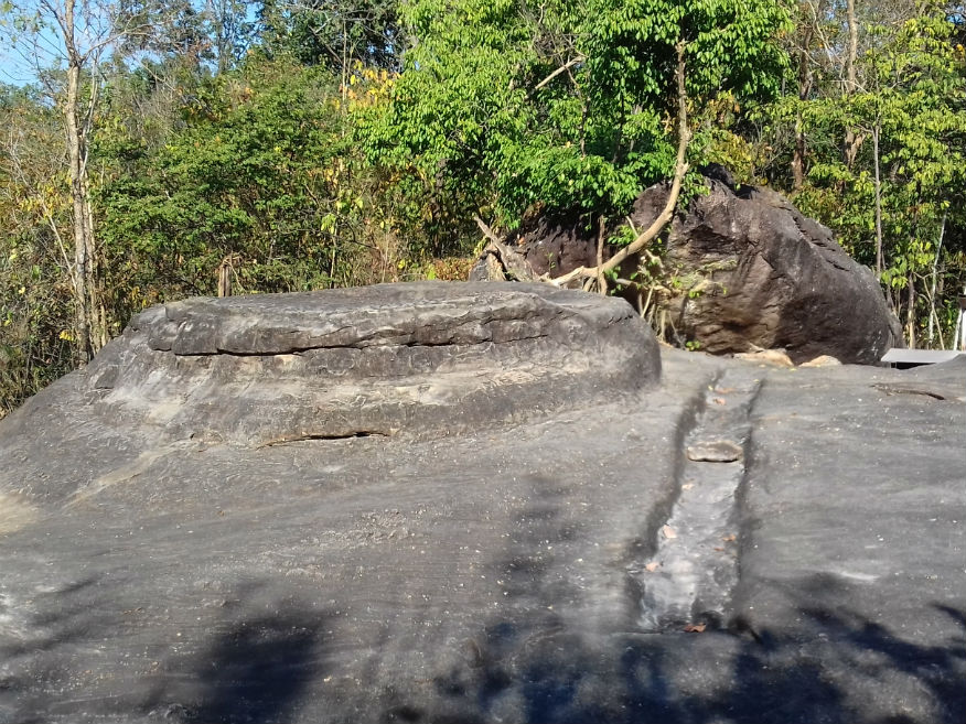
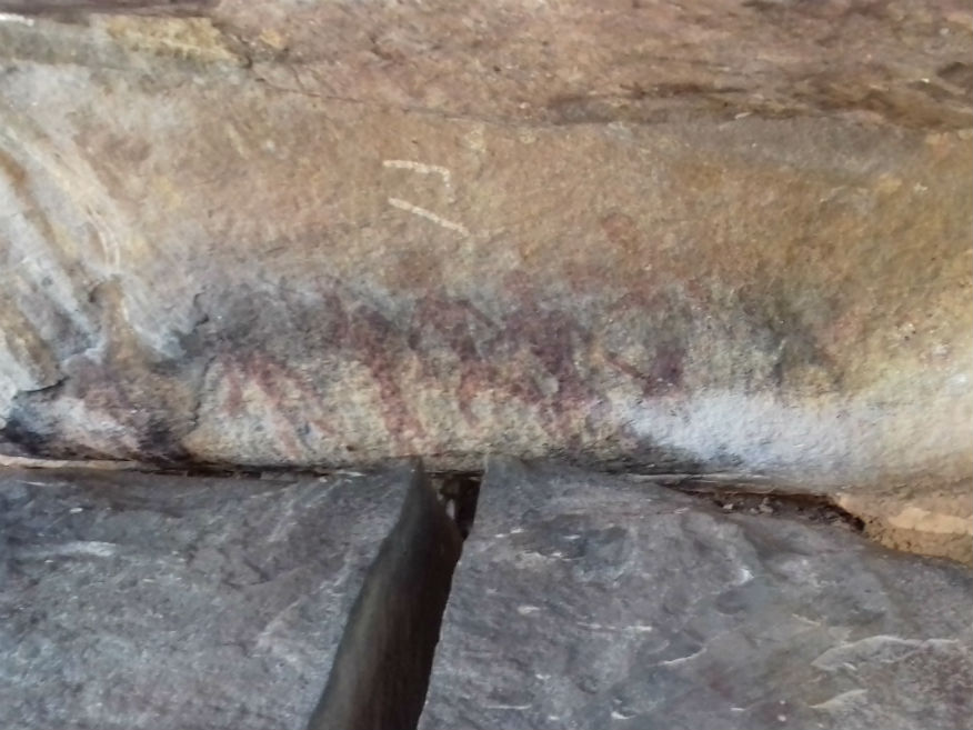
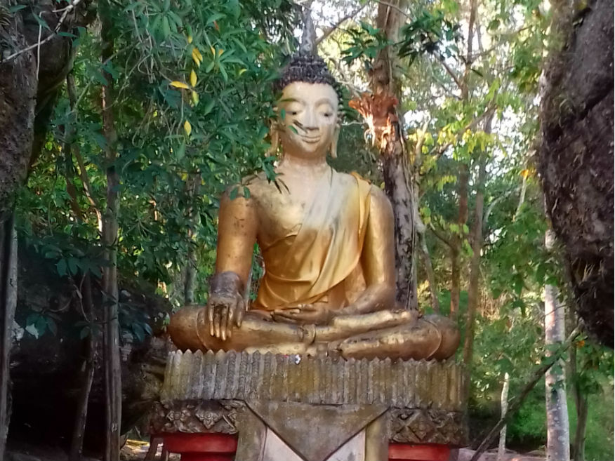
 Religious Practice, Phu Phra Baht Historical Park, Ban Phue District, Udon Thani Province
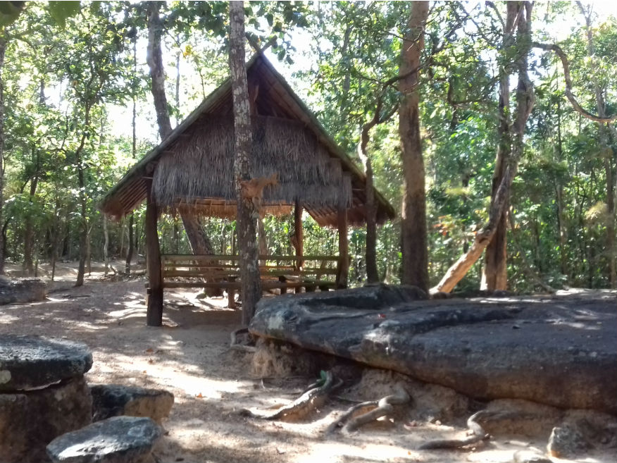
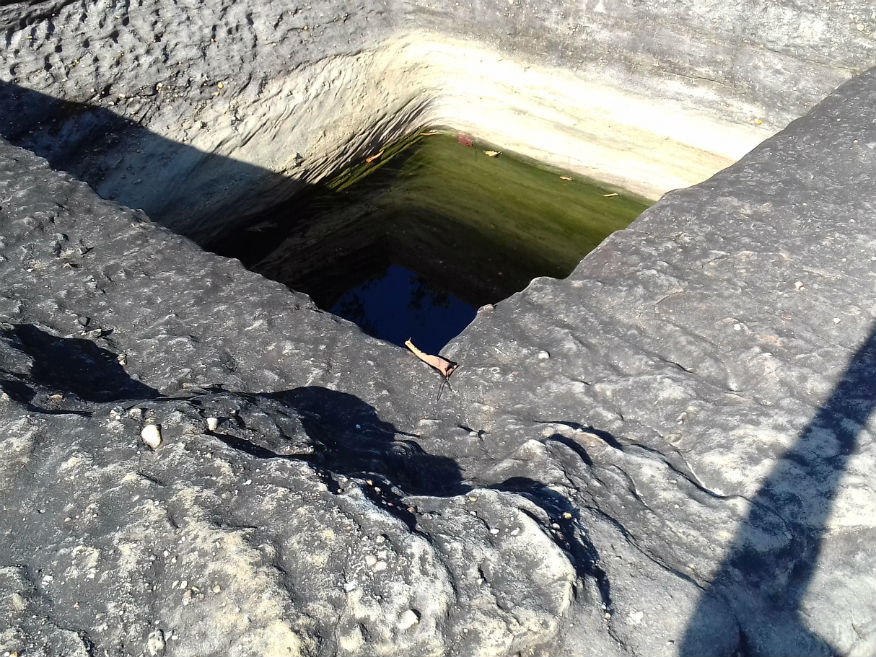
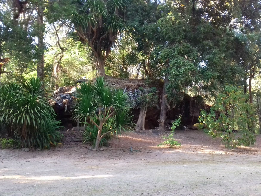
Some form of occupation is likely to have continued uninterrupted. At some point a well was carved out from the rock some 5 metres deep. With numerous standing stone formations there was bound to be folklore but for the archaeologist an interesting period occurred from the 8th – 10th century during the Dvaravati and Khmer eras. These introduced both Hindi and Buddhist influences and it’s clear that this site became a religious site possibly of pilgrimage. Evidence of Buddhists images and paintings can be found while standing stones form boundary markers. From the 13th century the area came under Lan Xang influence and it appears the site was still in use but towards the end of the 18th century it was probably abandoned when the area became under the control of Bangkok. For foreigners the site fee is 100 baht which includes a guide. Fortunately FAD usually provide information in both Thai and English so there is enough here including brochures. You will definitely need their site map as there are a number of trails but all the more important features are within easy walking distance with just one moderate trail and a hilltop climb which most people don’t attempt. Covering the main areas still takes an hour or two and is a good investment. Sadly though there are very few visitors; perhaps they’re all at the temple making merit. For me though it’s time well spent. Wat Phra Phuttabatbuabok........Google Map Wat Phra Phuttabatbuabok can be reached by turning left at the security checkpoint to the park. The main chedi described as Thai/Lao contains Buddha relics. It was built around the turn of the 20th century. It would seem to be an obvious site amongst the caves and boulders to locate a temple. 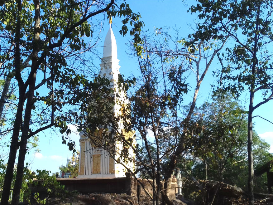
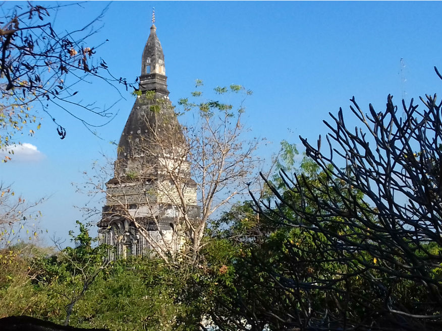
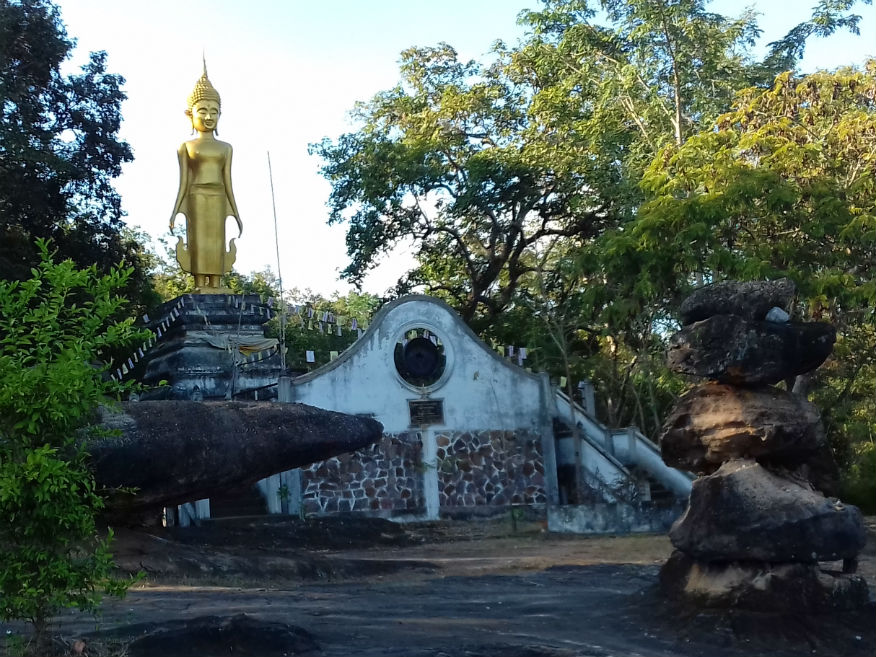 Wat Phra Phuttabatbuabok, Ban Phue District, Udon Thani Province
With time spent chatting to the head monk we’re aware that time is ticking on so a stopover needs to be arranged. In order to keep other options open during our return to Bangkok we need to enter yet another province. Nong Bua Lamphu........Google Map I’m sure I’ve never stayed in Nong Bua Lamphu but I believe I passed through it once. It’s one of Thailand’s north-eastern provinces but relatively small. There may be a few attractions here but we just need it for a stopover as we cut the distance to Bangkok. Arriving at around 5pm is perfect and we stumble on a resort on the new ring road. With better decor and facilities than at Pak Chom we’re happy to stopover here. Wondering what to do about dinner we note there is a separate kitchen here but the dining room is near reception. It seems the kitchen also provides for conferences and functions that the resort hosts but they seem happy to provide room service also. When I find they have pork streak I’m quite surprised then knocked out with the size of the meal: So big. I can’t get though it so it ends up in the fridge. With things now returning to normal and my blog finished in draft the same day, I can concentrate on a grand finale tomorrow with an early start. Next Page
| |