
- HOME PAGE
- TOURS LIST
- SITE INDEX
- THIS TOUR SUMMARY
-
TOUR BLOG
DAY 1 - BANGKOK/PHETCHABUN, 18 November 2014 DAY 2 - PHETCHABUN/KHAO KHO, 19 November 2014 DAY 3 - KHAO KHO, 20 November 2014 DAY 4 - KHAO KHO, 21 November 2014 DAY 5 - KHAO KHO/LOM KAO, 22 November 2014 DAY 6 - LOM KAO, 23 November 2014 DAY 7 - LOM KAO/CHAT PRAKAN, 24 November 2014 DAY 8 - CHAT PRAKAN/NAN, 25 November 2014 DAY 9 - NAN, 26 November DAY 10 - NAN/PUA, 27 November DAY 11 - PUA, 28 November DAY 12 - PUA/THA WANG PHA, 29 November DAY 13 - THA WANG PHA/NAN, 30 November DAY 14 - NAN/PHRAE, 1 December 2014 DAY 15 - PHRAE/PHITSANULOK, 2 December 2014 DAY 16 - PHITSANULOK/BANGKOK, 3 December 2014 DAY 16 - CONCLUSIONDay 6 - Sunday 23 November 2014, Lom Kao
Lom Kao Day 1.....Entering the fifth full day in Phetchabun province it's now a case of completing the tour plan I set myself on the first day. From my location now in Lom Kao the remaining areas of interest are now within easy reach. It should be an easy day to visit these today, shouldn't it? Last night I turned in early quite tired from my long drive to Nam Nao, so my blog for the day was nowhere near complete. However, I woke earlier and set about the task to recover lost time. I'm also anxious to check the result from Stamford Bridge; It's positive and Chelsea are 7 points clear. For breakfast, I still have some snacks leftover but no pot noodles. Coffee is free and two cups later I am more or less ready to travel just before 9.30 am.
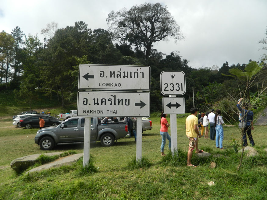
Phu Thap Boek.....On the list for today is Phu Thap Boek and Phu Hin Rong Kla National Park. I knew a little about the geography of the area before I started, but I soon learn that looking at a map hardly prepares me for the journey I will soon make. Leaving Chompoo Resort I have to find my way to the 2372 road running to the east of the park then make my way up to Phu Thap Boek on the challenging 2331.
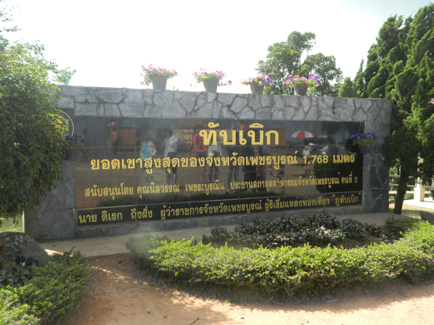
The photographs and guide notes I studied before I came here seem virtually useless as I make my way up to the summit. What I have learnt from local people is far more useful to me right now as I begin the ascent of virtually continuous switch-backs that require me to disengage automatic drive for the entire climb. I didn't check the clock but 40 minutes duration doesn't seem far out as I reach Ban Thap Boek, swollen by tourists eager to register their visit here, arguably the most well-known of Phetchabun's attractions. It is only recently that tourists have become excited about this place. True the views from the summit are breathtaking but were once just home to Hmong tribes people who are skilled at adapting to terrain like this. Now tourists swamp all over the peaks like ants in search of something back home we take for granted and often wish to see the back of. The area has earned the name 'Talay Mog'. 'Talay' I've always translated as ocean and 'mog' as mist or fog, so sea of mist is what they come for. At well over 1,000 metres above sea level it is quite normal to find oneself above the clouds here. Early morning is the best time to witness it as the sun rises. Most Thais know this and the curious site of cars noses to tail returning down the mountain at 10 am is quite normal. But at the summit I'm ready for lunch. Things are bound to be more expensive up here but not such that you would notice. I stick to the basics. Others are happy to row the boat out!
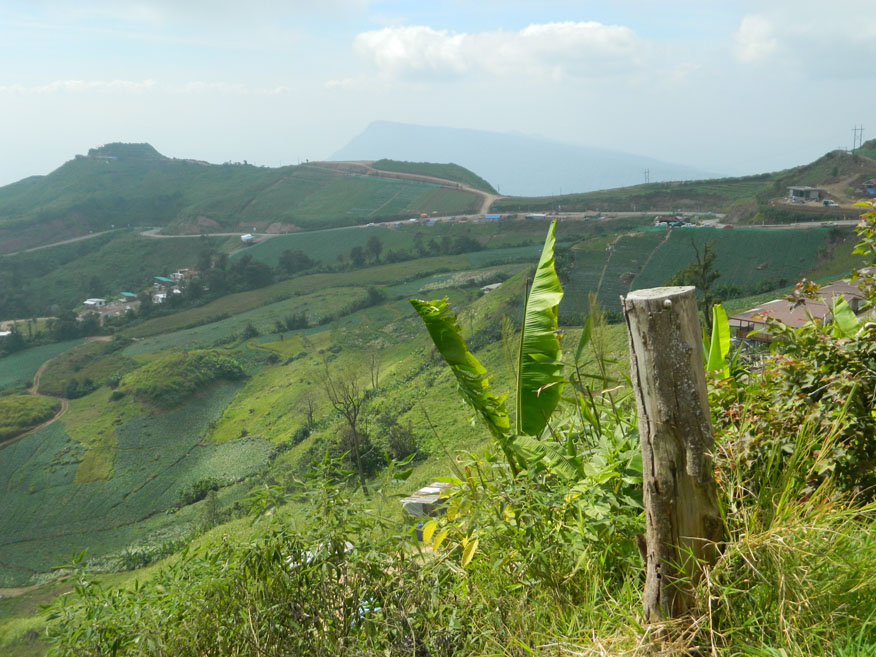
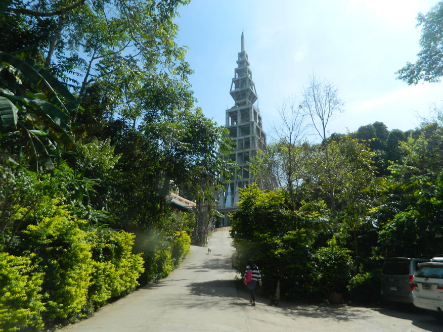
Wat Pa Phu Thap Boek.....The mountain top is cluttered with resorts, tents, restaurants gift shops and quite conspicuous, the sale of local produce. Temperate crops thrive in the cooler air and hillsides now bare of trees are given over to these crops. In particular and to the extent it's become an icon for Phu Thap Boek is the cabbage. Pick-up trucks loaded to the rafters are among those vehicles heading back down the mountain. As I take in the views there's a limit as to what else I can achieve here, and I have a plan for the afternoon. But first something else steals my attention. On a bluff on the far end of the ridge is a structure dominating the skyline. It's a deviation from my plan, but I'm curious. Heading towards it, I pass through the Hmong village seemingly unaffected by the tourist hoards I just left behind. Finding my way up the hill I'm far from alone as I park up. Yet again I've come across a Buddhist monastery but unlike the last one I visited it's far from complete. In fact the structure I observed is just a concrete shell. Nevertheless, it is a functional place of worship. As with so much new building of its kind in Thailand there is no shortage of donations from the faithful, eager to make their mark on this life as merit for the chance of a prosperous future one. I decide to make a donation. Just maybe my good fortune on the tour so far will continue but then again I doubt if I will get my money back if it doesn't. Before I head back, I join a few others who enter the structure. Building style is always interesting to me and besides, once the structure is complete and sanctified, access will not be possible except at ground level. It's now 1.30 pm and pressure on time is building yet again. I head back over the ridge past the body of humanity that has arrived here on its pilgrimage. Off to the left is the highest point of Phu Thap Boek indicated by its obelisk. Surrounded by tents, it offers stunning views, a must for every visitor, but I have to press on now.
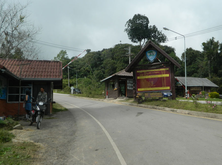
Phu Hin Rong Kla National Park.....Back near the summit is the entrance to Phu Hin Rong Kla National Park where cabbage growing stops and the natural forest returns. Few people enter the park itself. There is an entrance fee and a tax to pay for foreigners. Having declined to pay the fee at Nam Nao National Park I figure that this is the last opportunity I will get on this section of my tour to sample the wilderness. Just what I expect to see other than trees I'm not quite sure. Nevertheless, I head for the check-point and ticket office staffed by park rangers. I'm fully aware that as a foreigner I have a different status, but I decide to be cheeky and ask for a discount jokingly speaking in Thai. That works much to the amusement of all. As I enter the park proper the mass of humanity disappears but I'm immediately at a disadvantage due to poor road conditions. Then after 30 minutes driving there is nothing but trees.
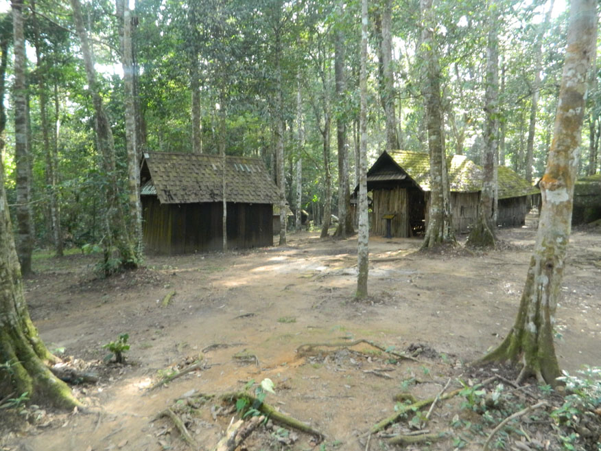
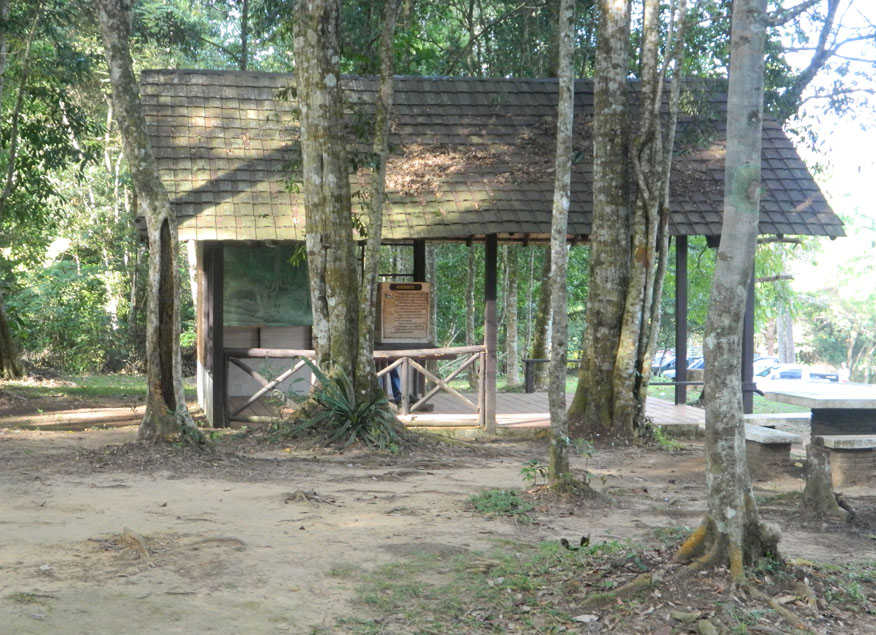
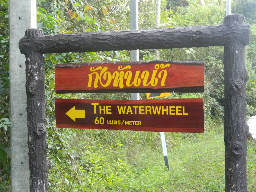
A short section of road has been resurfaced as if to show what can be done given the funds, but that soon disappears and so does Phetchabun province. It is clear that this is a through road crossing the park into Phitsanulok province, but you wouldn't want to use this as a shortcut. Eventually there is a clearing and Hmong vendors congregate along the roadside in makeshift stalls. But there is something else here that requires investigation. Unfortunately for foreign visitors there is nothing in English they can use, but I have the perfect guide with me. There is a collection of huts here, larger and more organised than at Khao Kho that was used by the Communists. This apparently was the headquarters of the Communist Party containing a political school, military training facilities and a field hospital, but I'm about to learn something more about this regime. I had assumed that the Communists were of Laotian, Chinese, Vietnamese and Russian influence, but I'm surprised how many Thais were involved. A student uprising in Bangkok in 1973 swelled the Communist numbers. In addition, disenchanted Hmong tribes people were eager to join too. This was a serious challenge to the Thai government. The Communists proved difficult to dislodge due to the difficult terrain which was easy to defend. The answer was to drive a road through the forest, but workers were frequently harassed and attacked. Just a short distance away is a waterwheel in better condition than the one I saw earlier on this tour. It was designed and constructed by the students for pounding rice.
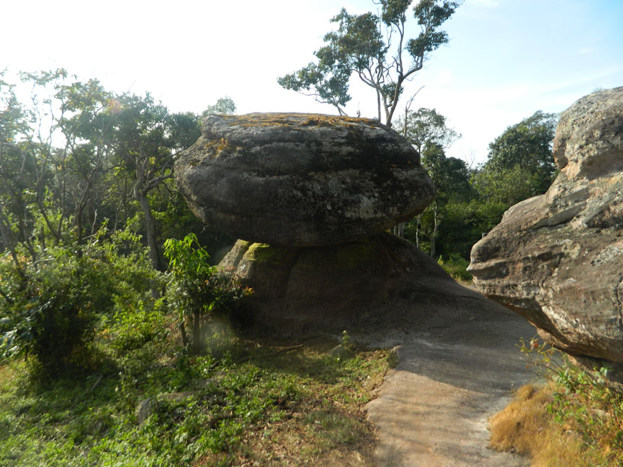
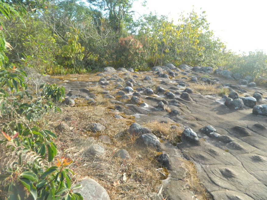
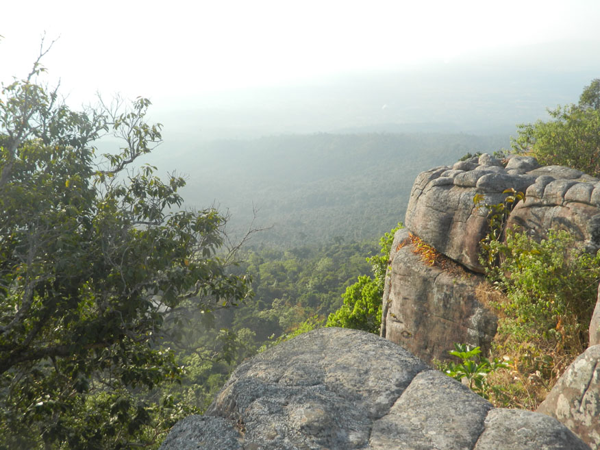
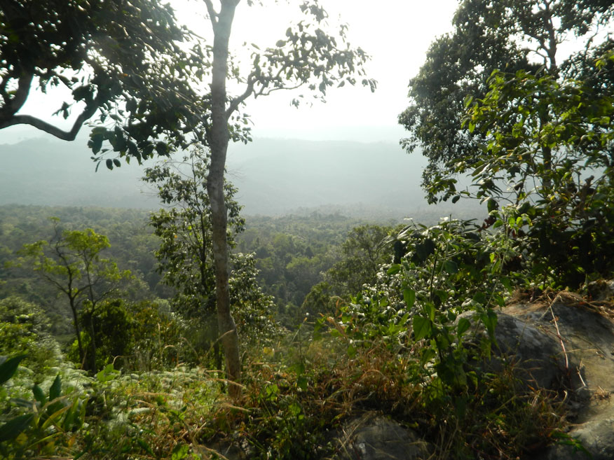
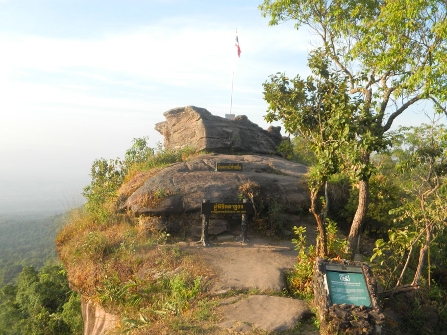
Phu Hin Rong Kla loop.....I need to press on and reach the main site within the park where there is a rest area with conveniences and the usual Hmong vendors and guides. Obvious is the number of group tours that come here by passenger van. Unlike me, they invariably arrive from the Phitsanulok side. The guides are busy, but I don't need to join a group having established that there is a trail running in a loop. It's not difficult to follow as I identify the features appearing along the trail. A guide informs me that it will take 90 minutes to complete the loop and that bothers me. It's now 3.30 pm, and I've set a limit of 4.30 pm before I must return. Can I reduce this to 1 hour? As expected there is evidence of communist occupation. Almost immediately there is a small cemetery, but a fair section of the trail contains natural features especially rock formations and stone fields that result from wind rain and chemical reaction. I'm bent on recording as much as I can, but my progress is slowed by the tour groups whose members want to do some recording of their own. At the furthest point the trail reaches a cliff edge offering outstanding views across the valley. Here the rock fields are heavily weathered and cracked requiring small wooden bridges to allow passage. Continuing around the loop the trail is close to the cliff edge affording spectacular views then on top of a rock stack sitting precariously at the cliff edge is the jewel of this tour. On the summit is a flag pole flying the Thai national flag. It wasn't always there. Just over 30 years ago the Communist flag flew defiantly from this spot. Phu Hin Rong Kla was the last stronghold of the Communist occupation. Its capture effectively ended the campaign and peace returned once more. The flag flying here is as important to Thais as the raising of the US flag at Iwo Jima in the Pacific War. It's time to head back. There is a smaller additional loop, but I have to head back. I must be content with my tour today. I simply can't do it all. On the smaller loop is a bomb shelter evidence of an air war against the Communists but with no evidence of bombs falling I have to give it a miss. By the time I leave the rest area it's gone 5 pm.
Now I need to press on and reach the main site within the park where there is a rest area with conveniences with the usual Hmong vendors and guides. Obvious is the number of group tours that come here by passenger van. Unlike me, they invariably arrive from the Phitsanulok side. The guides are busy. I don't need to join a group having established that there is a trail running in a loop. It's not difficult to follow as I identify the features appearing along the trail. A guide informs me that it will take 90 minutes to complete the loop and that bothers me. It's now 3.30pm, and I've set a limit of 4.30pm before I must return. Can I reduce this to 1 hour? As expected there is evidence of communist occupation. Almost immediately there is a small cemetery, but a fair section of the trail contains natural features especially rock formations and stone fields that result from wind rain and chemical reaction. I'm bent on recording as much as I can, but my progress is slowed by the tour groups whose members want to do some recording of their own. At the furthest point the trail reaches a cliff edge offering outstanding views across the valley. Here the rock fields are heavily weathered and cracked requiring small wooden bridges to allow passage.
Continuing around the loop the trail is close to the cliff edge affording spectacular views then on top of a rock stack sitting precariously at the cliff edge is the jewel of this tour. On the summit is a flag pole flying the Thai national flag. It wasn't always there. Just over 30 years ago the communist flag flew defiantly from this spot. Phu Hin Rong Kla was the last stronghold of the Communist occupation. Its capture effectively ended the campaign and peace returned once more. The flag flying here is as important to Thais as the raising of the US flag at Iwo Jima in the Pacific War. It’s time to head back. There is a smaller loop but I have to head back. I must be content with my tour today. I simply can't do it all. On the smaller loop is a bomb shelter evidence of and air war against the communists but with no evidence of bombs falling I have to give it a miss. By the time I leave the rest area it's well past 5 pm.
Cautious.....It means now that I will not make it back till after dark, something I'd hoped to avoid. As I exit the park light is fading. Now it's the long descent of 1,000 metres and countless switch-back bends. The light is not my only concern. There are vehicles on the road with no lights. Agricultural vehicles and motorcycles are the worst offenders. Nevertheless, I'm most of the way down the mountain before full darkness. It then becomes tricky retracing the route from morning using rural roads, but I eventually make it back and slip past Chompoo Resort heading for Lom Khao. The restaurant I used yesterday is closed today being a Sunday and besides I need something for breakfast tomorrow. It was part of my original plan to do some shopping before I returned, but the events of this day have put paid to that. I head back to the resort, arriving later than any other day so far this tour. Naturally, I will be short of time to write my blog. At 8 pm I follow text coverage of the F1 finale at Abu Dhabi. The result pleases me but as I settle down for the night it's in my mind that tomorrow I need to leave Phetchabun province. This tour is as intense as ever I have experienced in recent times.
Next Page.
Phetchabun Province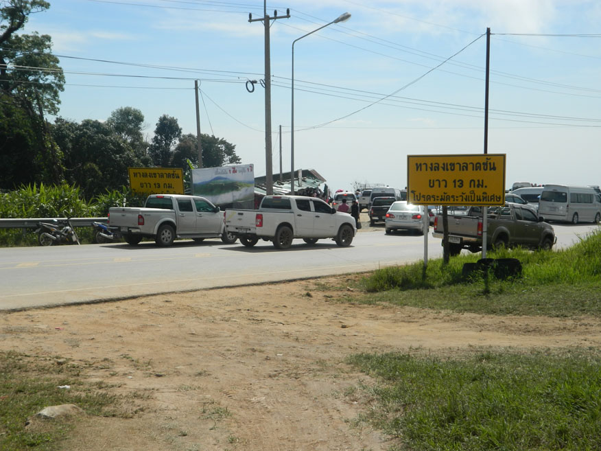
Phu Thap Boek
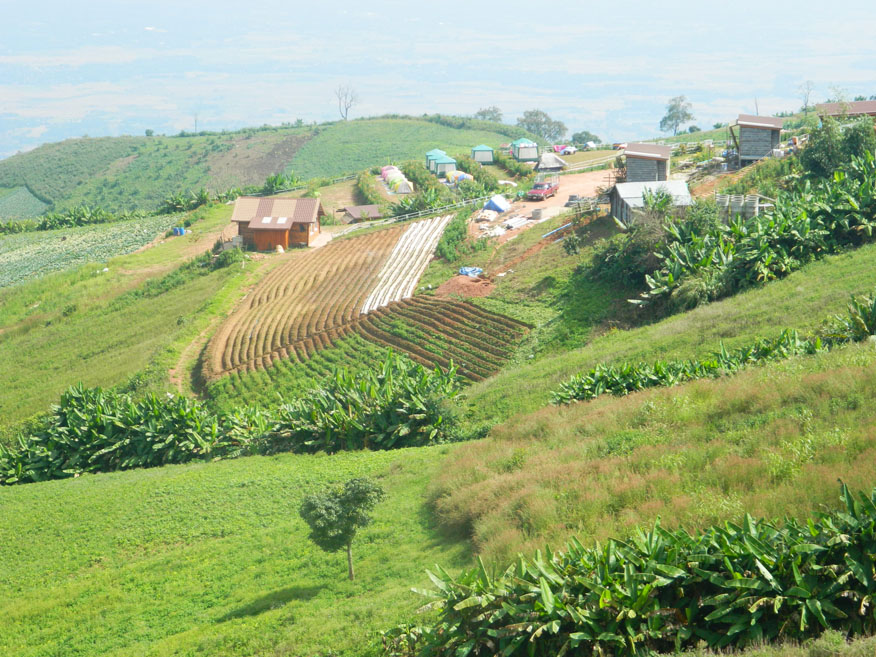
Terraces, Phu Thap Boek
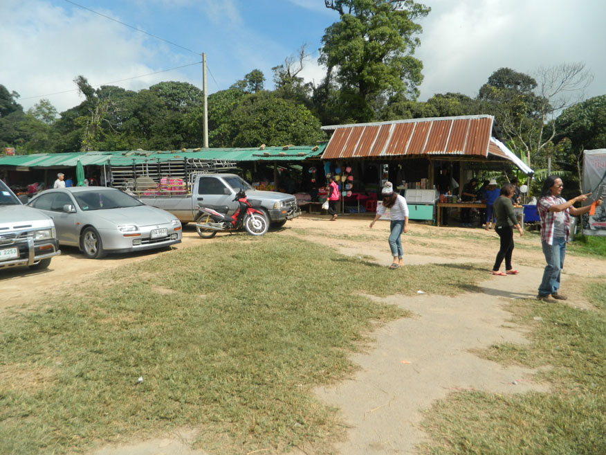
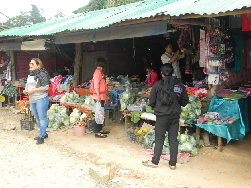
Produce Market, Phu Thap Boek
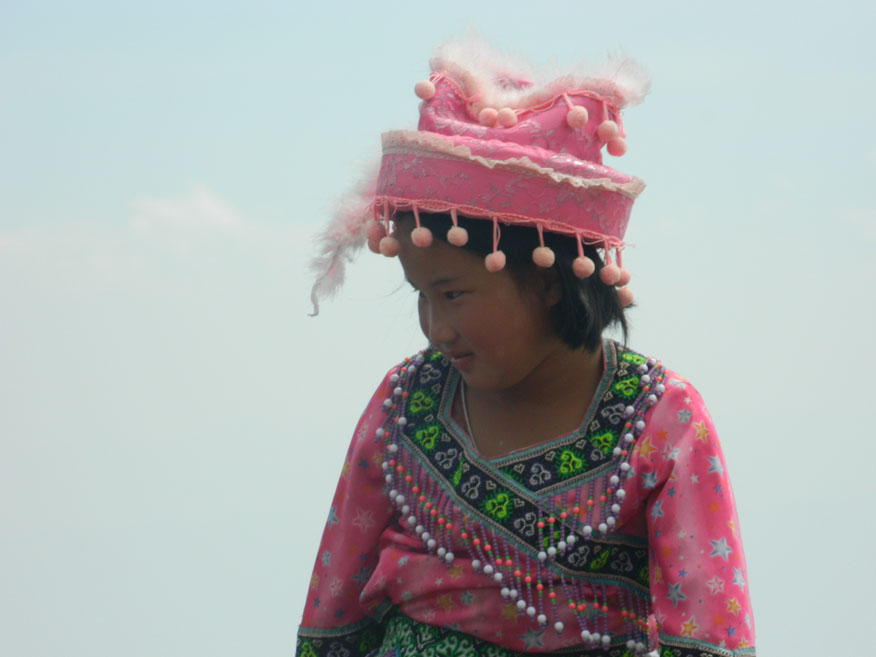
Tribal costume, Phu Thap Boek
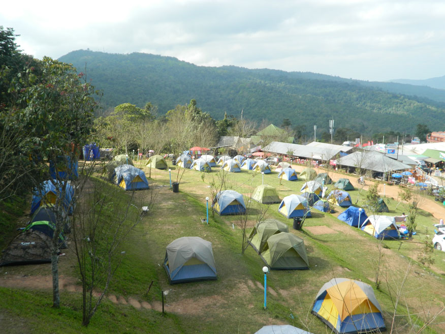
Campsite, Phu Thap Boek
Wat Phu Thap Boek
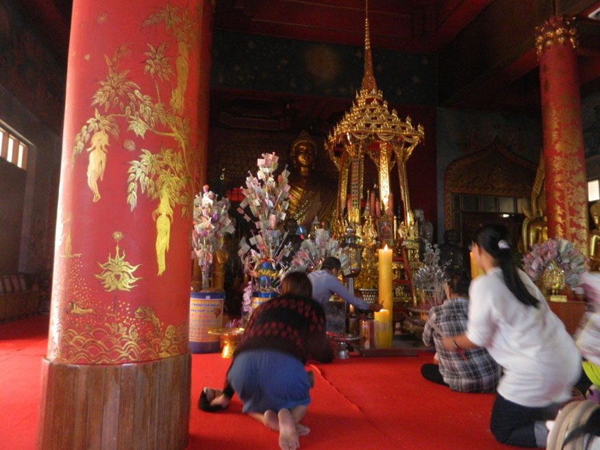
Merit making, Wat Phu Thap Boek
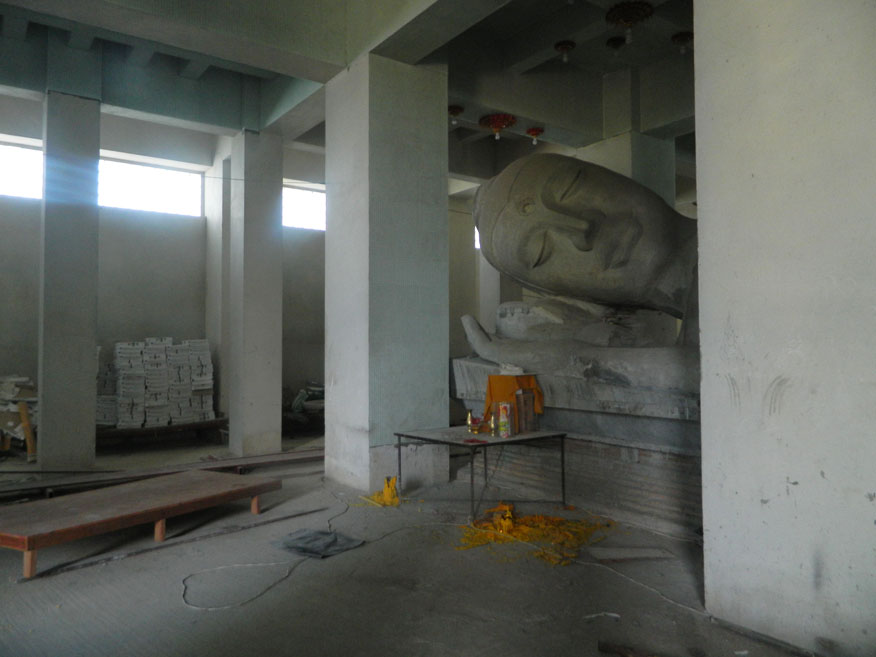
Constructon, Wat Phu Thap Boek
Phu Hin Rong Kla National Park
Communist Party hut,
Phu Hin Rong Kla National Park

Road making equipment,
Phu Hin Rong Kla National Park
Communist Party headquarters,
Phu Hin Rong Kla National Park
Sign to Waterwheel,
Phu Hin Rong Kla National Park
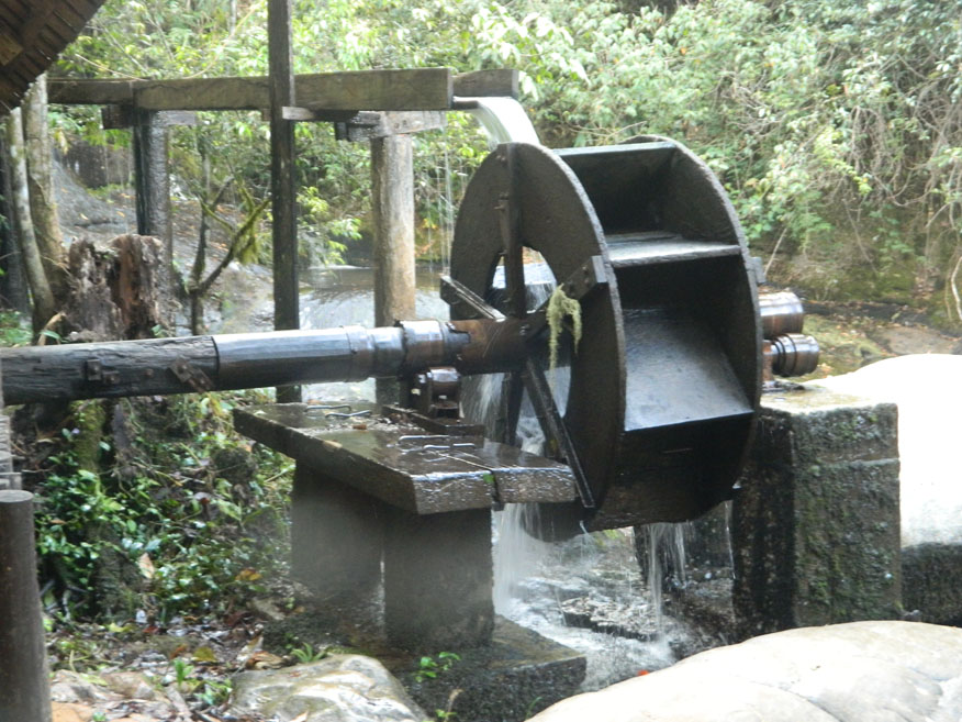
Waterwheel, Phu Hin Rong Kla National Park
Communist Party cemetery,
Phu Hin Rong Kla National Park
Phu Hin Rong Kla National Park
Nodulated Stone Field,
Phu Hin Rong Kla National Park
Viewpoint, Phu Hin Rong Kla National Park
Pha Chu Tong Cliff,
Phu Hin Rong Kla National Park