
- HOME PAGE
- TOURS LIST
- SITE INDEX
- THIS TOUR SUMMARY
-
TOUR BLOG
DAY 1 - BANGKOK/PENANG via HAT YAI, 22 October 2013 DAY 2 - PENANG, 23 October 2014 DAY 3 - PENANG, 24 October 2014 DAY 4 - PENANG/PANTAI CENANG, 25 October 2014 DAY 5 - PANTAI CENANG, 26 October 2014 DAY 6 - PANTAI CENANG, 27 October 2014 DAY 7 - PANTAI CENANG, 28 October 2014 DAY 8 - PANTAI CENANG/SATUN, 29 October 2013 DAY 9 - SATUN/KOH LIPE, 30 October 2014 DAY 10 - KOH LIPE, 31 October 2014 DAY 11 - KOH LIPE, 1 NOVEMBER 2014 DAY 12 - KOH LIPE/KOH KRADAN, 2 NOVEMBER 2014 DAY 13 - KOH KRADAN, 3 NOVEMBER 2014 DAY 14 - KOH KRADAN/BANGKOK, 4 NOVEMBER 2014Day 6, Sunday 27 October 2013 - Pantai Cenang
Orientation..... This morning by contrast, there's no rain, so I can begin exploring Langkawi Island in earnest. I finish off a coffee and snack then as I'm ready to go when the owner or agent of the motorbike turns up at Cenang Valley Inn: He does like his paperwork. I've also noticed the rear tire need some air. He takes the bike away to get that sorted and fills up the tank in the process. I now check my local map which confirms a good selection of sites to visit on the tourist trail. Not surprisingly, a good proportion of these are natural features. The archipelago of islands is a wonder in itself supported by impressive karsk rock formations heavily forested.
There are three national parks. To the west is Machinchang Cambrian Geoforest Park. I entered this briefly on the first day while looking for accommodation in Pantai Kok. The second park, Kilim Karst Geoforest Park covers the northeast and entire east coast of the island as well as a number of islands off the coast. I will enter here today. The third park is offshore to the south. The Pulau Dayang Bunting Geoforest Park can only be reached by boat. There is no shortage of tours there. These parks include their fair share of waterfalls, caves, freshwater lakes, jagged karst peaks, rocky coves, stacks and reefs all adding to the wonder in this area of outstanding natural beauty. Add to this, an abundance of man-made features and the question arises where to start and make sense of it all.
Heading inland..... One thing that has changed things is the situation with the motorbike. Kuah is definitely off the list for today yet as I head into the hinterland I take a wrong turn searching for one of the sites and find myself on the outskirts of the town. All I've managed so far is one viewpoint and it's already late morning. I finally reach the road to the north of the island at Air Hangat and wondering about lunch. On the roadside I notice what would pass as a mobile cafe; a small van with open sides that I've not seen in Southeast Asia before. Pre-packed rice dishes are on offer together with a rice meal with dried fish wrapped in banana leaf, spring rolls and a variety of cakes. I'm a willing customer as I don't want to waste more time. Further up the road is a rest area, again something I'm not used to out here. It overlooks a small artificial lake with a nature trail running around it. It's a great spot to eat my takeaway meal. I feel like a fisherman who has sat on the riverbank all day without a catch as I head off hoping for a bite.
This comes in the form of the Mardi Agrotechnology Park. Here you will find a tropical fruits farm, a grapes trail and a recreation spot. There is an admission fee but further along the road there is a forest park beautifully landscaped and set aside for recreation. There is no entry fee as there often is in Thailand. However, I'm having difficulty finding some of the places indicated on my map. It's becoming quite frustrating that Malaysia sees no reason to put signs up in English, hard to understand in a country where the vast majority of folk have some basic English. In Thailand, it's the opposite. Little English is spoken except at resorts but except for some religious sites, signs almost always include an English translation. Even in the former French colonies English translation is often available. Curious!
Gunung Raya..... As I head north it's ticking on 2 pm. A sign comes into view pointing to a right turn to Gunung Raya. This mountain stands at 881 metres and to reach it involves a climb of 12 kilometres by road. There is a trail to the summit, but it's a stiff climb of over 2 hours. This makes it one of the least accessible locations on the island. I'm sticking to the road option. At the base there is a sign warning of danger during bad weather due to rock falls. There is certainly no wall-to-wall sunshine and the cloud base could cause a problem at the summit obscuring magnificent views. On my way up I get a number of greetings from school children making their way down the mountain clearly on a school trip. At the halfway point the clouds look menacing and a few spots of rain appear. With 4 kilometres left I'm hit by a storm. There's nowhere to shelter with dense forest all around. I have to press on. Finally near the summit the rain eases and stops. I fear the journey wasted if there are no views from here but at the margin of cloud level I catch the magnificent panorama if Langkawi archipelago. It's not ideal, but I've ticked off one of the most remote locations on the island. Curiously, as I descend the sun come out drying my wet clothes. The children are still making their way down the mountain, some already at the base where a school bus awaits.
Tajung Rhu Beach..... I continue north to Air Hangat and the northern coast arriving at Tajung Rhu beach. Here there are no shops or hawkers, but the village is just a couple of kilometres away. The beach is inviting and practically deserted with the water scooters idle. I don't think they will be in high season. I turn back and take a left into Kilim Karst Geoforest Park.
Kilim Karst Geoforest Park..... A few kilometres on the right are hot springs in Air Hangat Village then a bit further, again on the right, is a turning to Durian Perangin Waterfall. These are bypassed as it's raining again, black clouds massing in front of me. Within minutes torrential rain is falling. At least here I can stop the bike at one of the food shelters; as basic as you like but with rain like this a tin roof is a godsend. I may as well have a bowl of noodle soup while I wait: Turns out to be quite filling. The storm is over quickly and I head for the Kilim Karst Geoforest Park visitor center. Here again I'm a bystander. The center is on a jetty on the mangrove surrounding the Kilim River, but the boat charter fees are beyond my budget at 250 Ringgit per hour. The best offer is to book on a group ticket. For this attraction, pre-booked day tours were available for 120 Ringgit. I am tempted by such a wealth of natural wonders. It's 5pm already and I'm at the opposite corner of the island to Pentai Cenang about 30 kilometres away.
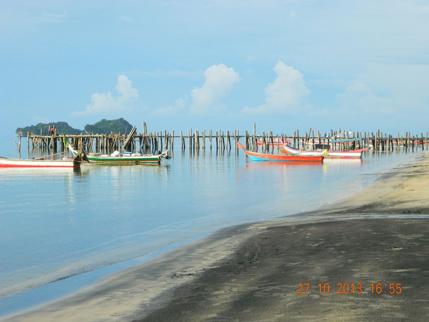
Black Sand Beach..... I head back to Air Hangat and straight over the roundabout looking for Black Sand beach. I find it and see why it has that name. The blackened sand is a geological phenomenon, the details of which I'm sure to forget. This has to be it for the day as I figure out the best way back to Cenang. Basically, it's back the way I came following the signs to the airport. It's 45 minutes easy riding and I reach Cenang before dark. Despite the noodles I ate at 4 pm I take prawn omelet and rice near Cenang Valley Inn, then head back to write up my notes. These are running behind schedule now and I still can't get an internet connection. I'll just have to call it a day.
Next Page.
Langkawi Island, Kedah, Malaysia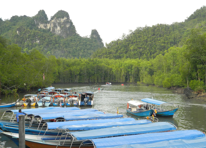
Kilim River, Kilim Karst Geoforest Park
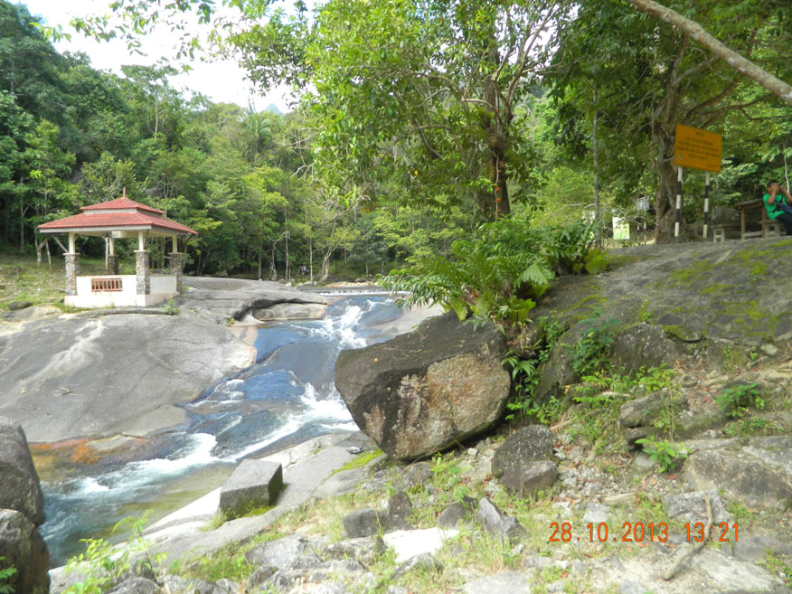
Seven Wells, Machinchang Cambrian Geoforest Park
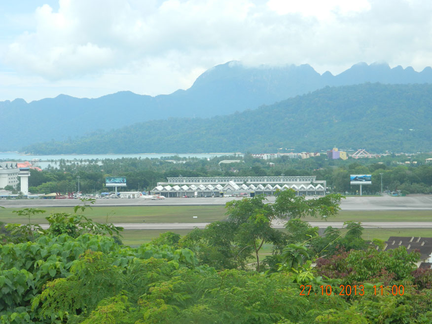
Langkawi Airport with Machinchang Cambrian Geoforest Park beyond
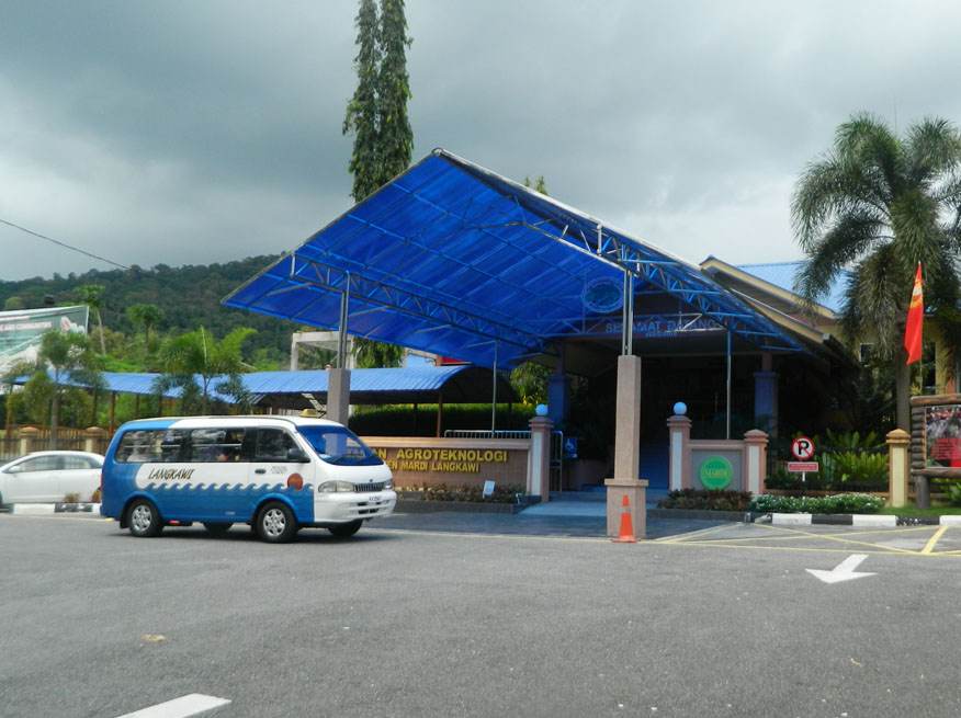
Mardi Agrotechnology Park
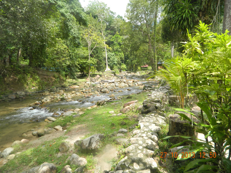
Forest Parkland, Mardi Agrotechnology Park
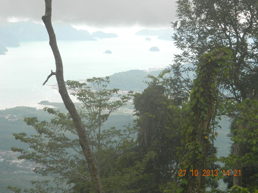
View of the Islands from Gunang Raya
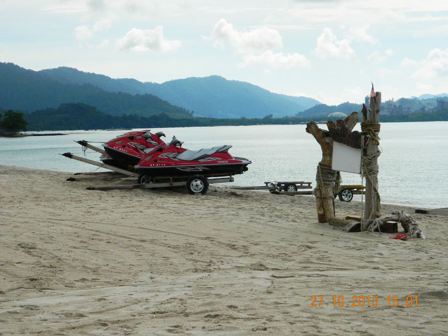
Tajung Rhu Beach
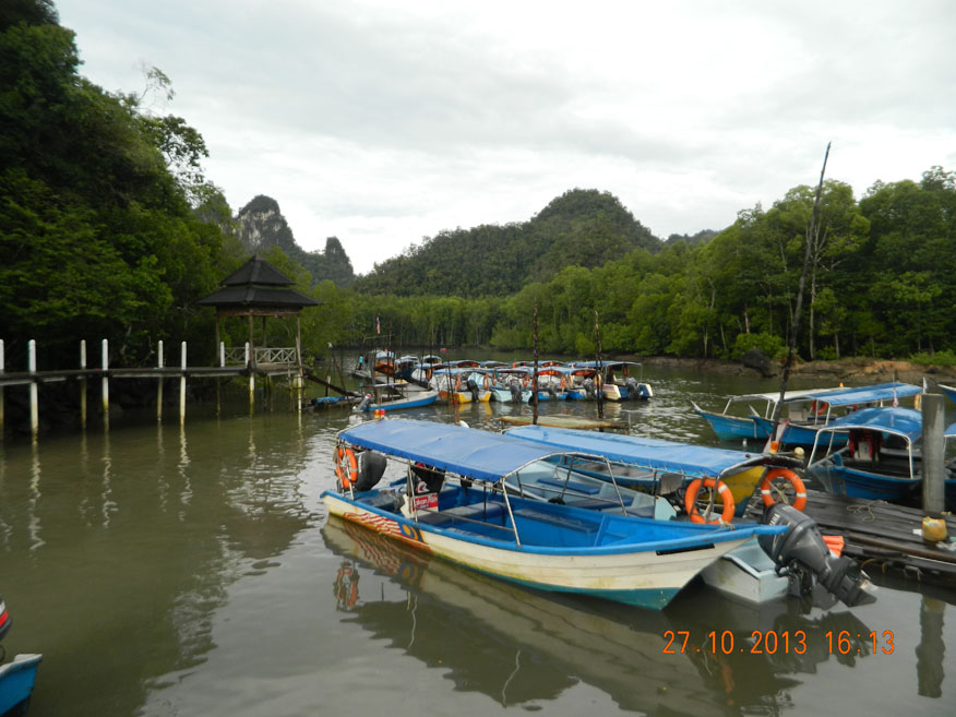
Kilim River Estuary, Kilim Karst Geoforest Park
Black Sand Beach