|
|

|
Sukhothai, Sawankholok, Phrae, Chiang Rai, Mae Chan, Mae Sai, Chiang Saen, Uttaradit
For more information on locations listed below use the 'Ref.', go to 'Tours Index' and select from the list
If you are still unsure about planning a visit there is a HELP key in 'Comments' for each site.....how to use the HELP key
If you are still unsure about planning a visit there is a HELP key in 'Comments' for each site.....how to use the HELP key
|
||||||||
|---|---|---|---|---|---|---|---|---|
| Name | Ref. | Description | Era | District/Province | Location | Date visited | Price (baht) | Comments |
| Wat Trapang Thong | 16E | Temple ruin | Sukhothai | Sukhothai Historic Park, Sukhothai Province | Google Map | 16 Dec 2016 | 100 per zone | Located inside a square pond (E,3,30m) |
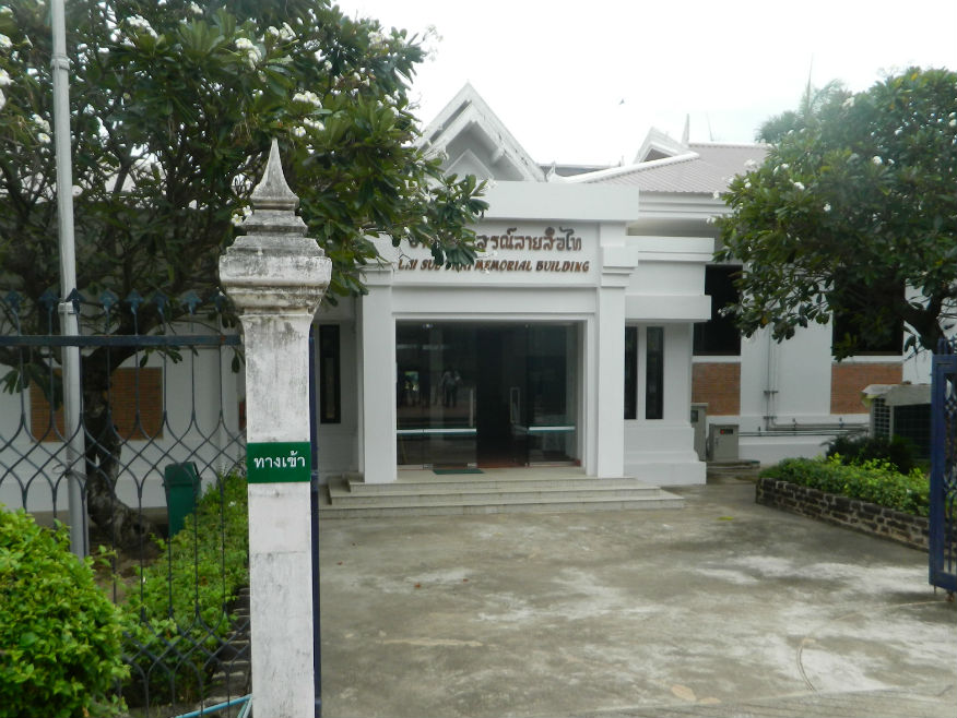
| Ramkhamhaeng National Museum | 16E | Museum | Sukhothai/early Ayutthaya | Sukhothai Historic Park, Sukhothai Province | Google Map | 16 Dec 2016 | 100 | Essential, before viewing the monuments (E,5,1.5h) |
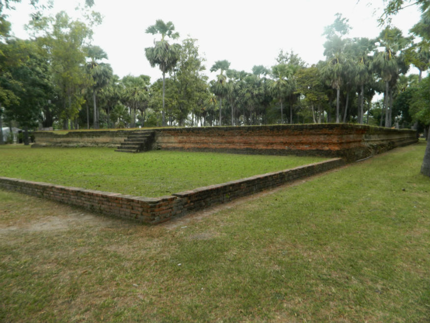
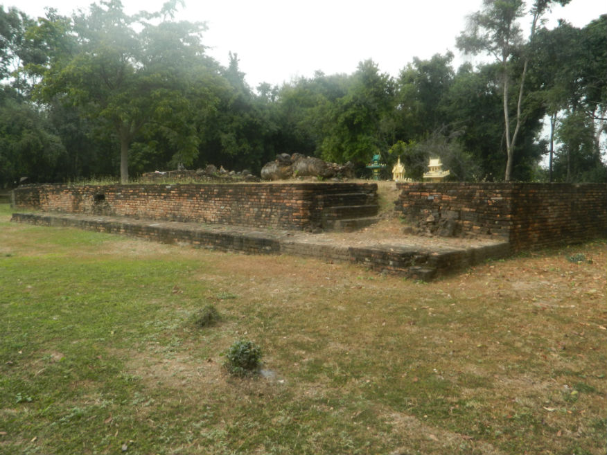
| Wat Kamphaeng Laeng | 16E | Temple ruin | Sukhothai | Sukhothai Historic Park, Sukhothai Province | Inner Monument | 16 Dec 2016 | 100 per zone | Base only (E,3,10m) |
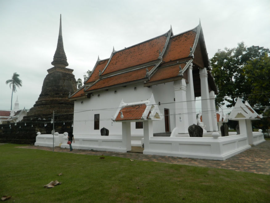
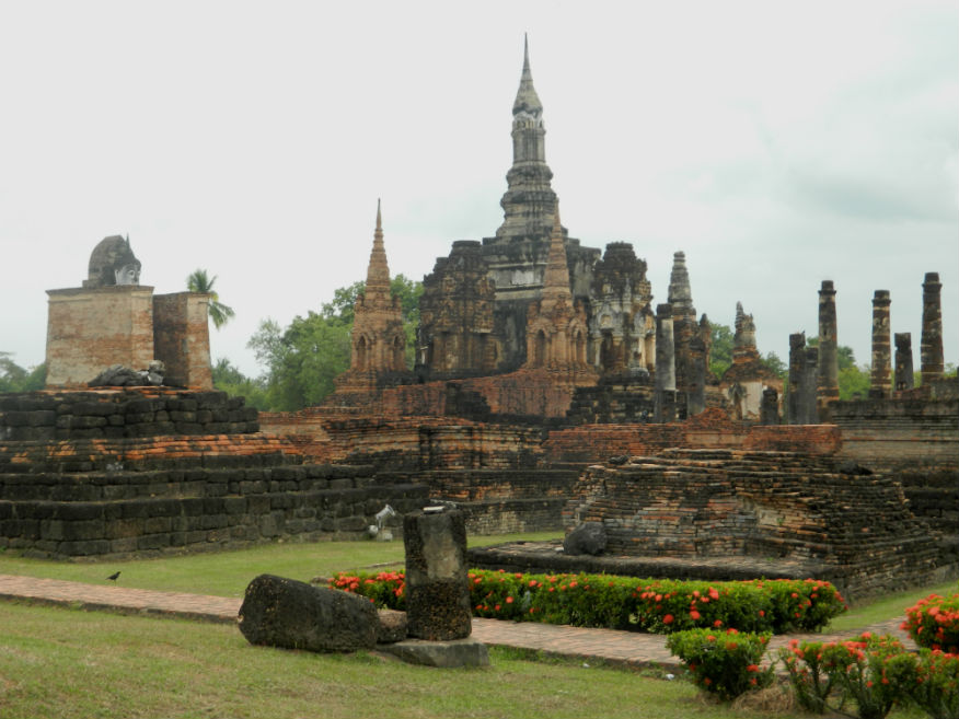
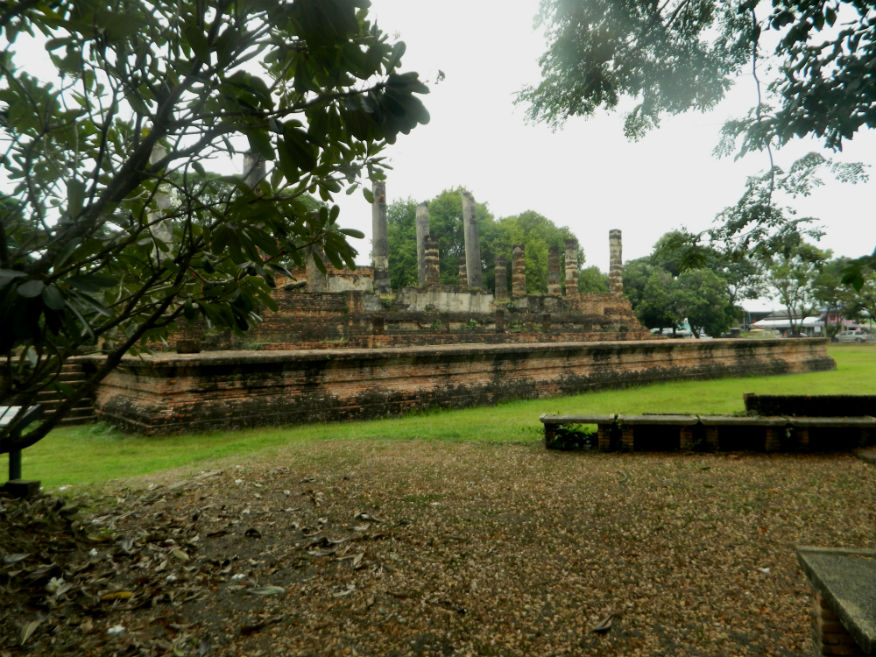
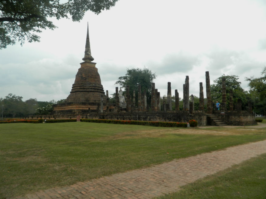
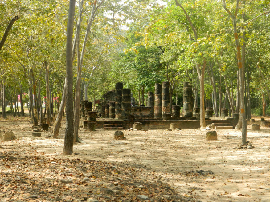
| Wat Mahathat | 16E | Temple ruin | Sukhothai | Sukhothai Historic Park, Sukhothai Province | Google Map | 16 Dec 2016 | 100 per zone | Royal temple (E,5,20m) |
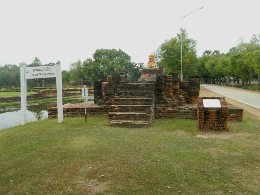
| City Shrine (Lak Muang) | 16E | Temple ruin | Sukhothai | Sukhothai Historic Park, Sukhothai Province | Google Map | 16 Dec 2016 | 100 per zone | Close to Wat Mahathat (E,3,5m) |
| Wat Noen Prasat | 16E | Temple ruin | Sukhothai | Sukhothai Historic Park, Sukhothai Province | Inner Monument | 16 Dec 2016 | 100 per zone | Laterite base only (E,3,10m) |
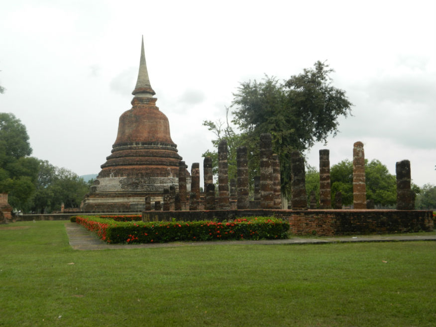
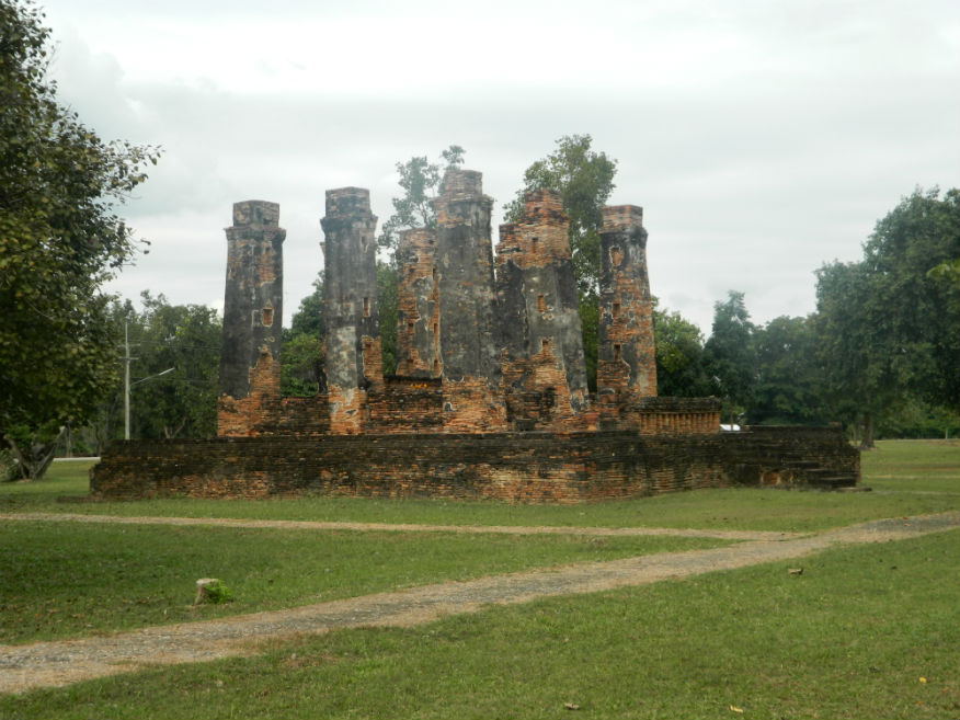
| Wat Chang Songkhram | 16E | Temple ruin | Ayutthaya | Sukhothai Historic Park, Sukhothai Province | Inner Monument | 16 Dec 2016 | 100 per zone | near the city pillar shrine, has a vast imposing bell-shaped chedi (E,4,15m) |
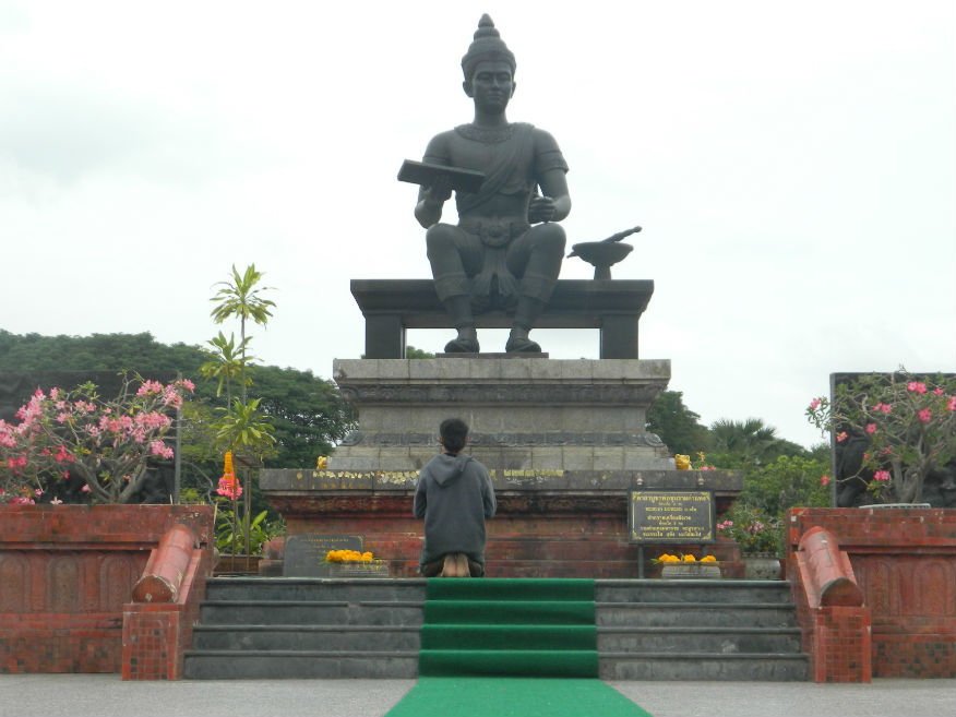
| King Ramkhamhaeng Monument | 16E | Monument | 26th November 1969 | Sukhothai Historic Park, Sukhothai Province | Google Map | 16 Dec 2016 | 100 per zone | commemorating King Ramkhamhaeng who reigned 1279–1298 (E,4,15m) |
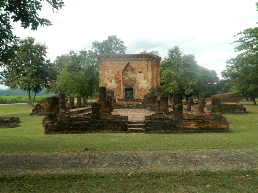
| Wat Mai | 16E | Temple ruin | Early Ayutthaya | Sukhothai Historic Park, Sukhothai Province | Google Map | 16 Dec 2016 | 100 per zone | huge assembly hall (vihara) showing Ayuttaya influence (E,4,15m) |
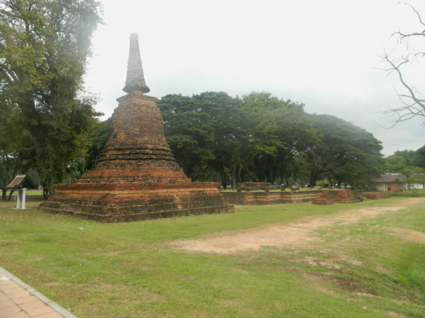
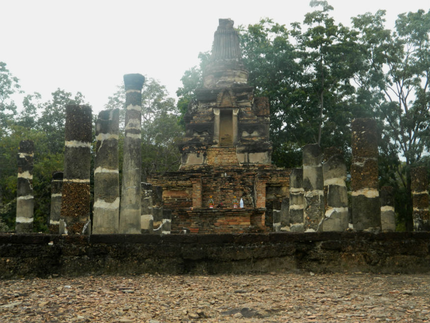
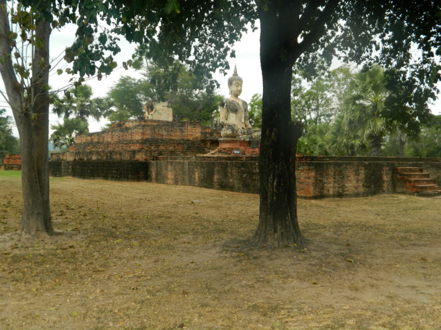
| Wat Sra Si | 16E | Temple ruin | Sinhalese/Sukhothai | Sukhothai Historic Park, Sukhothai Province | Google Map | 16 Dec 2016 | 100 per zone | in the middle of a large reservior, iconic (E,5,30m) |
| Wat Trapang Ngoen | 16E | Temple ruin | Sukhothai | Sukhothai Historic Park, Sukhothai Province | Google Map | 16 Dec 2016 | 100 per zone | viharn, ubosot and chedi in the shape of a lotus bud with niches for Buddha images (E,4,20m) |
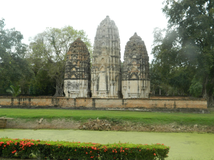
| Wat Si Sawai | 16E | Temple ruin | Sukhothai (Lopburi style) | Sukhothai Historic Park, Sukhothai Province | Google Map | 16 Dec 2016 | 100 per zone | located to the south of Wat Mahathat with three prangs imitating Hindu Shikhara Vimanas (E,5,20m) |
| Wat Tra Kuan | 16E | Temple ruin | Sukhothai | Sukhothai Historic Park, Sukhothai Province | Google Map | 16 Dec 2016 | 100 per zone | identified from a stone inscription found at Wat Sorasak (E,4,15m) |
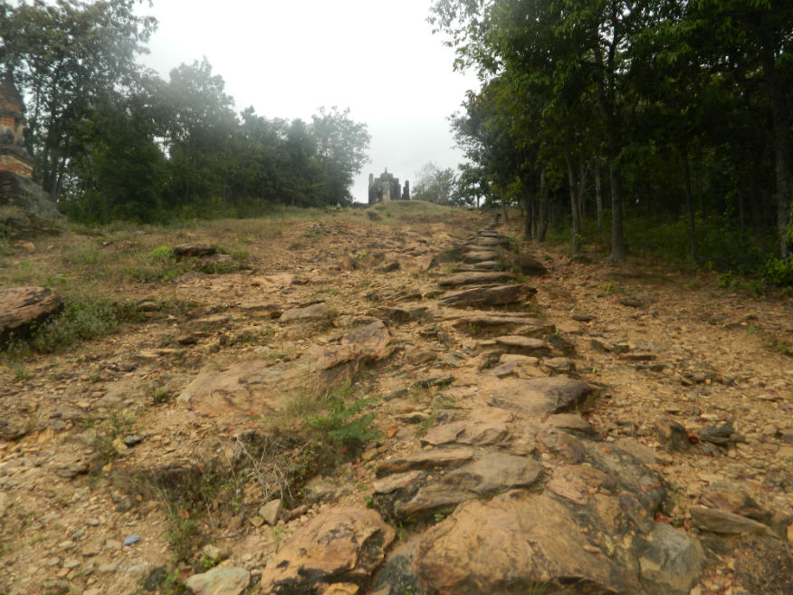
| Wat Saphan Hin | 16E | Temple ruin | Sukhothai | Sukhothai Historic Park, Sukhothai Province | Google Map | 16 Dec 2016 | 100 per zone | well-known for its standing Buddha image mentioned in stone inscription No.1, accessed via a stone bridge (M,4,20m) |
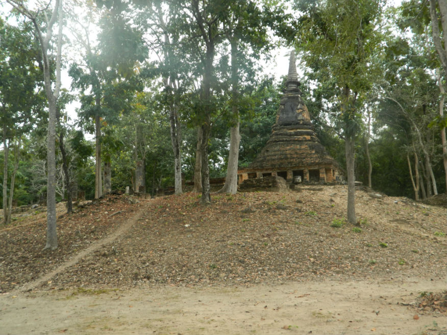
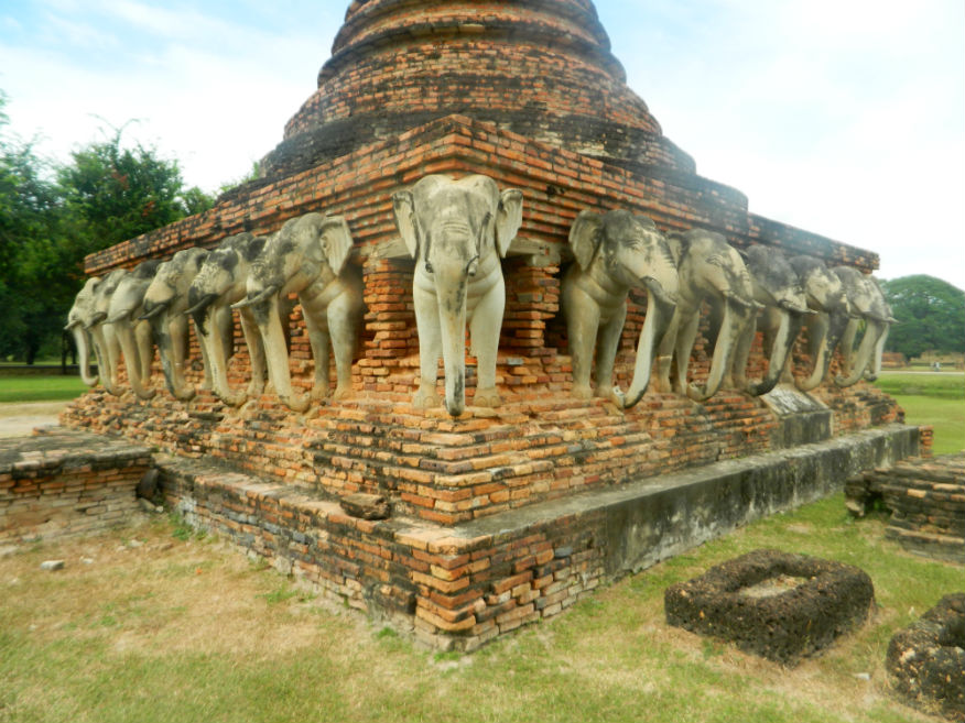
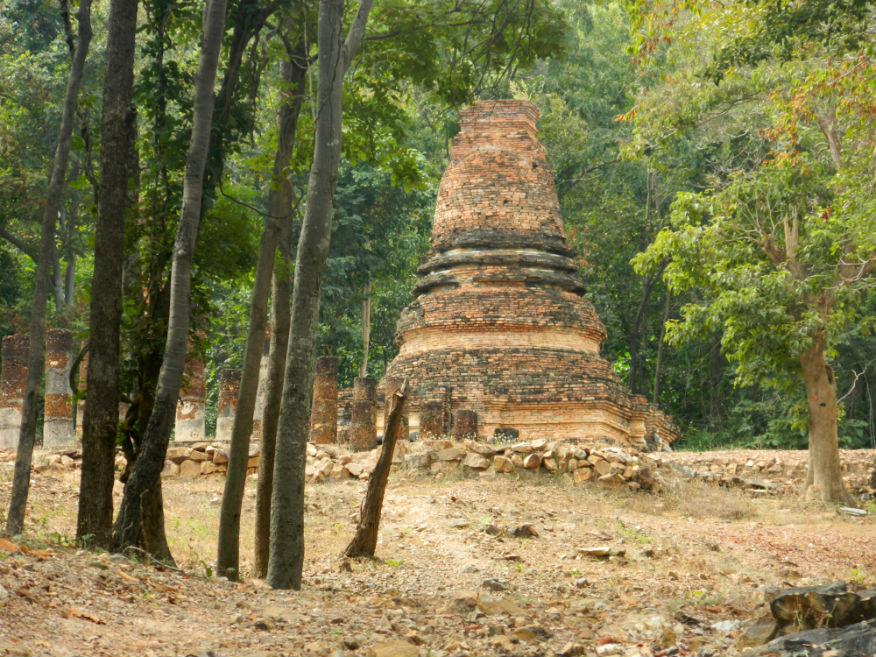
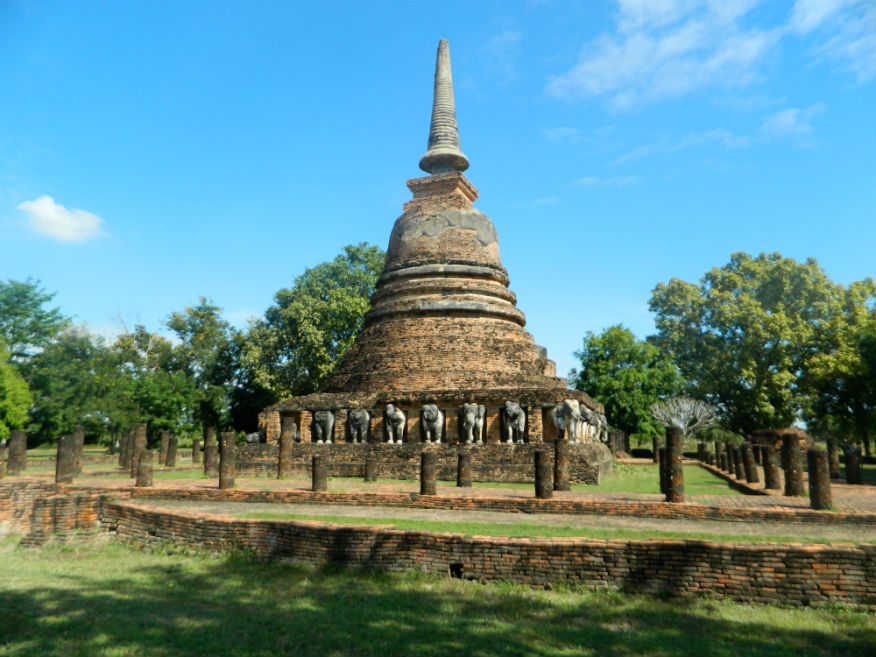
| Wat Chang Rop | 16E | Temple ruin | Sukhothai | Sukhothai Historic Park, Sukhothai Province | Outer Monument (west) | 16 Dec 2016 | 100 per zone | forest temple with a bell-shaped chedi with 24 elephant sculptures at the base (M,3,15m) |
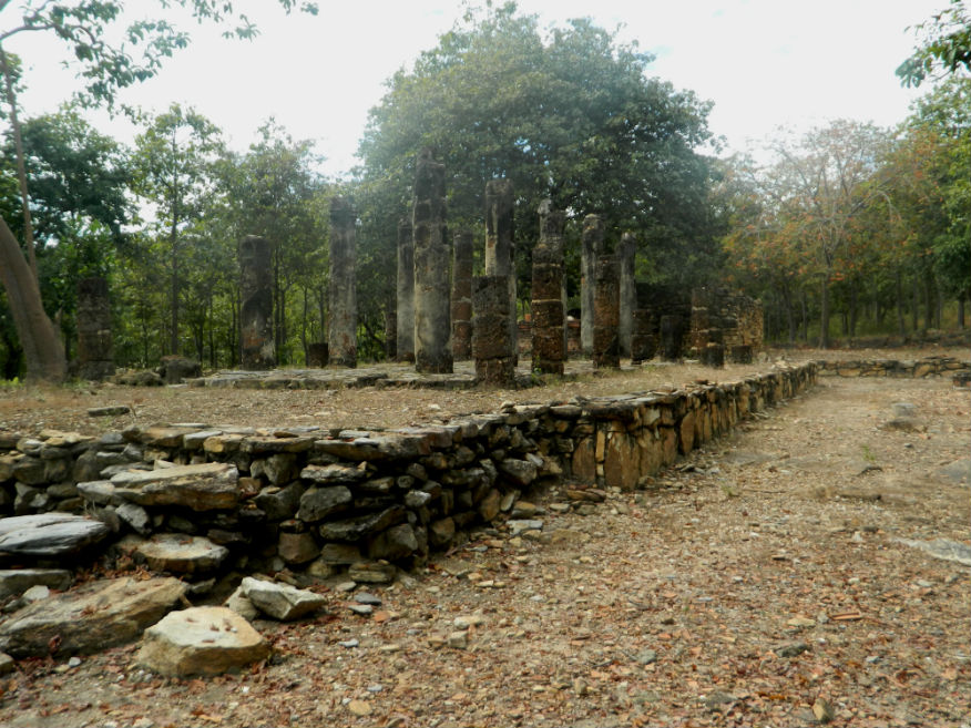
| Wat Aranyik | 16E | Temple ruin | Sukhothai | Sukhothai Historic Park, Sukhothai Province | Google Map | 16 Dec 2016 | 100 per zone | forest temple with viharn, ubosot and a rectangular well made from laterite blocks (M,3,15m) |
| Wat Khao Phra Bat Noi | 16E | Temple ruin | Sukhothai | Sukhothai Historic Park, Sukhothai Province | Google Map | 16 Dec 2016 | 100 per zone | unusual chedi on a square base with niches for Buddha images, the only one of this type in Sukhothai (E,4,15m) |
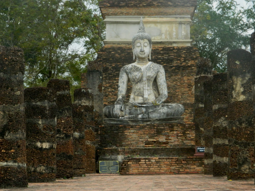
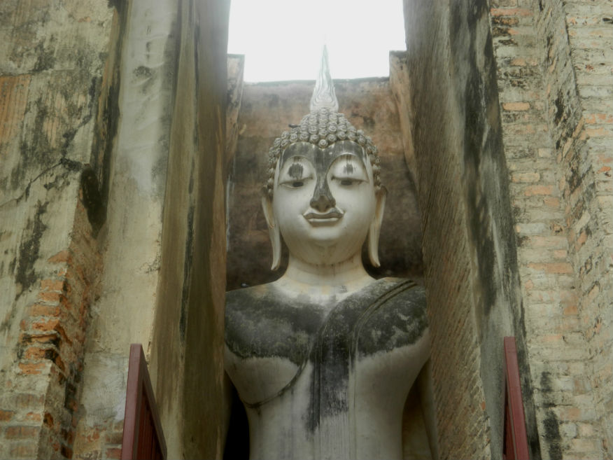
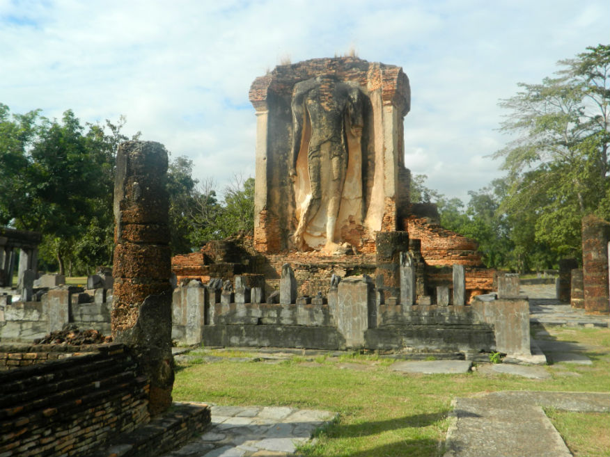
| Wat Si Chum | 16E | Temple ruin | Sukhothai | Sukhothai Historic Park, Sukhothai Province | Google Map | 16 Dec 2016 | 100 per zone | important monument with a large sitting Buddha image, mentioned in the stone inscription No 1 while stone inscription No 2 was found in a nich in the wall in the 1950's (E,5,30m) |
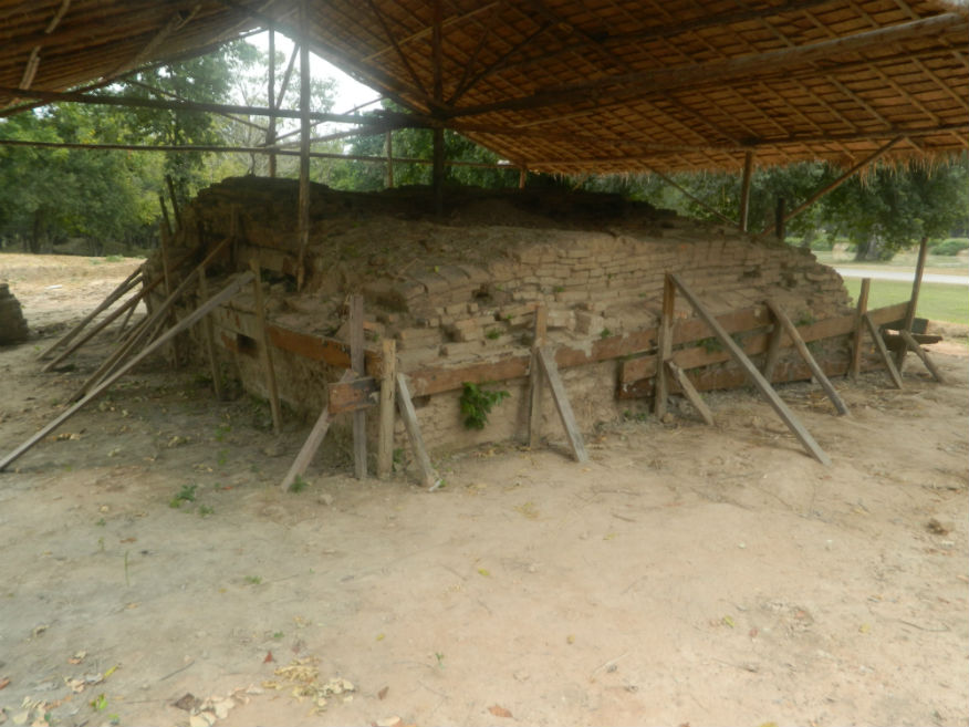
| Thuriang Kilns | 16E | Kiln site | Sukhothai | Sukhothai Historic Park, Sukhothai Province | Google Map | 16 Dec 2016 | 100 per zone | one of the Sangkhalok earthenware and stone ware production sites (E,4,15m) |
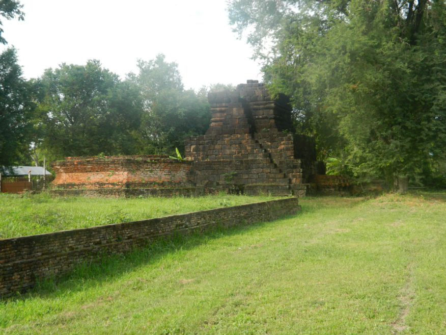
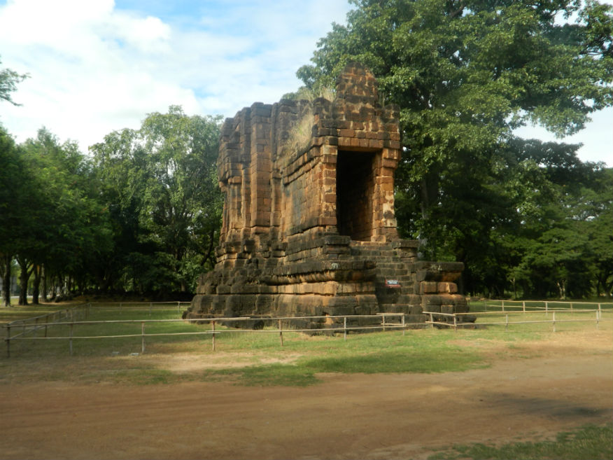
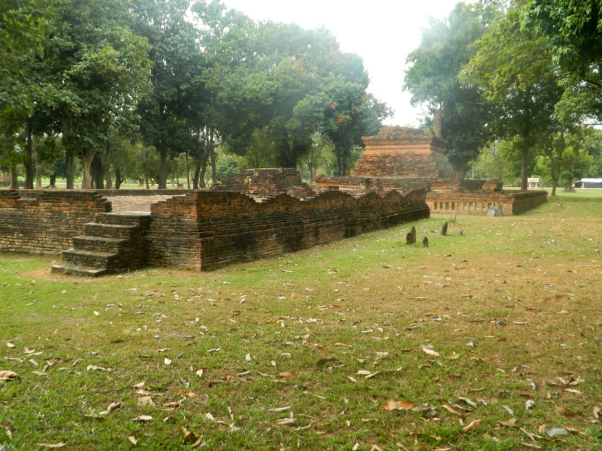
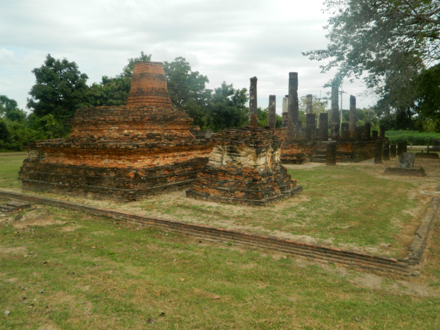
| Wat Phra Phai Luang | 16E | Temple ruin | Khmer | Sukhothai Historic Park, Sukhothai Province | Google Map | 16 Dec 2016 | 100 per zone | important monument predating the Sukhothai era built by the Khmer near the kiln site originally at the centre of the city (E,4,20m) |
| Wat Tao Thu Riang | 16E | Kiln site | Sukhothai | Sukhothai Historic Park, Sukhothai Province | City northwest | 16 Dec 2016 | 100 per zone | monument near the kiln site thought to have been built after production ceased, excavated in 1965 (E,3,15m) |
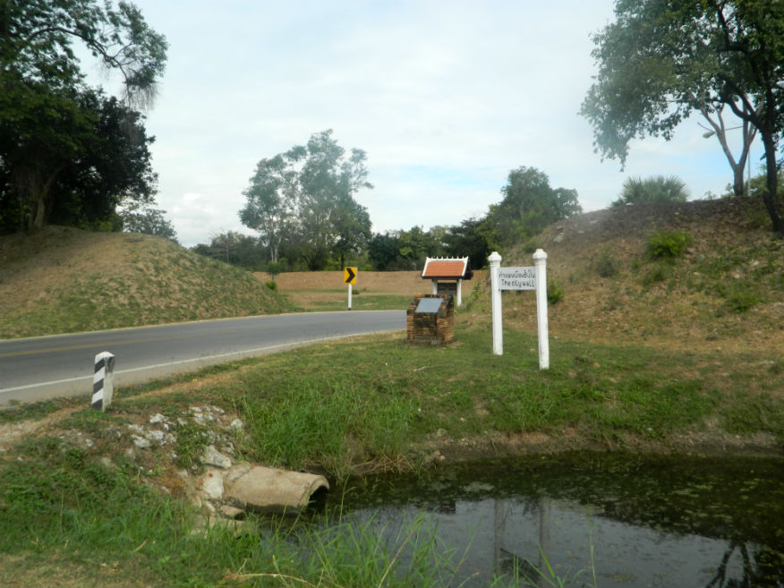
| Namo Gate and Guard Post | 16E | City gate (south) | Sukhothai | Sukhothai Historic Park, Sukhothai Province | City south | 17 Dec 2016 | 100 per zone | south gate, one of four city gates (E,3,15m) |
| Wat Kon Laeng | 16E | Temple ruin | Sukhothai | Sukhothai Historic Park, Sukhothai Province | Outer monuments (south) | 17 Dec 2016 | 100 per zone | small temple with lotus bud shaped chedi (E,3,15m) |
| Wat Chedi Si Hon | 16E | Temple ruin | Sukhothai | Sukhothai Historic Park, Sukhothai Province | Google Map | 17 Dec 2016 | 100 per zone | relief stuccos around the base of the main chedi depict men and women in different attire with ornaments (E,3,15m) |
| Wat Chetuphon | 16E | Temple ruin | Sukhothai | Sukhothai Historic Park, Sukhothai Province | Google Map | 17 Dec 2016 | 100 per zone | famous for its four Buddha images of vast size in different postures, lovely location surrounded by a lily pond (E,4,20m) |
| Ta Pha Daeng Shrine | 16E | Temple ruin | Khmer | Sukhothai Historic Park, Sukhothai Province | Google Map | 17 Dec 2016 | 100 per zone | adjacent to the Tra Kuan reservoir and the northern city gate, temple built in Khmer style (E,4,20m) |
| Wat Son Khao | 16E | Temple ruin | Sukhothai | Sukhothai Historic Park, Sukhothai Province | Google Map | 17 Dec 2016 | 100 per zone | close to the northern gate, temple well-known for its lotus bud shaped chedi presently in ruins, surrounded by a wall and moat (E,4,20m) |
| San Luang Gate | 16E | City gate | Sukhothai | Sukhothai Historic Park, Sukhothai Province | City north | 17 Dec 2016 | 100 per zone | one of the four city gates (E,3,20m) |
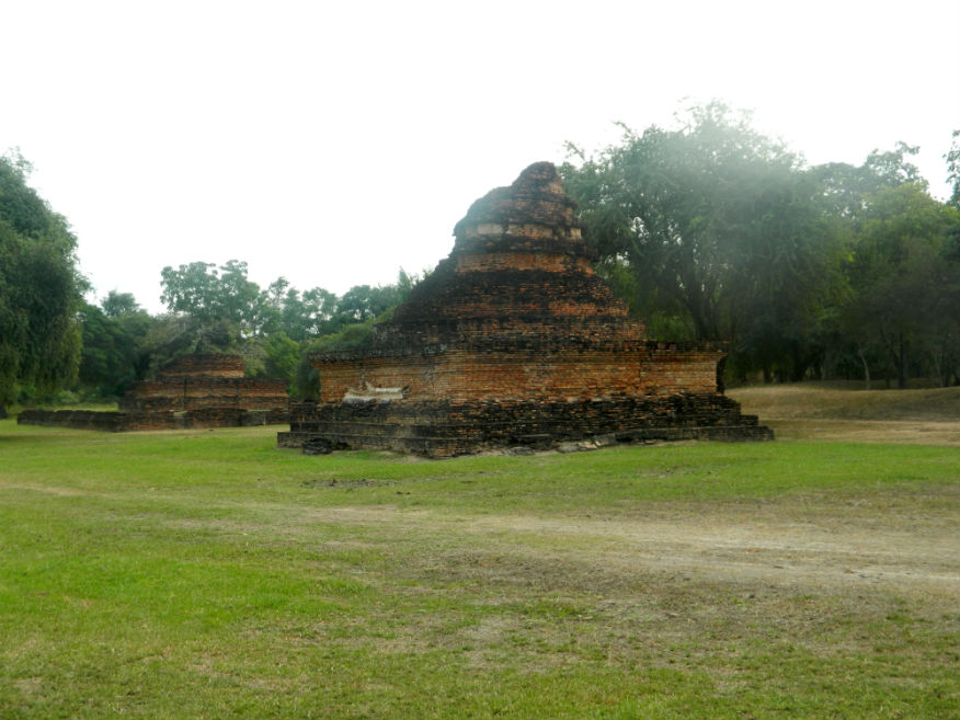
| Wat Traphang Phan | 16E | Temple ruin | Sukhothai | Sukhothai Historic Park, Sukhothai Province | Outer monuments (north) | 17 Dec 2016 | 100 per zone | short distance from the San Luang Gate (E,3,20m) |
| Wat Mae Chon | 16E | Temple ruin | Sukhothai | Sukhothai Historic Park, Sukhothai Province | Google Map | 17 Dec 2016 | 100 per zone | featuring a slate lined well, the Buddha image has been renovated (E,3,15m) |
| Wat Sorasak | 16E | Temple ruin | Sukhothai | Sukhothai Historic Park, Sukhothai Province | Google Map | 17 Dec 2016 | 100 per zone | located inside the northern wall, a temple with royal connections according to a stone insscription (E,4,10m) |
| Or Gate | 16E | Temple ruin | Sukhothai | Sukhothai Historic Park, Sukhothai Province | City Gate (west) | 17 Dec 2016 | 100 per zone | well preserved gate with access to the Aranyik forest (E,4,10m) |
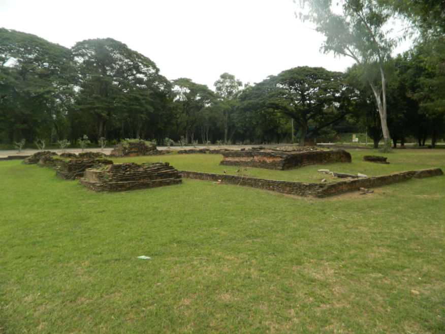
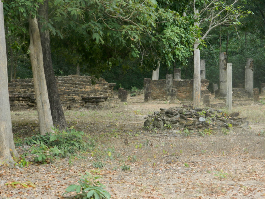
| Wat Tuk | 16E | Temple ruin | Sukhothai | Sukhothai Historic Park, Sukhothai Province | Outer monument (west) | 17 Dec 2016 | 100 per zone | consists of a mandapa, an assembly hall (viharn) and 13 subordinate chedis, not mentioned in any inscriptions (E,3,10m) |
| Thewalai Mahakaset | 16E | Temple ruin | Sukhothai | Sukhothai Historic Park, Sukhothai Province | Google Map | 17 Dec 2016 | 100 per zone | mentioned in the stone inscription found at Wat Pa Mamuang giving the date 1361, a place of Brahmin worship (E,4,10m) |
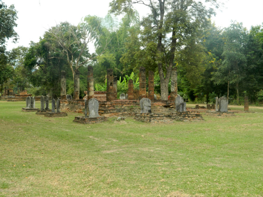
| Wat Pasak | 16E | Temple ruin | Sukhothai or earlier | Sukhothai Historic Park, Sukhothai Province | Outer monument (west) | 17 Dec 2016 | 100 per zone | small ordination hall (ubosot) surrounded by 12 bases for boundary stones (Sema) made of slate the chedi made of brick (E,3,10m) |
| Wat Pa Mamuang | 16E | Temple ruin | Sukhothai | Sukhothai Historic Park, Sukhothai Province | Google Map | 17 Dec 2016 | 100 per zone | stone inscription No 6 was found at this temple and refers to the importance of this temple as a place where Phra Maha Dharmaraja Li Thai was ordained as a priest in 1361, Hindu connections (E,3,10m) |
| Wat Mangkon | 16E | Temple ruin | Sukhothai | Sukhothai Historic Park, Sukhothai Province | Outer monument (west) | 17 Dec 2016 | 100 per zone | glazed bars of Sangkalok on the inner wall are unique, name of the temple derives from sculptures of Sangkalok Makara found there (E,3,10m) |
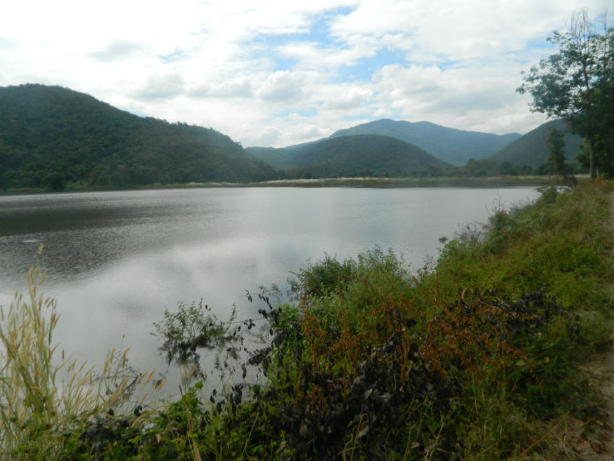
| Saritphong or Sa Lead Pong Dam | 16E | Reservior | Sukhothai | Sukhothai Historic Park, Sukhothai Province | Google Map | 17 Dec 2016 | 100 per zone | located in the Prathak Range to the west, an important water source for the city via the Sao Ho canal, examples of ceramic water pipes are in the museum (M,3,10m) |
| Wat Tham Hip Lang | 16E | Temple ruin | Sukhothai | Sukhothai Historic Park, Sukhothai Province | Google Map | 17 Dec 2016 | 100 per zone | located in the foothills of the Aranyik forest, small temple built of stone and laterite (M,3,10m) |
| Wat Tham Hip Bon | 16E | Temple ruin | Sukhothai | Sukhothai Historic Park, Sukhothai Province | Google Map | 17 Dec 2016 | 100 per zone | located in the foothills of the Aranyik forest, consists of a bell-shaped subordinate chedi, a laterite assembly hall (viharn), a bell-shaped main chedi and two brick buildings for monks to practice meditation (M,3,10m) |
| Wat Chedi Ngam | 16E | Temple ruin | Sukhothai | Sukhothai Historic Park, Sukhothai Province | Google Map | 17 Dec 2016 | 100 per zone | located on a mound with a slate pathway, a meditation centre with chedi, assembly hall and pond dug into the rock (M,3,10m) |
| Wat Kamphaeng Hin | 16E | Temple ruin | Sukhothai | Sukhothai Historic Park, Sukhothai Province | Outer monument (west) | 17 Dec 2016 | 100 per zone | located in the Aranyik forest, has a slate wall, assembly hall with staircases, in brick with laterite columns and a brick chedi (M,3,15m) |
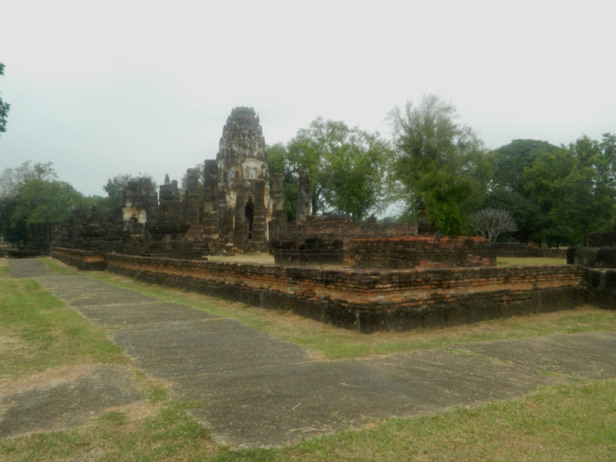
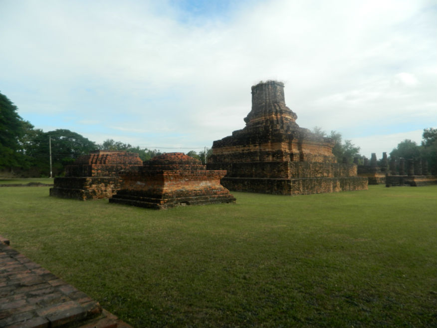
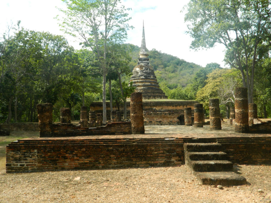
| Wat Chang Lom | 16E | Temple ruin | Sukhothai | Sukhothai Historic Park, Sukhothai Province | Google Map | 17 Dec 2016 | 100 per zone | outside the city to the east, chang lom means 'elephants around' a popular design, near the canal with moat, built no earlier than 1384 after the death of the King Phra Maha Dharmaraja Li Thai (E,4,15m) |