Tours Section by Province |
| Name |
Ref. |
Description |
Era |
District/Province |
Location |
Date visited |
Price (baht) |
Rating/Comment |
| Sukhothai Province |
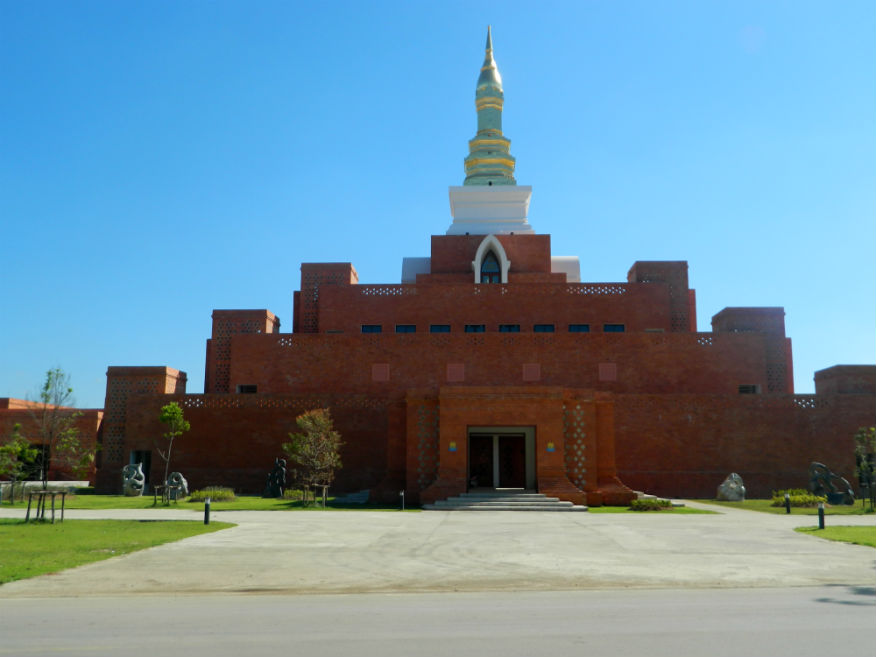
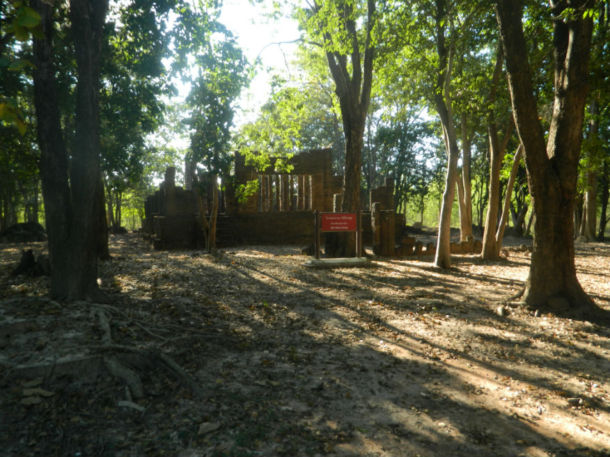
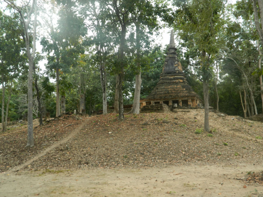
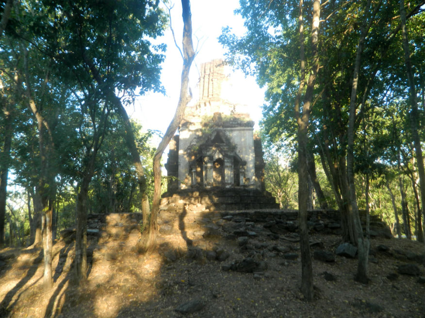
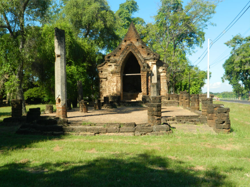
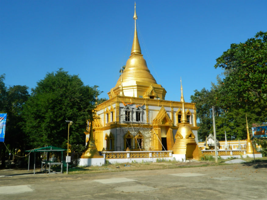
| Bhodidart Pagoda |
16E |
Cultural Site |
---- |
Sawankhalok District |
Google Map |
18 Dec 2016 |
n/a |
7 - a pagoda with creative architecture next to Sukhothai airport (M,3,open by invitation) |
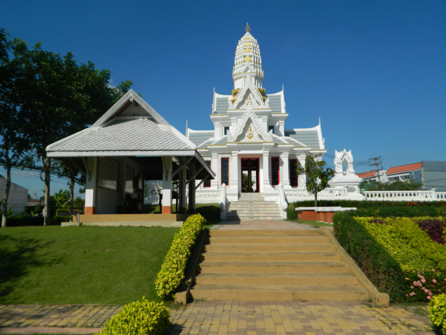
| City Pillar Shrine |
16E |
Shrine |
--- |
Sawankhalok |
Google Map |
18 Dec 2016 |
--- |
representing the foundation and future prosperity of the city (E,5,10m) |
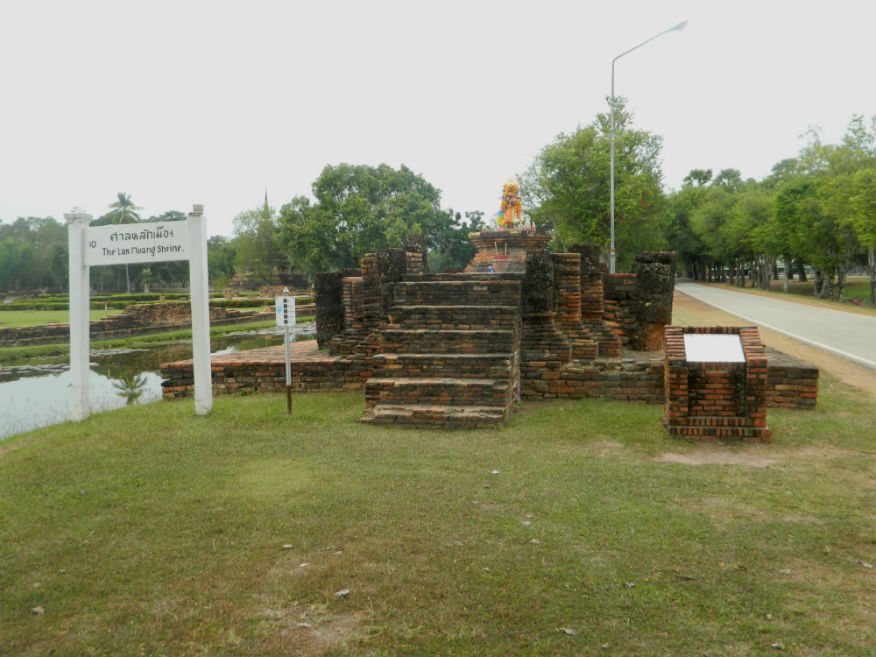
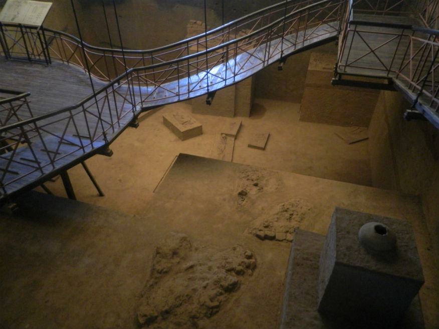
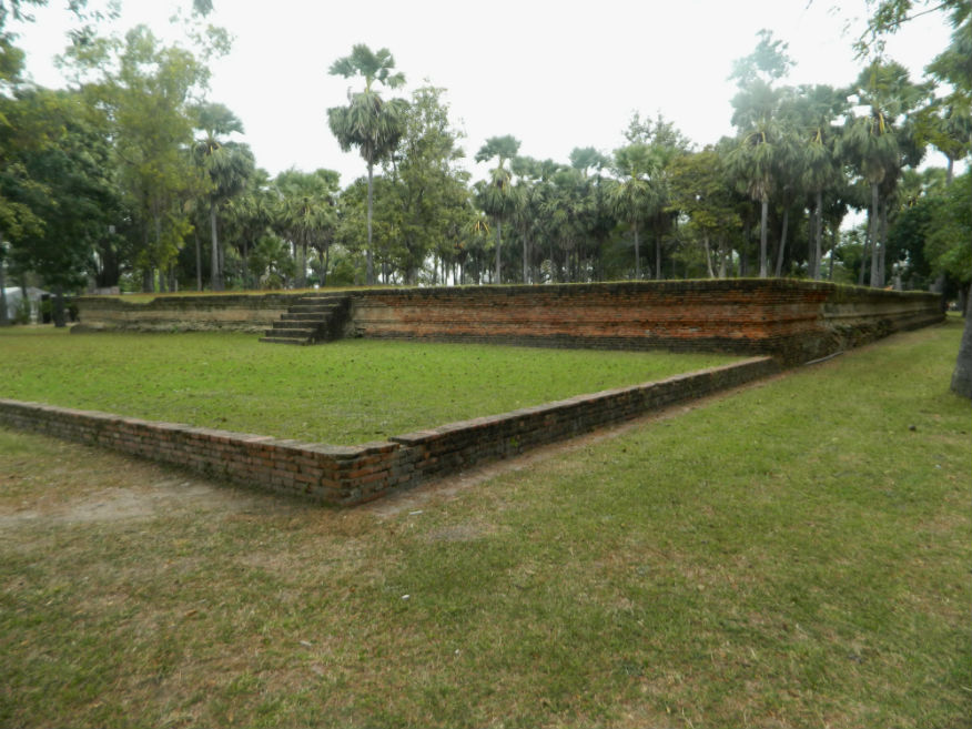
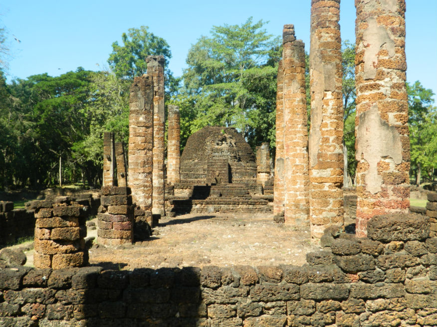
| City Shrine (Lak Muang) |
16E |
Temple ruin |
Sukhothai |
Sukhothai Historic Park, Mueang Sukothai District |
Google Map |
16 Dec 2016 |
100 per zone |
Close to Wat Mahathat (E,3,5m) |
| Holy Heartland Talay Luang |
23H |
Wetland
| n/a |
Ban Kluai, Mueang Sukhothai District |
Google Map |
23 Sep 2023 |
Free |
(Moderate..Sukhothai 9.9km,Wonderful)..... Wikipedia |
| Monument w.4 |
16E |
Temple ruin |
Sukothai |
Si Satchanalai Historical Park, Si Satchanalai District |
outer monument (west) |
19 Dec 2016 |
100 or 220 all-inclusive |
small temple built from laterite blocks - the brick base indicates the site of a former structure - site cleared and excavated in 1992 (E,3,10m) |
| Monument w.5 |
16E |
Temple ruin |
Sukothai |
Si Satchanalai Historical Park, Si Satchanalai District |
outer monument (west) |
19 Dec 2016 |
100 or 220 all-inclusive |
small temple with a chedi assumed to have been lotus-shaped and a viharn - site cleared and excavated in 1992 (E,3,10m) |
| Namo Gate and Guard Post |
16E |
City gate (south) |
Sukhothai |
Sukhothai Historic Park, Mueang Sukhothai District |
City south |
17 Dec 2016 |
100 per zone |
south gate, one of four city gates (E,3,15m) |
| Or Gate |
16E |
Temple ruin |
Sukhothai |
Sukhothai Historic Park, Mueang Sukhothai District |
City Gate (west) |
17 Dec 2016 |
100 per zone |
well preserved gate with access to the Aranyik forest (E,4,10m) |
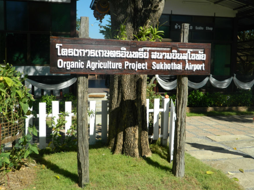
| Organic Agriculture Project |
16E |
Cultural Site |
---- |
Sawankhalok District |
Google Map |
18 Dec 2016 |
n/a |
8 - Set up by Bangkok Airways, a small farm using traditional methods next to Sukhothai airport (M.4,1h) |
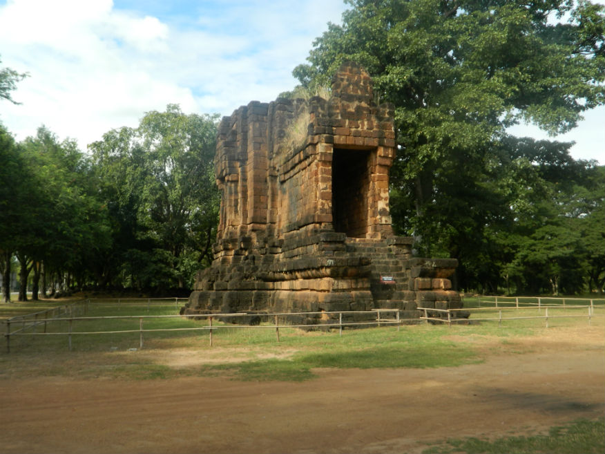
| Phra Ya Lithai Monument |
16E |
Temple ruin |
Sukhothai |
Si Satchanalai Historical Park, Si Satchanalai District |
Google Map |
19 Dec 2016 |
100 or 220 all-inclusive |
Phraya Li Thai was the sixth king of the Phra Ruang dynasty (E,3,5m) |
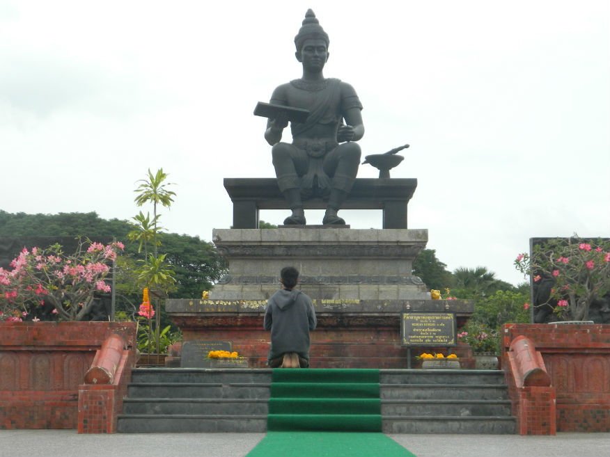
| King Ramkhamhaeng Monument |
16E |
Monument |
26th November 1969 |
Sukhothai Historic Park, Mueang Sukhothai District |
Google Map |
16 Dec 2016 |
100 per zone |
commemorating King Ramkhamhaeng who reigned 1279–1298 (E,4,15m) |
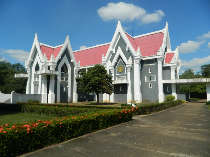
| Ramkhamhaeng National Museum |
16E |
Museum |
Sukhothai/early Ayutthaya |
Sukhothai Historic Park, Mueang Sukhothai District |
Google Map |
16 Dec 2016 |
100 |
Essential, before viewing the monuments (E,5,1.5h) |
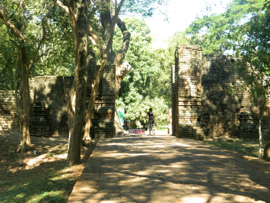
| Ramnarong Gate |
16E |
City gate |
Early Ayuttaya |
Si Satchanalai Historical Park, Si Satchanalai District |
the park entrance |
19 Dec 2016 |
100 or 220 all-inclusive |
substantial, built of laterite some 3.5 metres wide by 4 metres high dating back to 1474 (E,4,15m) |
| San Luang Gate |
16E |
City gate |
Sukhothai |
Sukhothai Historic Park, Mueang Sukhothai District |
City north |
17 Dec 2016 |
100 per zone |
one of the four city gates (E,3,20m) |
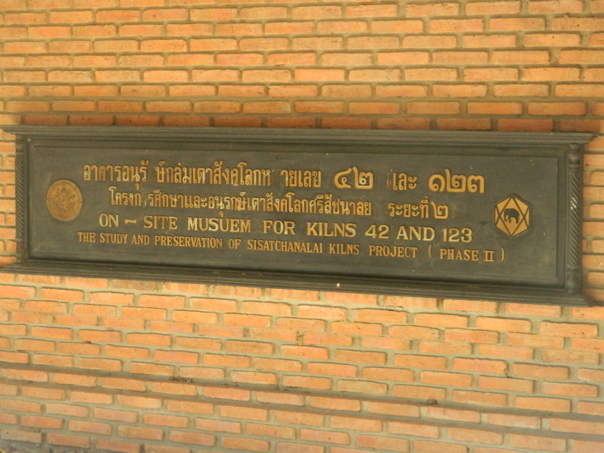
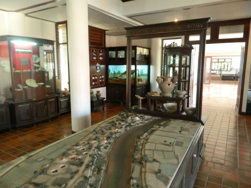
| Museum for kilns 42 and 123 |
16E |
Museum |
Sukhothai |
Si Satchanalai Historical Park, Si Satchanalai District |
Google Map |
19 Dec 2016 |
100 or 220 all-inclusive |
museum for kilns 42 and 123 situated in Ban Ko Noi some 5 kilometres north from the Tao Mor Gate, museum concentrates on the work of excavating the numerous Thuriang kiln sites in the area (E,5,30m) |
| Sangkhalok Kiln Preservation Centre (Kiln 61) |
16E |
Museum |
Sukhothai |
Si Satchanalai Historical Park, Si Satchanalai District |
Google Map |
19 Dec 2016 |
100 or 220 all-inclusive |
located a few kilometres north from the Tao Mor Gate, centre has a useful collection of Sangkhalok wares as well as a preserved excavation pit (E,3,30m) |
| Saphan Chan Gate |
16E |
City gate |
Sukhothai |
Si Satchanalai Historical Park, Si Satchanalai District |
old city |
19 Dec 2016 |
100 or 220 all-inclusive |
at the base of Suwankhiri Mountain to the south, in use before 1474, gate is 2.5 metres wide by 2.7 metres high (E,3,10m) |
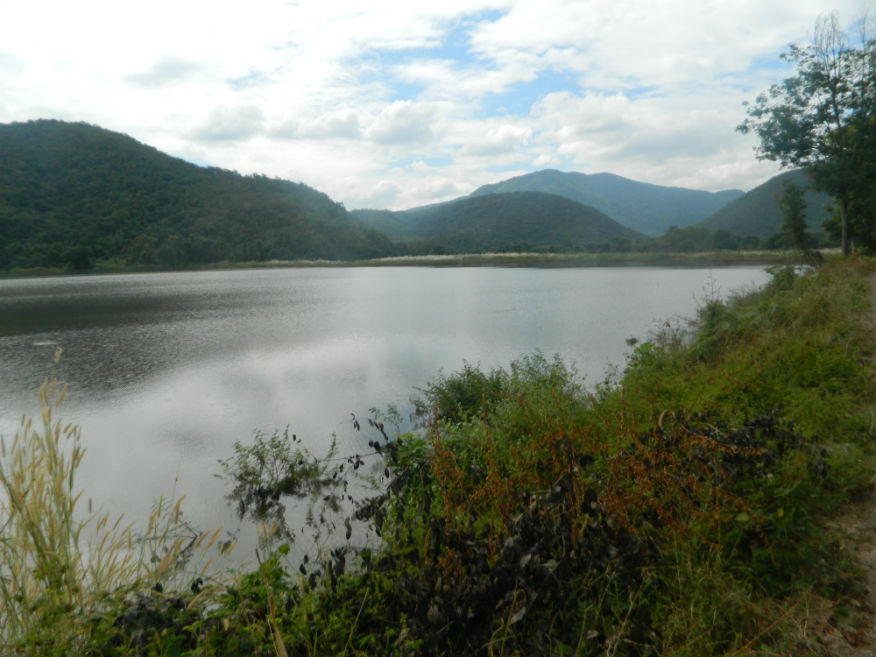
| Saritphong or Sa Lead Pong Dam |
16E |
Reservior |
Sukhothai |
Sukhothai Historic Park, Mueang Sukhothai District |
Google Map |
17 Dec 2016 |
100 per zone |
located in the Prathak Range to the west, an important water source for the city via the Sao Ho canal, examples of ceramic water pipes are in the museum (M,3,10m) |
| Sathon Gold Textile Museum |
18A |
Museum |
1988 |
Hat Siao, Si Satchanalai District |
Google Map |
20 Apr 2018 |
free |
(E,4,1h).....Learn |
| Sawankhalok |
16E |
Town |
----- |
Sawankhalok District |
Google Map |
18 Dec 2016 |
n/a |
quiet town in Sukhothai Province and jumping off point for Si Satchanalai Historic Park (E,3,30+m) |
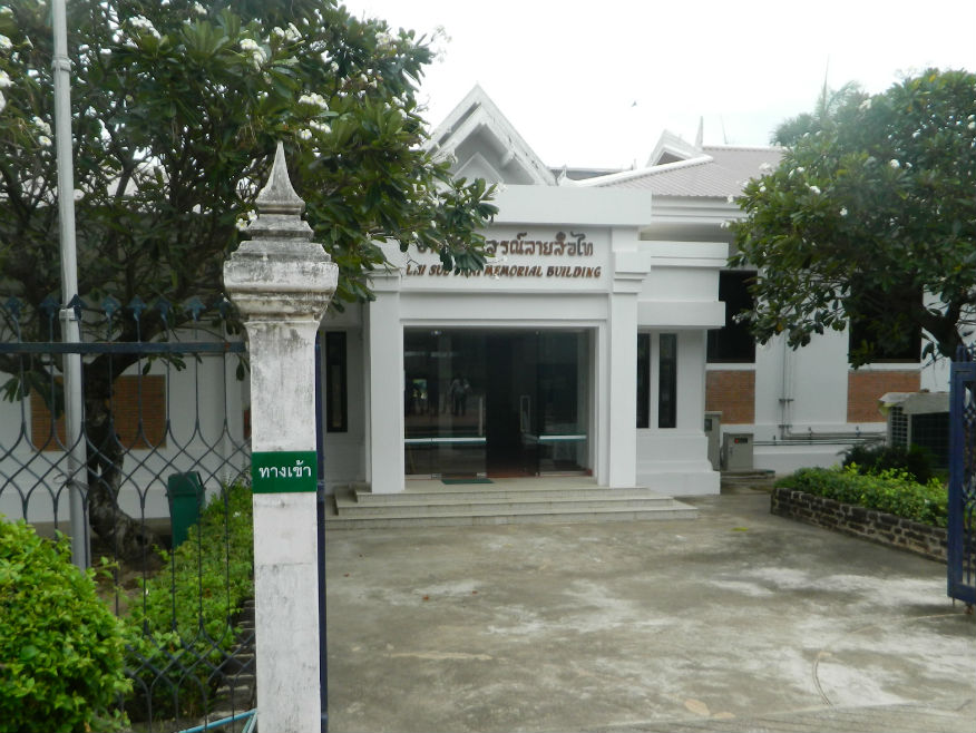
| Sawanworanayok National Museum |
16E |
Museum |
Various |
Sawankhalok District |
Google Map |
18 Dec 2016 |
unknown |
considerable collection of national artefacts left by the founder Phra Sawanworanayok together with his personal possessions (E,5,1h) |
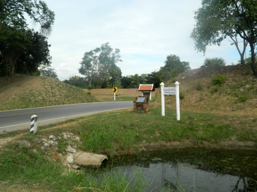
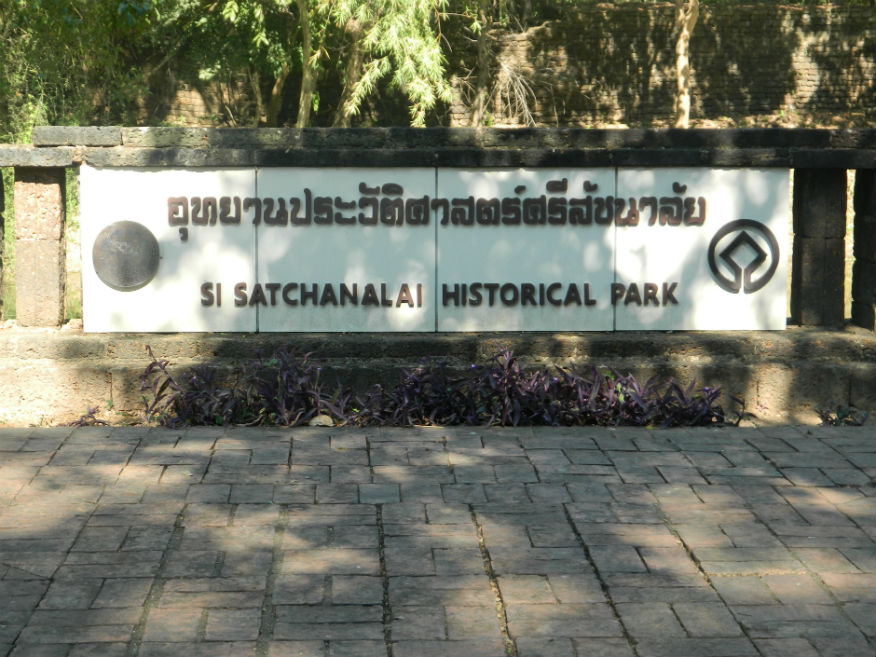
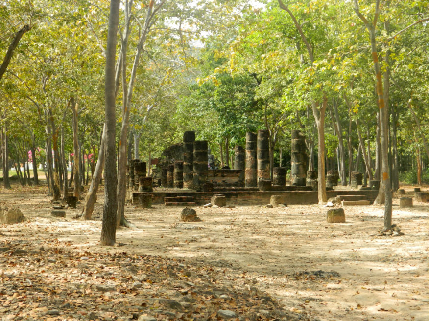
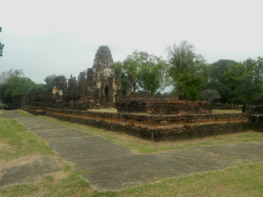
| Si Satchanalai Historical Park |
16E |
Historical Park |
Sukhothai |
Si Satchanalai Historical Park, Si Satchanalai District |
Google Map |
19 Dec 2016 |
100 or 220 all-inclusive |
important historical park from the Sukhothai era (E,5,1d) |
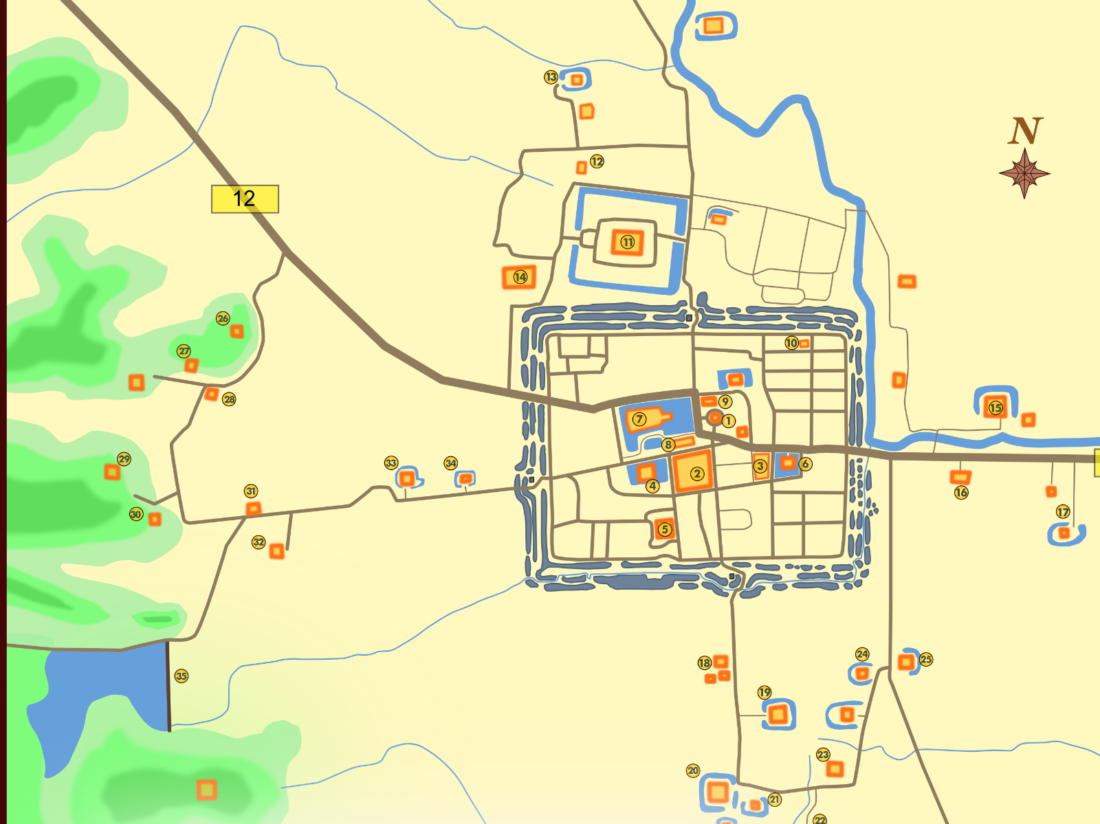
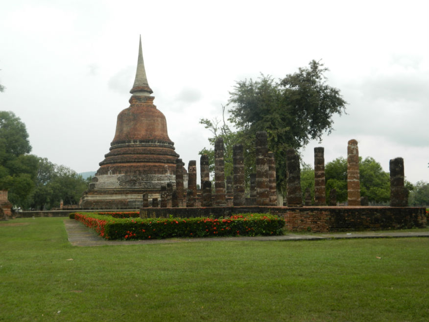
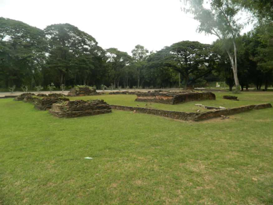
| Sukhothai Historical Park |
16E |
Historical Park |
Sukhothai |
Sukhothai Historic Park, Mueang Sukhothai Distrct |
Google Map |
15 to 17 Dec 2016 |
100 per zone |
Historically important location - covers the ruins of Sukhothai, literally 'Dawn of Happiness', capital of the Sukhothai Kingdom in the 13th and 14th centuries (E,5,1+d) |
| Ta Pha Daeng Shrine |
16E |
Temple ruin |
Khmer |
Sukhothai Historic Park, Mueang Sukhothai Distrct |
Google Map |
17 Dec 2016 |
100 per zone |
adjacent to the Tra Kuan reservoir and the northern city gate, temple built in Khmer style (E,4,20m) |
| Talay Luang Stadium |
23H,24Oct |
Stadium
| by 2017 |
Ban Kluai, Mueang Sukhothai District |
Google Map |
23 Sep 2023,5 Oct 2024 |
ticket |
(Moderate - Sukhothai 10.4km,,Brilliant)..... Wikipedia |
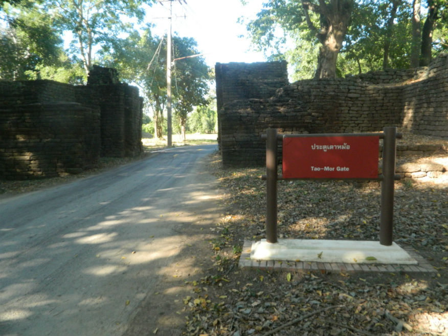
| Tao Mor Gate |
16E |
City gate |
Early Ayutthaya |
Si Satchanalai Historical Park, Si Satchanalai District |
City north |
19 Dec 2016 |
100 or 220 all-inclusive |
northern city gate of the old city, well constructed with fortifications built in laterite of similar proportions to the other gates (E,3,10m) |
| Thewalai Mahakaset |
16E |
Temple ruin |
Sukhothai |
Sukhothai Historic Park, Mueang Sukhothai District |
Google Map |
17 Dec 2016 |
100 per zone |
mentioned in the stone inscription found at Wat Pa Mamuang giving the date 1361, a place of Brahmin worship (E,4,10m) |
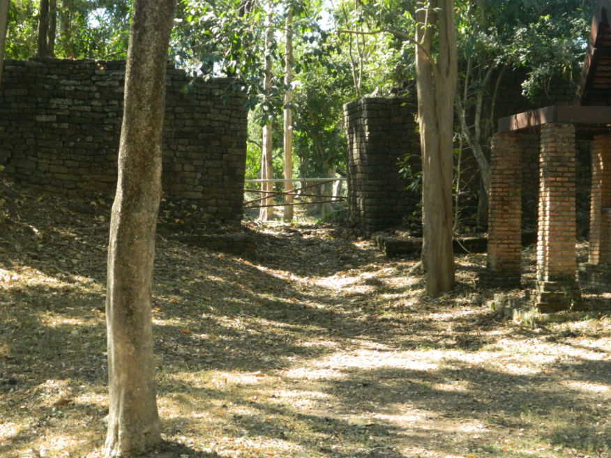
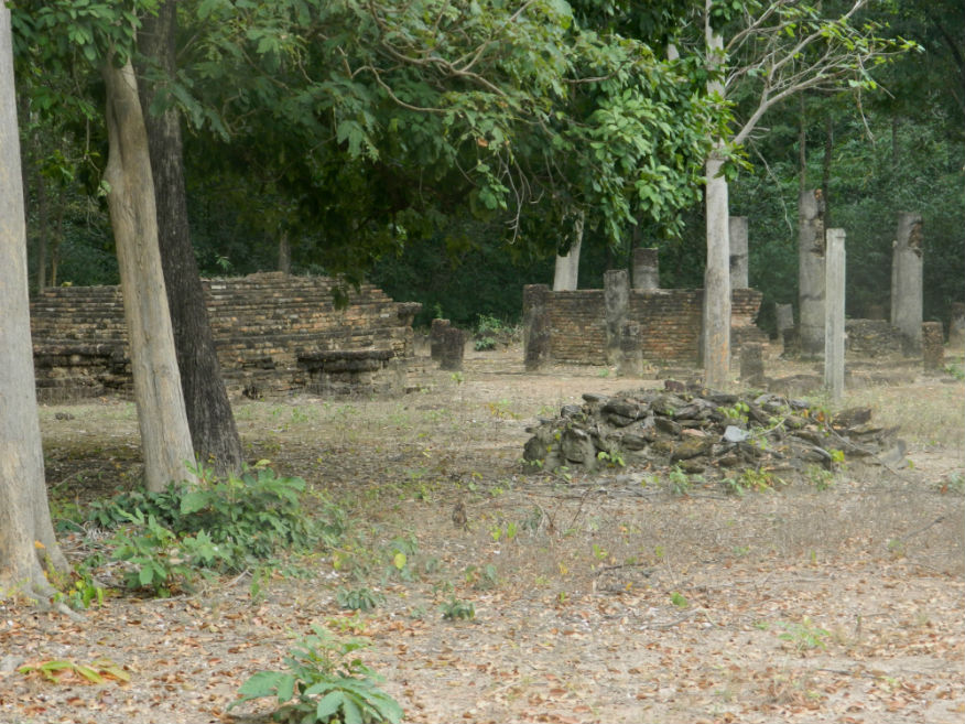
| Thuriang Kilns |
16E |
Kiln site |
Sukhothai |
Sukhothai Historic Park, Mueang Sukhothai District |
Google Map |
16 Dec 2016 |
100 per zone |
one of the Sangkhalok earthenware and stone ware production sites
(E,4,15m) |
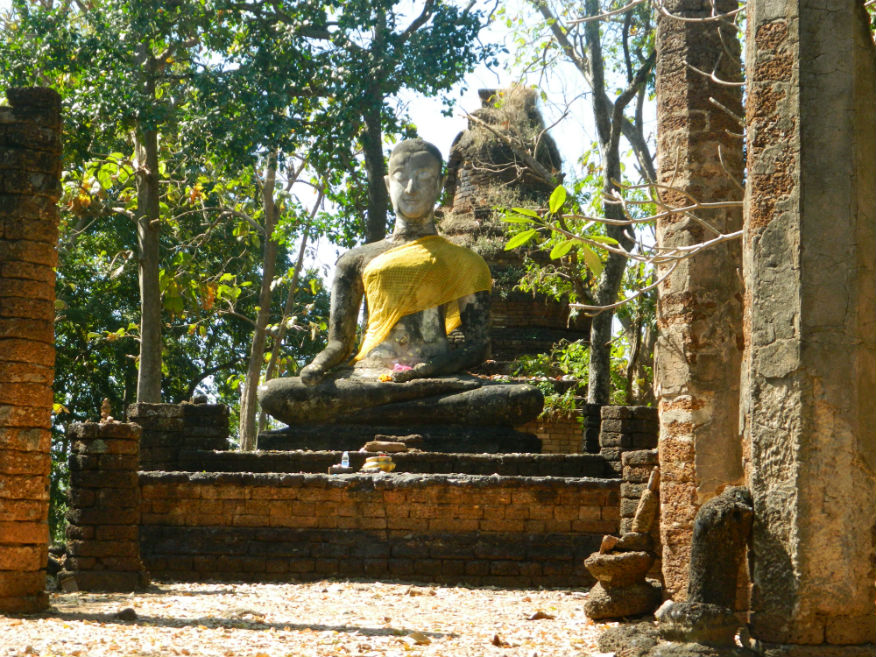
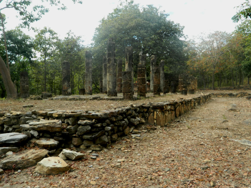
| Wat Aranyik |
16E |
Temple ruin |
Sukhothai |
Sukhothai Historic Park, Mueang Sukhothai District |
Outer Monument (west) |
16 Dec 2016 |
100 per zone |
forest temple with viharn, ubosot and a rectangular well made from laterite blocks (M,3,15m) |
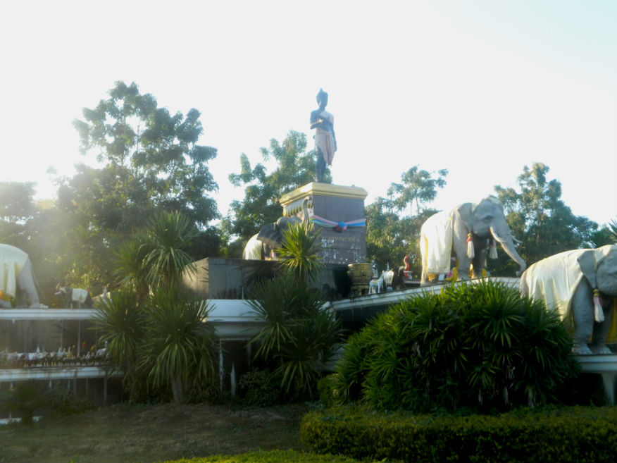
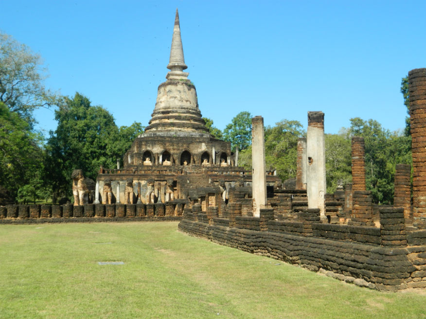
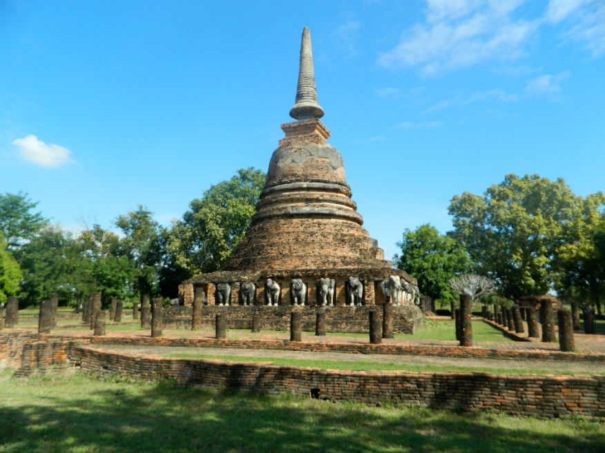
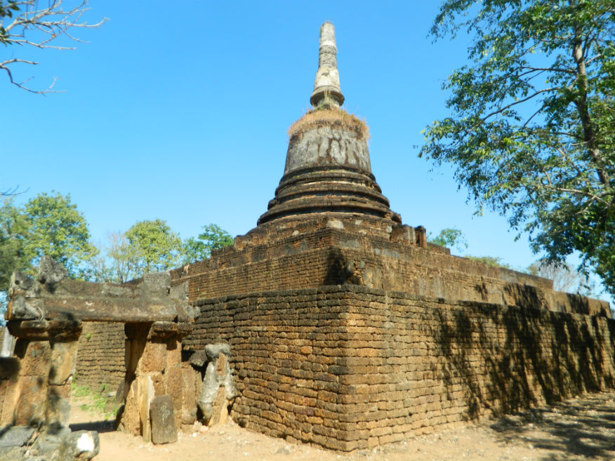
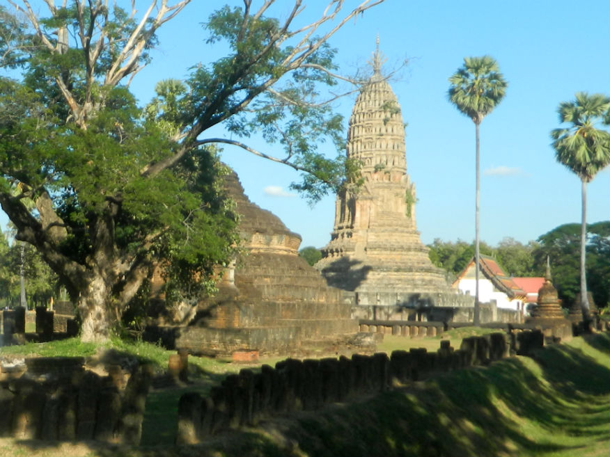
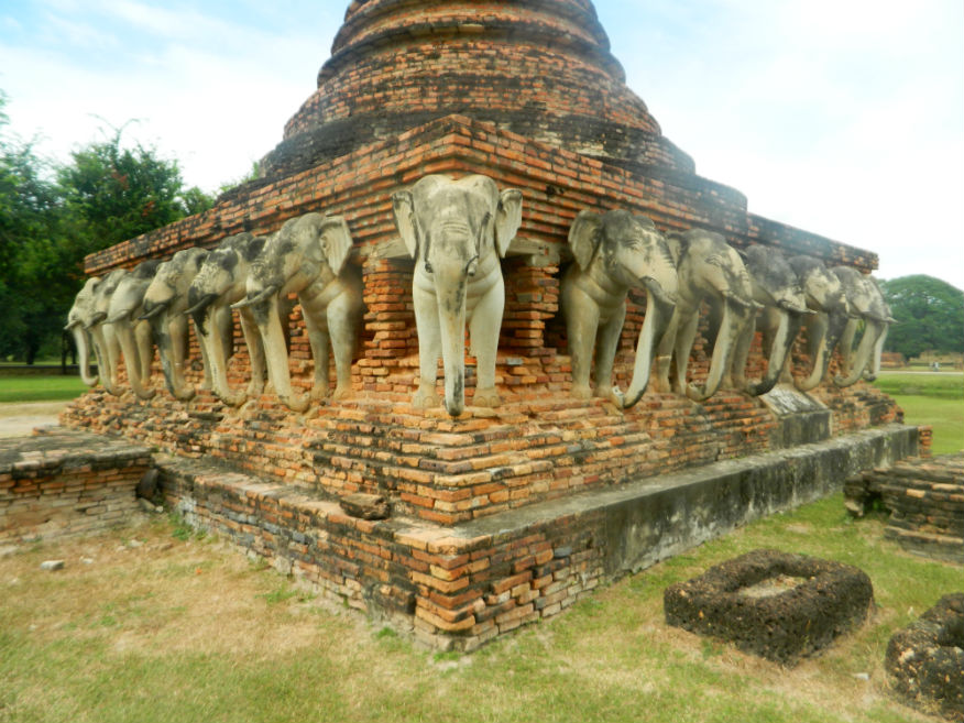
| Wat Chang Lom |
16E |
Temple ruin |
Sukhothai |
Si Satchanalai Historical Park, Si Satchanalai District |
Google Map |
19 Dec 2016 |
100 or 220 all-inclusive |
a large temple in the centre of the city noted for its elephant sculptures, possibly built as early as 1295, referred to in stone inscription No.1 as a site of consecration of Buddha's relics (E,5,20m) |
| Wat Chang Lom |
16E |
Temple ruin |
Sukhothai |
Sukhothai Historic Park, Mueang Sukhothai District |
Google Map |
17 Dec 2016 |
100 per zone |
outside the city to the east, chang lom means 'elephants around' a popular design, near the canal with moat, built no earlier than 1384 after the death of the King Phra Maha Dharmaraja Li Thai (E,4,15m) |
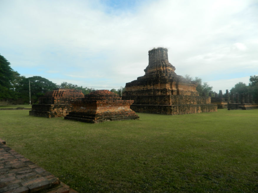
| Wat Chang Rop |
16E |
Temple ruin |
Sukhothai |
Sukhothai Historic Park, Mueang Sukhothai District |
Outer Monument (west) |
16 Dec 2016 |
100 per zone |
forest temple with a bell-shaped chedi with 24 elephant sculptures at the base (M,3,15m) |
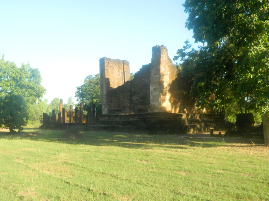
| Wat Chang Songkhram |
16E |
Temple ruin |
Ayutthaya |
Sukhothai Historic Park, Mueang Sukhothai District |
Inner Monument |
16 Dec 2016 |
100 per zone |
near the city pillar shrine, has a vast imposing bell-shaped chedi (E,4,15m) |
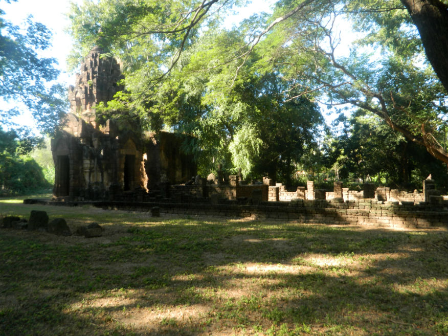
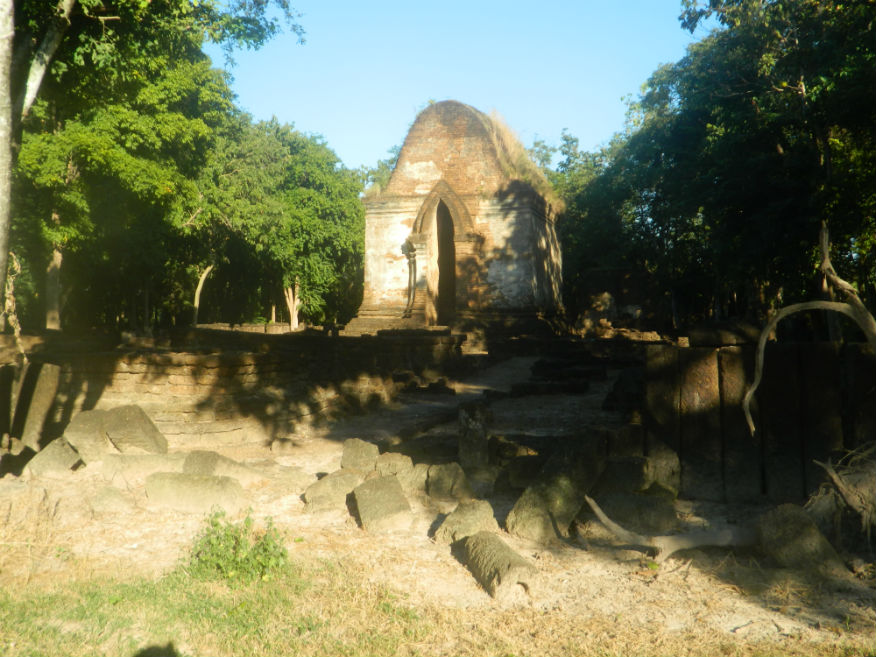
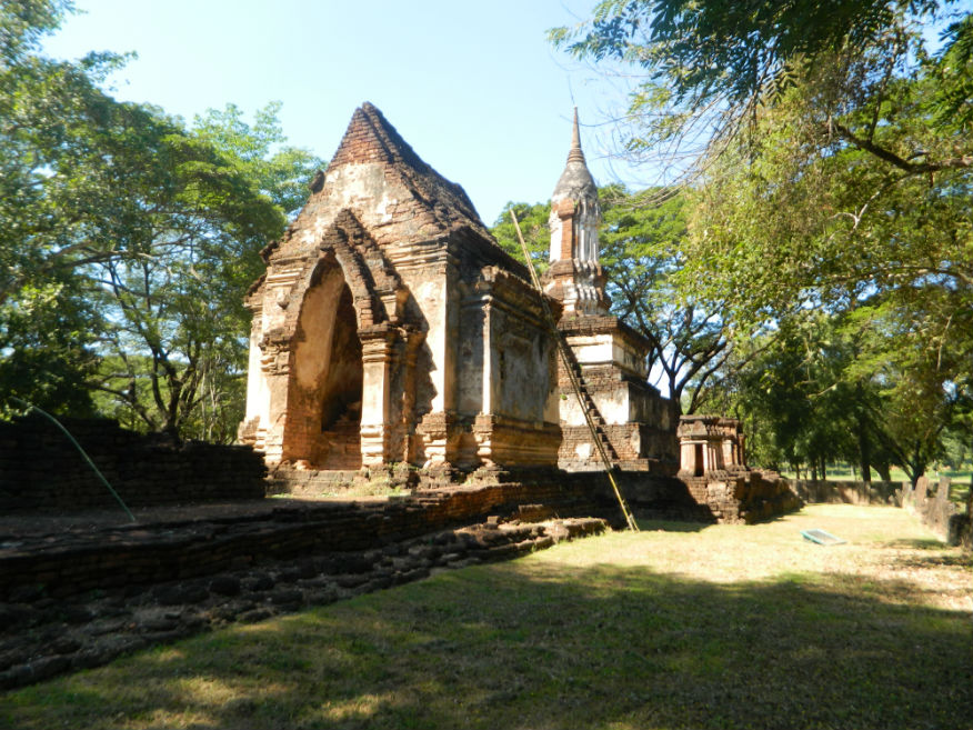
| Wat Chao Chan |
16E |
Temple ruin |
Khmer/Sukhothai |
Si Satchanalai Historical Park, Si Satchanalai District |
Chaliang |
19 Dec 2016 |
100 or 220 all-inclusive |
a good example of a temple converted to Theravada Buddhism during the reign of King Ramkhamhaeng, the viharn is early Sukhothai while the prasat is Khmer in Bayon style (E,5,20m) |
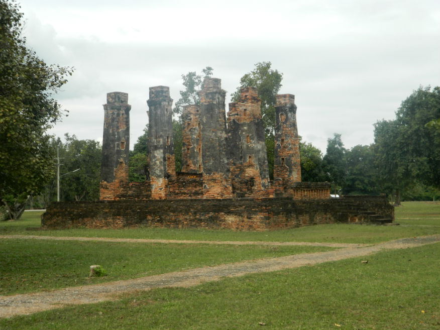
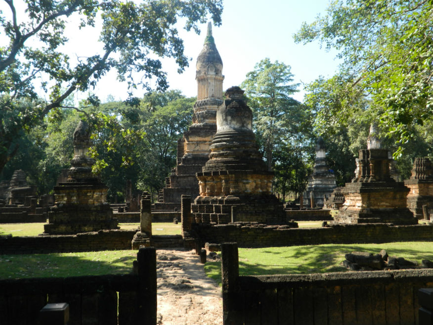
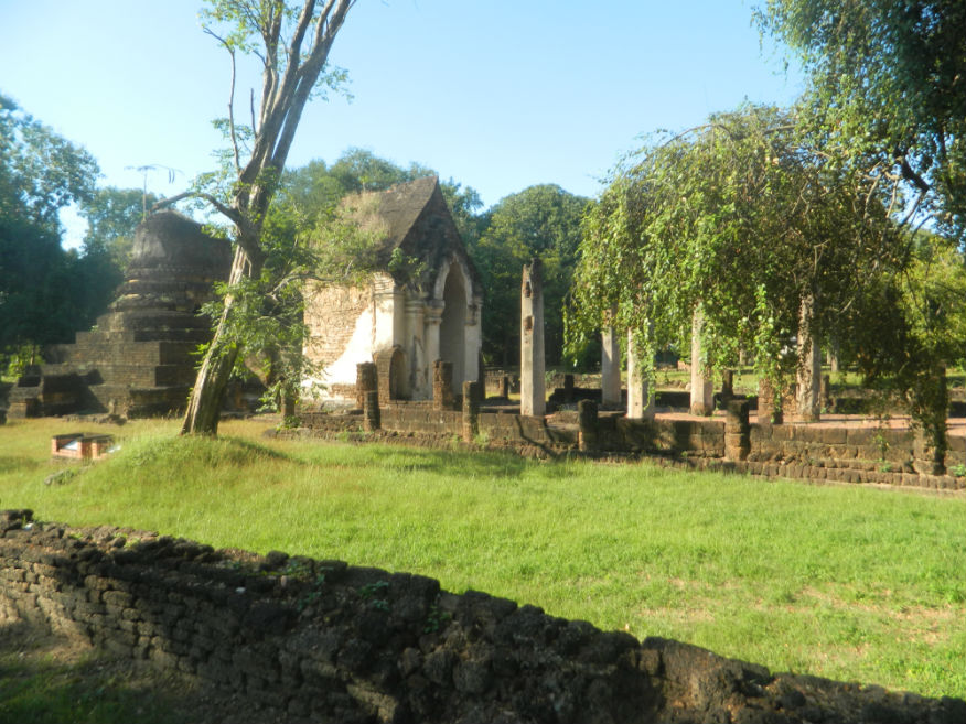
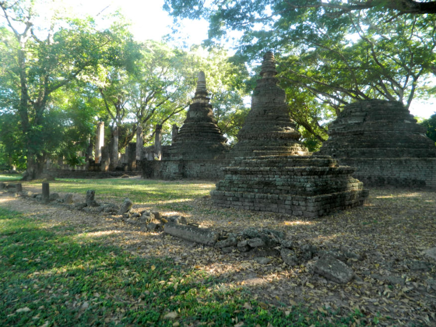
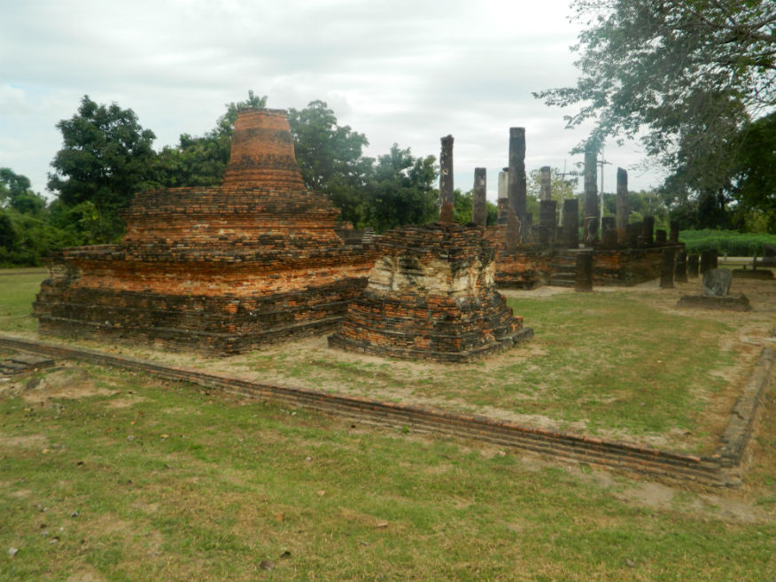
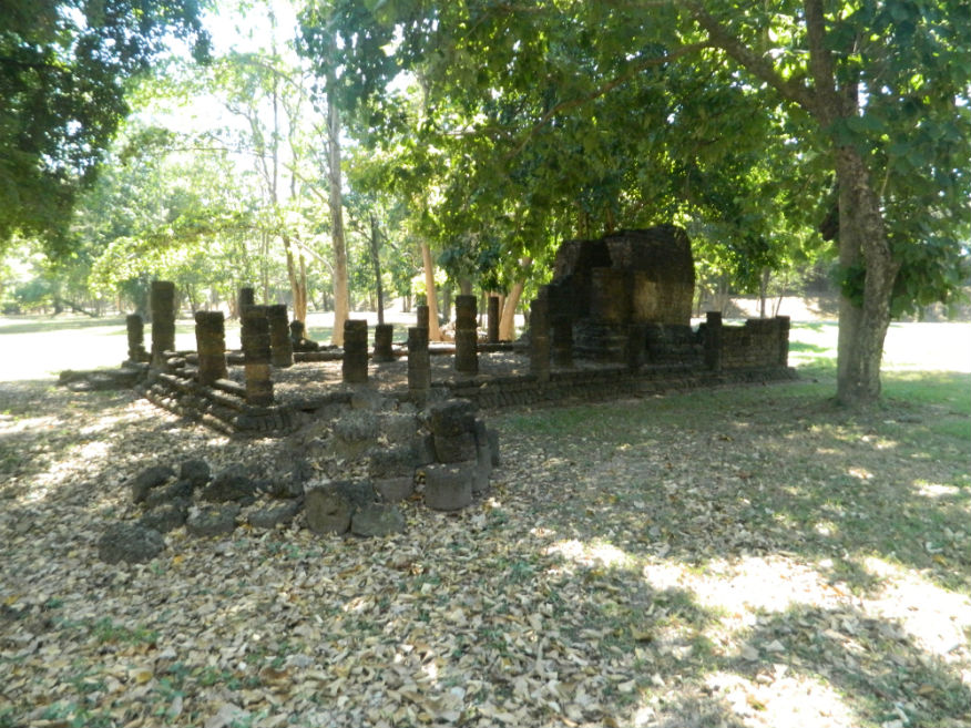
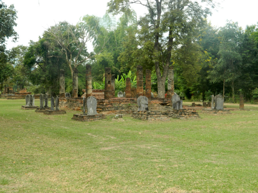
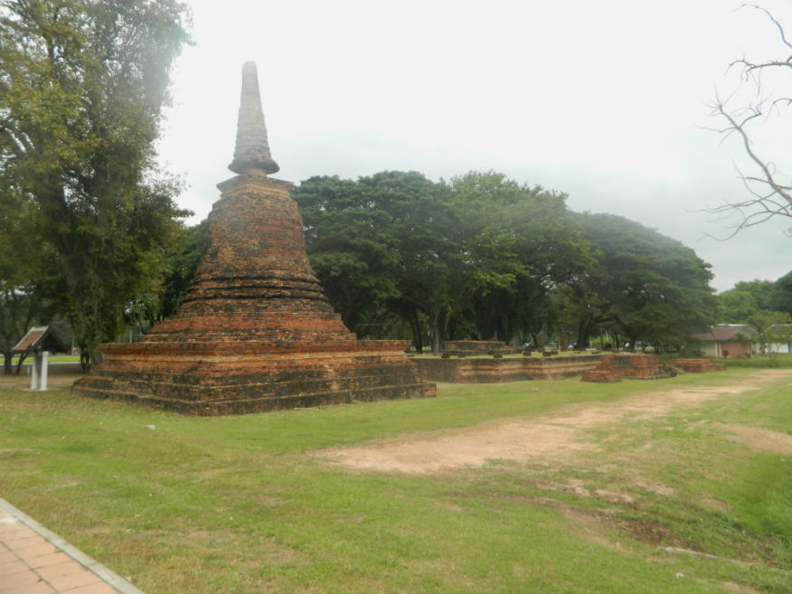
| Wat Chedi Ched Thaeo |
16E |
Temple ruin |
Sukhothai |
Si Satchanalai Historical Park, Si Satchanalai District |
Google Map |
19 Dec 2016 |
100 or 220 all-inclusive |
inside the town wall, temple has 33 chedis in various styles representing cosmology in three types, lotus bud, prasat and round, possible royal graveyard (E,5,20m) |
| Wat Chedi Khao Yod |
16E |
Temple ruin |
Early Ayutthaya |
Si Satchanalai Historical Park, Si Satchanalai District |
Google Map |
19 Dec 2016 |
100 or 220 all-inclusive |
temple name translates as 'chedi on a mountain peak', in fact Khao Yai mountain - the temple was built on natural rock leveled to support a viharn with the main chedi at the rear in Ayutthaya style (E,3,10m) |
| Wat Chedi Ngam |
16E |
Temple ruin |
Sukhothai |
Sukhothai Historic Park, Mueang Sukhothai District |
Google Map |
17 Dec 2016 |
100 per zone |
located on a mound with a slate pathway, a meditation centre with chedi, assembly hall and pond dug into the rock (M,3,10m) |
| Wat Chedi Si Hon |
16E |
Temple ruin |
Sukhothai |
Sukhothai Historic Park, Mueang Sukhothai District |
Outer monuments (south) |
17 Dec 2016 |
100 per zone |
relief stuccos around the base of the main chedi depict men and women in different attire with ornaments (E,3,15m) |
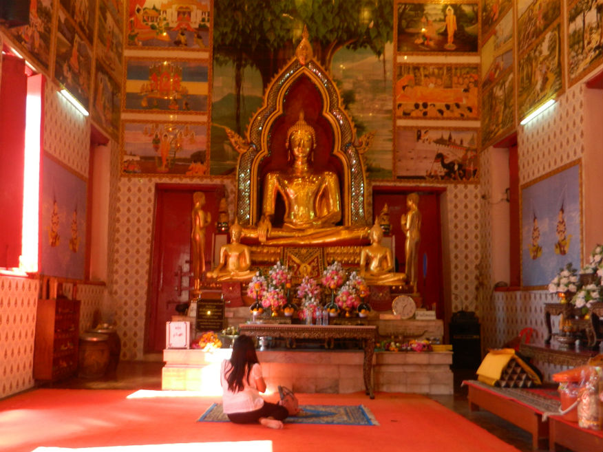
| Wat Chetuphon |
16E |
Temple ruin |
Sukhothai |
Sukhothai Historic Park, Mueang Sukhothai District |
Google Map |
17 Dec 2016 |
100 per zone |
famous for its four Buddha images of vast size in different postures, lovely location surrounded by a lily pond (E,4,20m) |
| Wat Chom Chuen |
16E |
Temple ruin |
Khmer/Sukhothai |
Si Satchanalai Historical Park, Si Satchanalai District |
Google Map |
19 Dec 2016 |
100 or 220 all-inclusive |
located in the old city of Chaliang on the banks of the Yom River, the main chedi of Lankan style, the viharn and mondrop all constructed from laterite blocks, the site of a temple pre-dating the Sukhothai era (E,4,15m) |
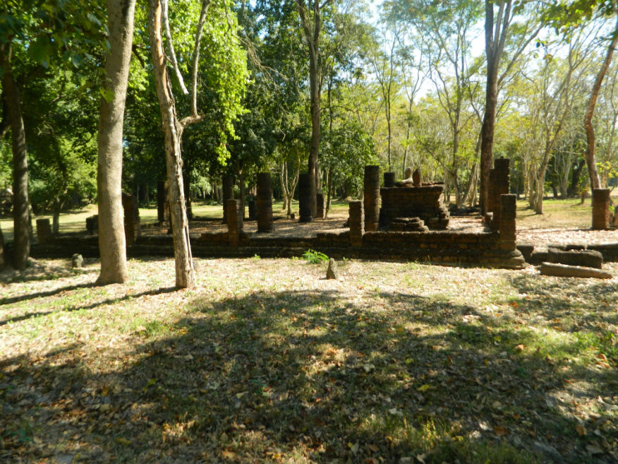
| Archaeological Site Museum (Wat Jan Jao) |
16E |
Archaeological Site |
3rd/4th century |
Si Satchanalai Historical Park, Si Satchanalai District |
Google Map |
19 Dec 2016 |
100 or 220 all-inclusive |
burial site revealing occupation from 3rd/4th century - brick buildings from the 11th century also discovered (E,4,20m) |
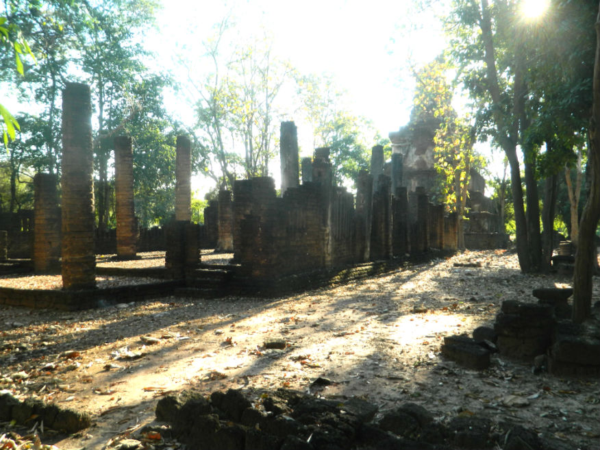
| Wat Kamphaeng Hin |
16E |
Temple ruin |
Sukhothai |
Sukhothai Historic Park, Mueang Sukhothai District |
Outer monument (west) |
17 Dec 2016 |
100 per zone |
located in the Aranyik forest, has a slate wall, assembly hall with staircases, in brick with laterite columns and a brick chedi (M,3,15m) |
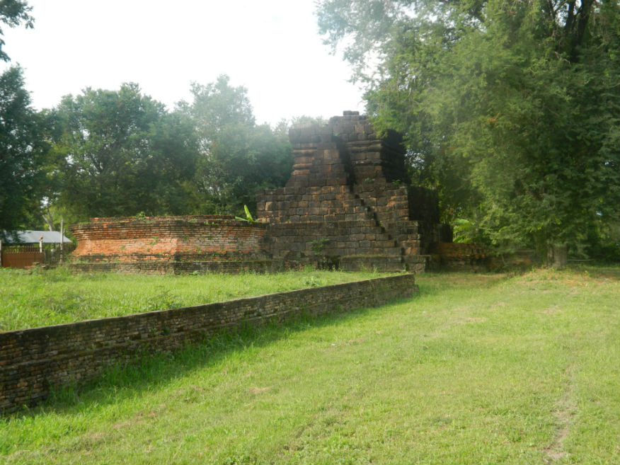
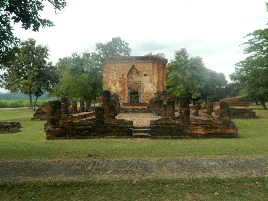
| Wat Kamphaeng Laeng |
16E |
Temple ruin |
Sukhothai |
Sukhothai Historic Park, Mueang Sukhothai District |
Inner Monument |
16 Dec 2016 |
100 per zone |
Base only (E,3,10m) |
| Wat Khao Phanom Phloeng |
16E |
Temple ruin |
Sukhothai |
Si Satchanalai Historical Park, Si Satchanalai District |
Google Map |
19 Dec 2016 |
100 or 220 all-inclusive |
located on top of Phanom Phloeng Hill overlooking the city reached by a staircase built of laterite, buildings include a rounded chedi, ubosot and mondrop/shrine (E,4,15m) |
| Wat Khao Phra Bat Noi |
16E |
Temple ruin |
Sukhothai |
Sukhothai Historic Park, Mueang Sukhothai District |
Google Map |
16 Dec 2016 |
100 per zone |
unusual chedi on a square base with niches for Buddha images, the only one of this type in Sukhothai (E,4,15m) |
| Wat Khao Suwankhiri |
16E |
Temple ruin |
Early Sukhothai |
Si Satchanalai Historical Park, Si Satchanalai District |
Google Map |
19 Dec 2016 |
100 or 220 all-inclusive |
located adjacent to Wat Khao Phanom Phloeng overlooking the city, consists of a five tiered chedi similar to the one at Wat Chang Lom, the ubosot and other buildings are to the east (E,4,20m) |
| Wat Khok Singkharam |
16E |
Temple ruin |
Sukhothai/Ayutthaya |
Si Satchanalai Historical Park, Si Satchanalai District |
Google Map |
19 Dec 2016 |
100 or 220 all-inclusive |
constructed in the Sukhothai period with modifications carried out during the Ayutthaya Period located within the walls of Chaliang, a town predating Si Satchanalai, temple is walled with a viharn and three rounded-style chedis in Ayutthaya style (E,5,20m) |
| Wat Kon Laeng |
16E |
Temple ruin |
Sukhothai |
Sukhothai Historic Park, Mueang Sukhothai District |
Outer monuments (south) |
17 Dec 2016 |
100 per zone |
small temple with lotus bud shaped chedi (E,3,15m) |
| Wat Kudi Rai |
16E |
Temple ruin |
Sukhothai |
Si Satchanalai Historical Park, Si Satchanalai District |
outside the north wall |
19 Dec 2016 |
100 or 220 all-inclusive |
located beside the Yom River facing the Tao Mor Gate, consisting of a viharn, ubosot, mondrops enshrining Buddha images, three lotus-shaped chedis and one round one (E,3,10m) |
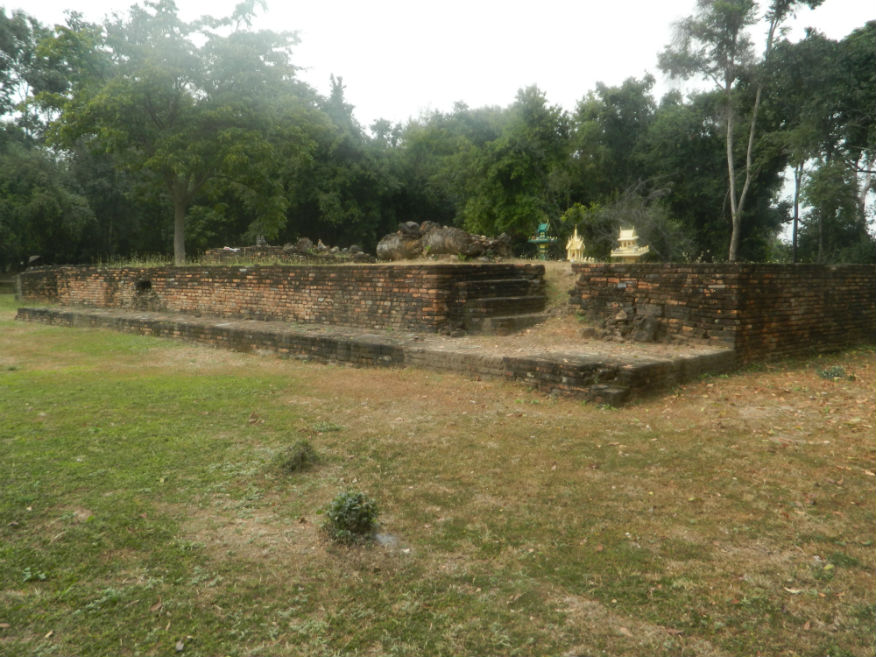
| Wat Lak Muang |
16E |
Temple ruin |
Lavo/Sukhothai |
Si Satchanalai Historical Park, Si Satchanalai District |
Google Map |
19 Dec 2016 |
100 or 220 all-inclusive |
inside the town near the Royal Palace, facing southeast, consists of a viharn, mondrop and chedi with Khmer artwork, lak muang means 'town post' i.e. it was built when the city was created (E,5,15m) |
| Wat Mae Chon |
16E |
Temple ruin |
Sukhothai |
Sukhothai Historic Park, Mueang Sukhothai District |
Google Map |
17 Dec 2016 |
100 per zone |
featuring a slate lined well, the Buddha image has been renovated (E,3,15m) |
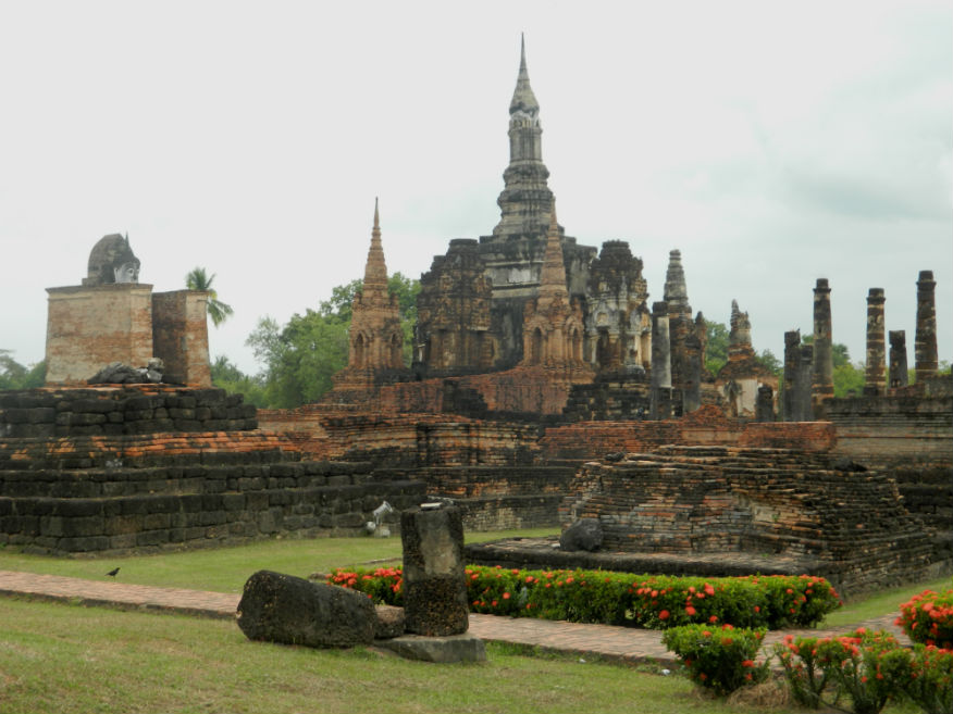
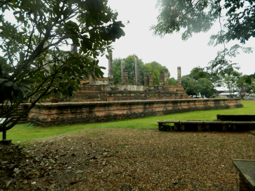
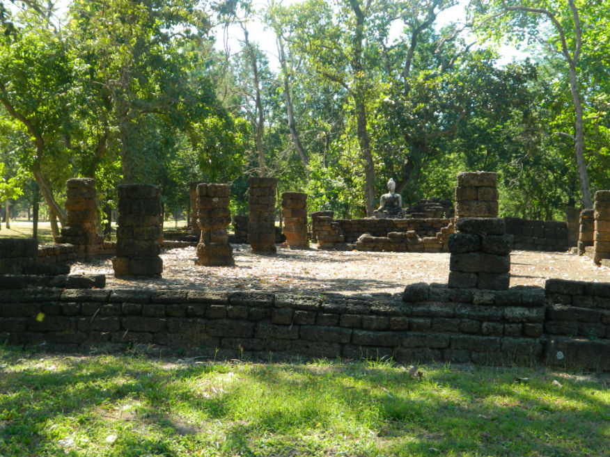
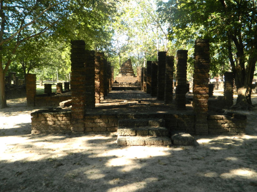
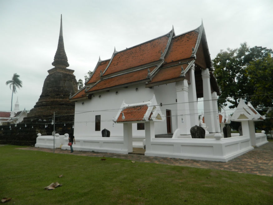
| Wat Mahathat |
16E |
Temple ruin |
Sukhothai |
Sukhothai Historic Park, Mueang Sukhothai District |
Google Map |
16 Dec 2016 |
100 per zone |
Royal temple (E,5,20m) |
| Wat Mai |
16E |
Temple ruin |
Early Ayutthaya |
Sukhothai Historic Park, Mueang Sukhothai District |
Google Map |
16 Dec 2016 |
100 per zone |
huge assembly hall (vihara) showing Ayuttaya influence (E,4,15m) |
| Wat Mangkon |
16E |
Temple ruin |
Sukhothai |
Sukhothai Historic Park, Mueang Sukhothai District |
Outer monument (west) |
17 Dec 2016 |
100 per zone |
glazed bars of Sangkalok on the inner wall are unique, name of the temple derives from sculptures of Sangkalok Makara found there (E,3,10m) |
| Wat Na Phaeng |
16E |
Temple ruin |
Sukhothai |
Si Satchanalai Historical Park, Si Satchanalai District |
old city |
19 Dec 2016 |
100 or 220 all-inclusive |
temple facing east consisting of a viharn with five rooms with laterite base supporting a mondrop with arched entrance likely to be of rose petal design (E,3,10m) |
| Wat Nang Phaya |
16E |
Temple ruin |
Early Ayuttaya |
Si Satchanalai Historical Park, Sukhothai Province |
Google Map |
19 Dec 2016 |
100 or 220 all-inclusive |
built in the early Ayutthaya Period, 16th century, chedi resembles Wat Phra Si Sanphet in Ayutthaya, veharn has seven rooms built in laterite with limestone plaster (E,5,30m) |
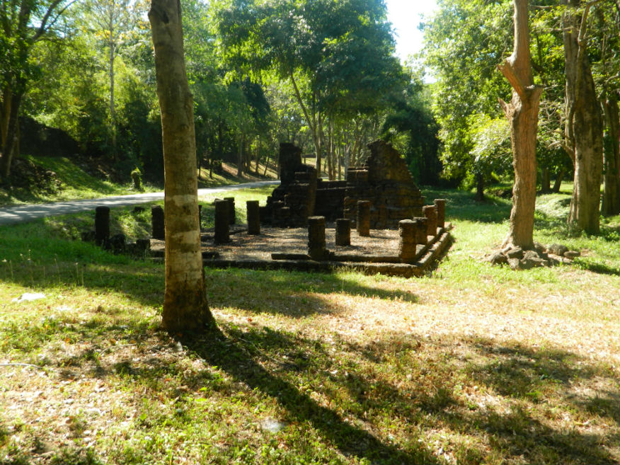
| Wat Noen Prasat |
16E |
Temple ruin |
Sukhothai |
Sukhothai Historic Park, Mueang Sukhothai District |
Inner Monument |
16 Dec 2016 |
100 per zone |
Laterite base only (E,3,10m) |
| Wat Pa Krasa |
16E |
Temple ruin |
Sukhothai |
Si Satchanalai Historical Park, Si Satchanalai District |
Google Map |
19 Dec 2016 |
100 or 220 all-inclusive |
near the park entrance, consists of a base for a bell-shaped chedi and a viharn with glassless windows (E,3,20m) |
| Wat Pa Makham |
16E |
Temple ruin |
Sukhothai |
Si Satchanalai Historical Park, Si Satchanalai District |
old city |
19 Dec 2016 |
100 or 220 all-inclusive |
a minor temple in the old city facing east consisting of a main chedi, a viharn and subordinate chedis all built in laterite (E,3,10m) |
| Wat Pa Mamuang |
16E |
Temple ruin |
Sukhothai |
Sukhothai Historic Park, Mueang Sukhothai District |
Google Map |
17 Dec 2016 |
100 per zone |
stone inscription No 6 was found at this temple and refers to the importance of this temple as a place where Phra Maha Dharmaraja Li Thai was ordained as a priest in 1361, Hindu connections (E,3,10m) |
| Wat Phai Lom |
16E |
Buddhist Temple |
Rattanakosin |
Sawankhalok District |
Google Map |
18 Dec 2016 |
accepts donations |
(M,3,10m) |
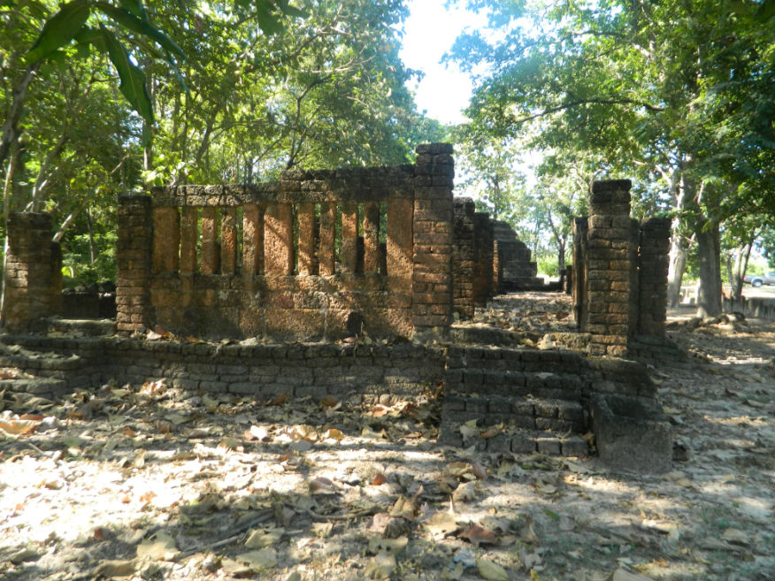
| Wat Phra Phai Luang |
16E |
Temple ruin |
Khmer |
Sukhothai Historic Park, Mueang Sukhothai District |
Google Map |
16 Dec 2016 |
100 per zone |
important monument predating the Sukhothai era built by the Khmer near the kiln site originally at the centre of the city (E,4,20m) |
| Wat Phaya Dam |
16E |
Temple ruin |
Sukothai/Early Ayutthaya |
Sukhothai Historic Park, Mueang Sukhothai District |
outer monument (west) |
19 Dec 2016 |
100 or 220 all-inclusive |
a viharn is at the front while the mondrop has an unusual arched roof in laterite - there are two image halls and bases for minor chedis (E,3,10m) |
| Wat Pasak |
16E |
Temple ruin |
Sukhothai or earlier |
Sukhothai Historic Park, Mueang Sukhothai District |
Outer monument (west) |
17 Dec 2016 |
100 per zone |
small ordination hall (ubosot) surrounded by 12 bases for boundary stones (Sema) made of slate the chedi made of brick (E,3,10m) |
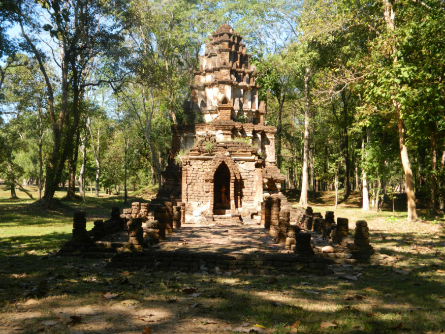
| Wat Phra Si Rattana Mahathat |
16E |
Temple ruin |
Khmer/Sukothai |
Si Satchanalai Historical Park, Si Satchanalai District |
Google Map |
19 Dec 2016 |
100 or 220 all-inclusive |
important royal temple in Bayon style possibly built around 1237 in Chaliang - six buildings at the site are: The main shrine, Phra That Mutao, Mondrop of Phra Attarot, Wiharn Phra Song Phi Nong, Ubosoth and Kui Phra Ruang Phra Lue (E,5,45m) |
| Wat Rahu |
16E |
Temple ruin |
Sukothai/Early Ayutthaya |
Si Satchanalai Historical Park, Si Satchanalai District |
outer monument (west) |
19 Dec 2016 |
100 or 220 all-inclusive |
viharn is early Ayutthaya period with a raised platform for monks and a pedestal for the Buddha image, the main chedi is lotus-bud shaped in Sukhothai style and is the largest in Si Satchanalai (E,3,10m) |
| Wat Sa Pathum |
16E |
Temple ruin |
Sukothai/Early Ayutthaya |
Si Satchanalai Historical Park, Si Satchanalai District |
outer monument (west) |
19 Dec 2016 |
100 or 220 all-inclusive |
near Ramnarong Gate, facing east - temple is rectangular surrounded by a moat with a viharn at the front and has a portico while at the rear is a mondrop within which is seated a Buddha image (E,3,10m) |
| Wat Sa Yakha |
16E |
Temple ruin |
Sukhothai |
Si Satchanalai Historical Park, Si Satchanalai District |
old city |
19 Dec 2016 |
100 or 220 all-inclusive |
temple facing east located inside the city near the junction with the south and west corner of the city wall near a pond, consisting of a viharn, a principal chedi and two subordinate chedis in laterite (E,3,10m) |
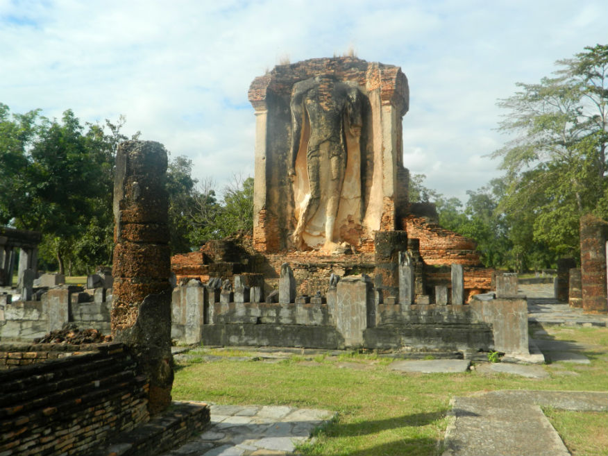
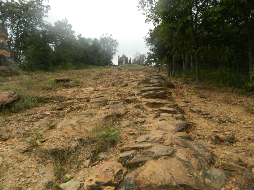
| Wat Saphan Hin |
16E |
Temple ruin |
Sukhothai |
Sukhothai Historic Park, Mueang Sukhothai District |
Google Map |
16 Dec 2016 |
100 per zone |
well-known for its standing Buddha image mentioned in stone inscription No.1, accessed via a stone bridge (M,4,20m) |
| Wat Sawang Arom Worawihan |
16E |
Buddhist Temple |
-------- |
Sawankhalok District |
Google Map |
18 Dec 2016 |
accepts donations |
(E,3,20m) |
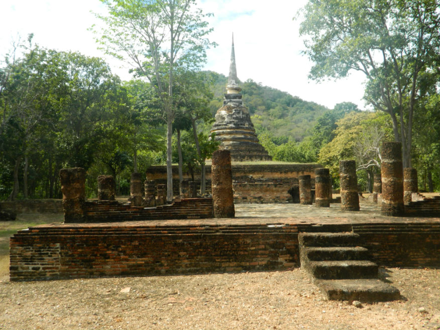
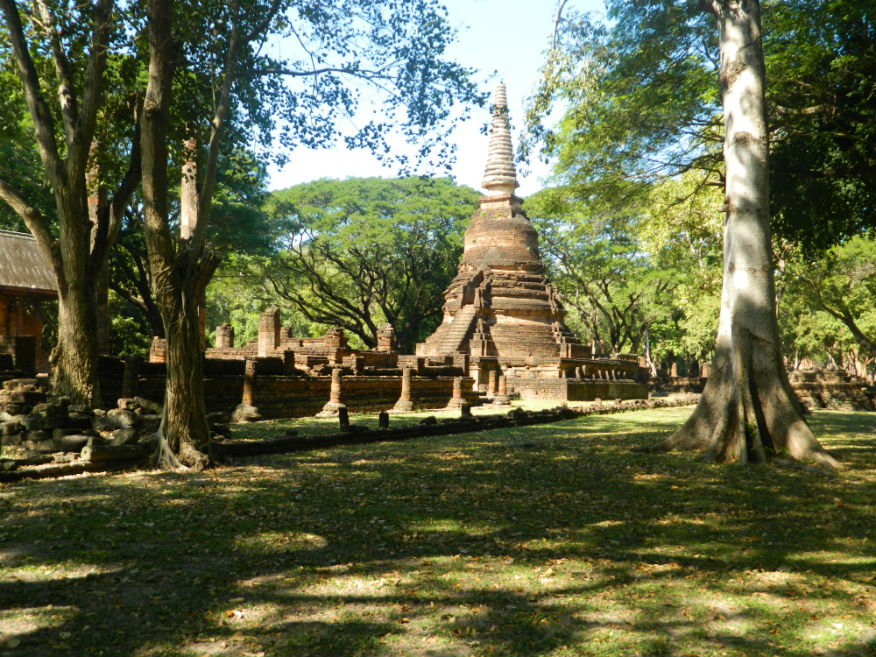
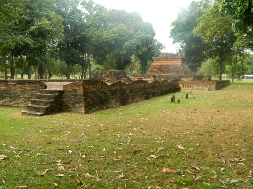
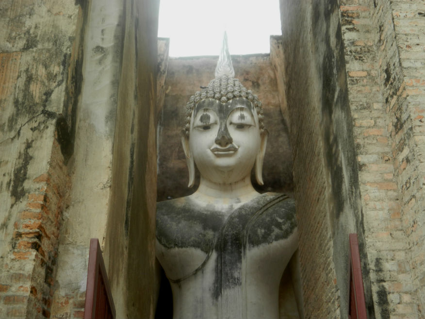
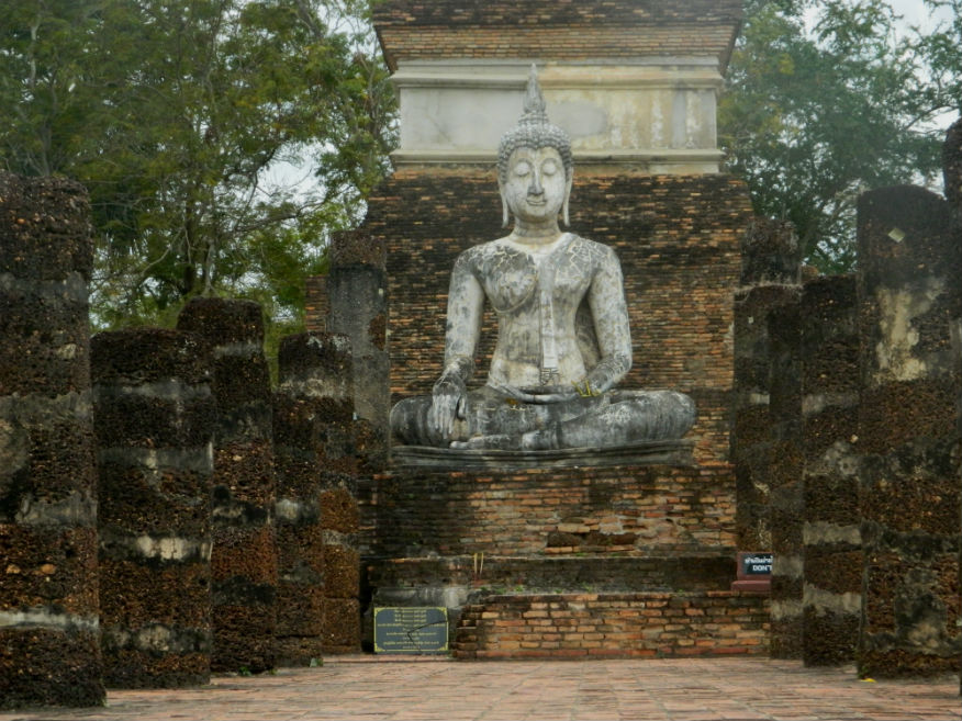
| Wat Si Chum |
16E |
Temple ruin |
Sukhothai |
Sukhothai Historic Park, Mueang Sukhothai District |
Google Map |
16 Dec 2016 |
100 per zone |
important monument with a large sitting Buddha image, mentioned in the stone inscription No 1 while stone inscription No 2 was found in a nich in the wall in the 1950's (E,5,30m) |
| Wat Som Siao |
16E |
Temple ruin |
Sukhothai |
Si Satchanalai Historical Park, Si Satchanalai District |
old city |
19 Dec 2016 |
100 or 220 all-inclusive |
a minor temple in the old city facing northeast, consists of a base for a viharn with balconies in the front and back built in laterite and a principal chedi and altar in laterite (E,3,10m) |
| Wat Son Khao |
16E |
Temple ruin |
Sukhothai |
Sukhothai Historic Park, Mueang Sukhothai District |
Google Map |
17 Dec 2016 |
100 per zone |
close to the northern gate, temple well-known for its lotus bud shaped chedi presently in ruins, surrounded by a wall and moat (E,4,20m) |
| Wat Sorasak |
16E |
Temple ruin |
Sukhothai |
Sukhothai Historic Park, Mueang Sukhothai District |
Google Map |
17 Dec 2016 |
100 per zone |
located inside the northern wall, a temple with royal connections according to a stone insscription (E,4,10m) |
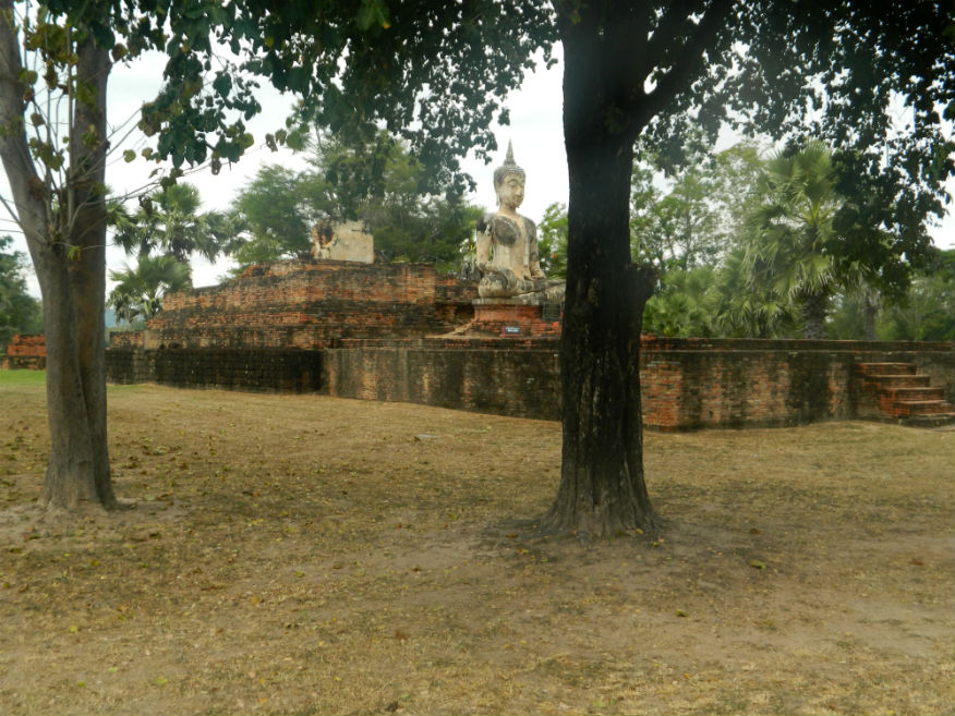
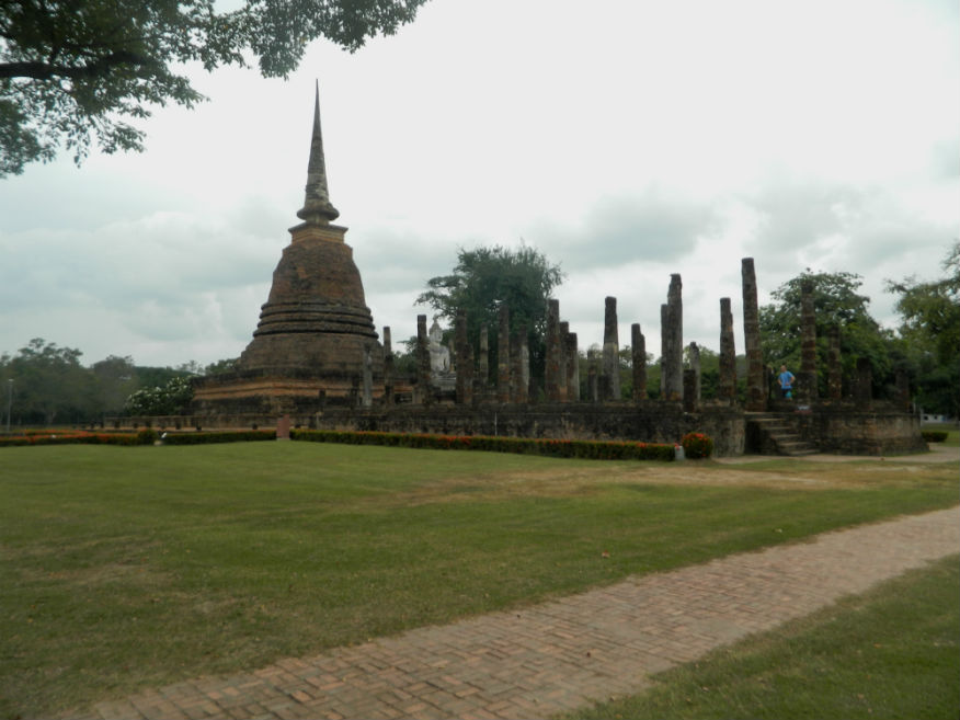
| Wat Sra Si |
16E |
Temple ruin |
Sinhalese/Sukhothai |
Sukhothai Historic Park, Mueang Sukhothai District |
Google Map |
16 Dec 2016 |
100 per zone |
in the middle of a large reservior, iconic (E,5,30m) |
| Wat Suan Kaeo Utthayan Noi |
16E |
Temple ruin |
Sukhothai |
Si Satchanalai Historical Park, Si Satchanalai District |
old city centre |
19 Dec 2016 |
100 or 220 all-inclusive |
located close to the original city centre, build in distinctive Sukhothai style with Khmer and Sri Lankan influence, possible royal temple (E,4,15m) |
| Wat Suan Kaeo Utthayan Yai |
16E |
Temple ruin |
Sukhothai |
Si Satchanalai Historical Park, Si Satchanalai District |
Google Map |
19 Dec 2016 |
100 or 220 all-inclusive |
temple is rectangular facing southeast, ruin of the circular chedi has just a set of pedestals, viharn has six rooms without partitions, mentioned in the Northern Historic Chronicles (E,5,20m) |
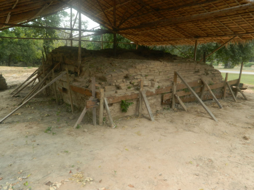
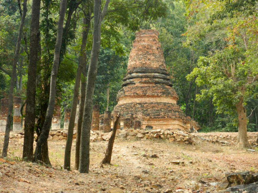
| Wat Tao Thu Riang |
16E |
Kiln site |
Sukhothai |
Sukhothai Historic Park, Mueang Sukhothai District |
City northwest |
16 Dec 2016 |
100 per zone |
monument near the kiln site thought to have been built after production ceased, excavated in 1965
(E,3,15m) |
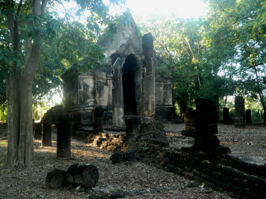
| Wat Tham Hip Bon |
16E |
Temple ruin |
Sukhothai |
Sukhothai Historic Park, Mueang Sukhothai District |
Google Map |
17 Dec 2016 |
100 per zone |
located in the foothills of the Aranyik forest, consists of a bell-shaped subordinate chedi, a laterite assembly hall (viharn), a bell-shaped main chedi and two brick buildings for monks to practice meditation (M,3,10m) |
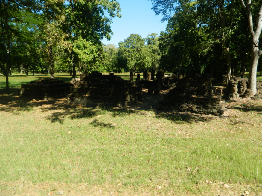
| Wat Tham Hip Lang |
16E |
Temple ruin |
Sukhothai |
Sukhothai Historic Park, Mueang Sukhothai District |
Google Map |
17 Dec 2016 |
100 per zone |
located in the foothills of the Aranyik forest, small temple built of stone and laterite (M,3,10m) |
| Wat Thung Setthi |
16E |
Temple ruin |
Sukhothai |
Si Satchanalai Historical Park, Si Satchanalai District |
near park entrance |
19 Dec 2016 |
100 or 220 all-inclusive |
near the Ramnarong Gate, the ruin consists of a viharn which had six rooms and a terrace in front, a principle chedi on a square base and several smaller chedis in alignment to the rear (E,4,15m) |
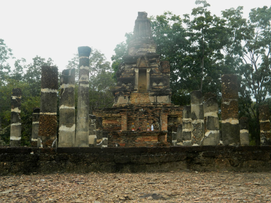
| Wat Tra Kuan |
16E |
Temple ruin |
Sukhothai |
Sukhothai Historic Park, Mueang Sukhothai District |
Google Map |
16 Dec 2016 |
100 per zone |
identified from a stone inscription found at Wat Sorasak (E,4,15m) |
| Wat Trapang Ngoen |
16E |
Temple ruin |
Sukhothai |
Sukhothai Historic Park, Mueang Sukhothai District |
Google Map |
16 Dec 2016 |
100 per zone |
viharn, ubosot and chedi in the shape of a lotus bud with niches for Buddha images (E,4,20m) |
| Wat Traphang Phan |
16E |
Temple ruin |
Sukhothai |
Sukhothai Historic Park, Mueang Sukhothai District |
Google Map |
17 Dec 2016 |
100 per zone |
short distance from the San Luang Gate (E,3,20m) |
| Wat Trapang Thong |
16E |
Temple ruin |
Sukhothai |
Sukhothai Historic Park, Mueang Sukhothai District |
Google Map |
16 Dec 2016 |
100 per zone |
Located inside a square pond (E,3,30m) |
| Wat Tuk |
16E |
Temple ruin |
Sukhothai |
Sukhothai Historic Park, Mueang Sukhothai District |
Outer monument (west) |
17 Dec 2016 |
100 per zone |
consists of a mandapa, an assembly hall (viharn) and 13 subordinate chedis, not mentioned in any inscriptions (E,3,10m) |
| Wat Vihan Noi |
16E |
Temple ruin |
Sukhothai |
Si Satchanalai Historical Park, Si Satchanalai District |
old city |
19 Dec 2016 |
100 or 220 all-inclusive |
temple facing northeast constructed in laterite, consists of a viharn with three rooms and a mondrop behind (E,3,10m) |
| Wat Yai Ta |
16E |
Temple ruin |
Early Ayutthaya |
Si Satchanalai Historical Park, Si Satchanalai District |
outer monument (south) |
19 Dec 2016 |
100 or 220 all-inclusive |
near the Suphan Chan Gate - most important structure on this site is the mondrop which is the highest and largest in Si Satchanalai - the seated Buddha image with only parts of the legs remaining would be the largest in the city - stucco reliefs suggest Ayutthaya period (E,3,10m) |
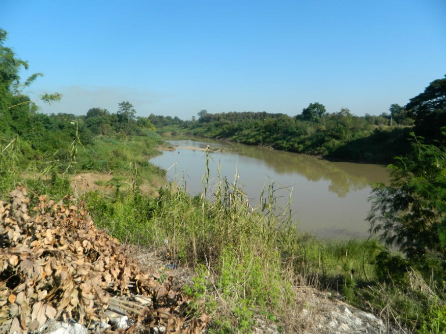
| Yom River |
16E |
River |
|
Si Satchanalai District |
Google Map |
18 Dec 2016 |
n/a |
tributary of the Chao Phraya River, runs near Si Satchanalai Historical Park (E,3,#h) |
